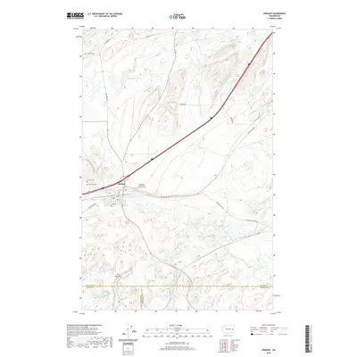
2020 Map of Sprague
USGS Topo · Published 2020About this map
Sprague serves as the central hub of this eastern Washington landscape, situated along a busy transportation corridor where rail lines and highways converge near the northern edge of the Channeled Scablands. The town is flanked by two historic burial sites, Macabee Cem and Lake View Cem, providing valuable documentation for genealogical researchers in Lincoln County. To the east of the town center lies the Redfern Aerodrome, highlighting the area's local aviation footprint.
Find a feature on this map
32 named features on this map. Tap any name to fly to it.
Don’t see what you’re looking for? This feature index may not catch every label — zoom into the map to look around manually.
Map Details
Editions of this 2020 Sprague Map
This is the sole edition of this map. No revisions or reprints were ever made.
Other maps of this area

1953 · Ritzville
USGS Topo · 1:250,000

1954 · Sprague
USGS Topo · 1:62,500

1955 · Spokane
USGS Topo · 1:250,000

1958 · Spokane
USGS Topo · 1:250,000

1959 · Ritzville
USGS Topo · 1:250,000

1964 · Lamont NE
USGS Topo · 1:24,000

1964 · Lamont NW
USGS Topo · 1:24,000

1964 · Palm Lake
USGS Topo · 1:24,000

1965 · Ritzville
USGS Topo · 1:250,000

1969 · Sprague Lake
USGS Topo · 1:24,000