Old Maps of Mohrweis, Washington for Hiking & Exploration
Hike through history with 11 historic maps of Mohrweis. Explore old trails, ghost towns, and forgotten backroads — perfect for outdoor adventurers and local explorers.
- Rediscover forgotten places: Map out old mining camps, roads, and footpaths that no longer exist on modern maps.
- Layer with modern tools: Combine with LiDAR or satellite views to plan hikes through historical terrain.
- Made for exploration: Popular among hikers, overlanders, and local history lovers.
Use these maps to find adventure and explore the hidden past of Mohrweis.
Mohrweis, WA maps
(11)- 1943 Map of Potlatch
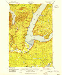
 1943 Potlatch1943 Print · USGSThe Skokomish River valley and Hood Canal shoreline are captured here during the Second World War. Researchers can trace the early layout of the Skokomish Indian Reservation and waterfront towns like Potlatch and Union.
 - 1952 Map of Potlatch, 1954 Print
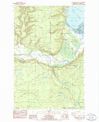
 1952 Potlatch1954 Print · USGSHood Canal and the Skokomish River delta were centers of maritime and timber life in the early fifties. Genealogists and researchers can trace local landmarks like the Skokomish Indian Reservation, the Tahuya School, and the community of Hoodsport as they appeared before modern expansion.3 unique versions available
 - 1958 Map of Seattle, 1966 Print
 1958 Seattle1966 Print · USGSThe Puget Sound region in the mid-fifties showcases a balance of urban growth and Olympic wilderness. Trace the industrial waterfronts of Tacoma, old naval facilities like Keyport Naval Res, and mountain peaks like Mount Constance.3 unique versions available
 - 1962 Map of Seattle
 1962 Seattle1962 Print · USGSThe Puget Sound region and Olympic Peninsula are shown at a peak of mid-century growth. Genealogists and historians can trace rail lines like the Pacific Coast RR or locate landmarks such as Fort Lawton and the Bothell Power Station.
 - 1986 Map of Skokomish Valley
 1986 Skokomish Valley1986 Print · USGSThe Skokomish Valley and Hood Canal shoreline are captured here in the mid-eighties as the local salmon-rearing and tribal infrastructure expanded. Researchers can locate the Skokomish Cem, the Wash State Patrol Academy, and the George Adams Salmon Hatchery.2 unique versions available
 - 1988 Map of Shelton
 1988 Shelton1988 Print · USGSThe Olympic Peninsula's transition from high mountain wilderness to Puget Sound tideflats is captured here in the late eighties. Researchers can trace the path of the Logging Railroad or locate historical sites like Sanderson Field and the Skokomish Indian Reservation.
 - 2011 Map of Skokomish Valley, 2011 Print
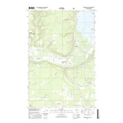
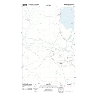 2011 Skokomish Valley2011 Print · USGSCovers Mohrweis, including Brockdale, Skokomish, and other nearby areas
 - 2014 Map of Skokomish Valley, 2014 Print
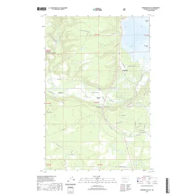
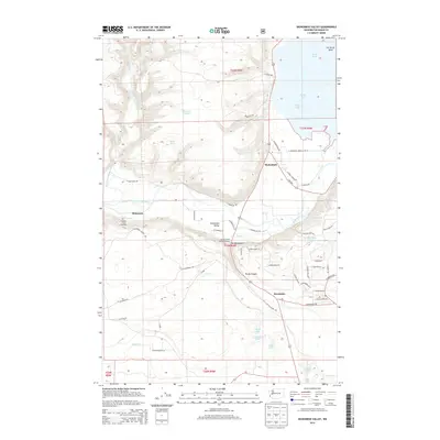 2014 Skokomish Valley2014 Print · USGSCovers Mohrweis, including Brockdale, Skokomish, and other nearby areas
 - 2017 Map of Skokomish Valley, 2017 Print
 2017 Skokomish Valley2017 Print · USGSCovers Mohrweis, including Brockdale, Skokomish, and other nearby areas
 - 2020 Map of Skokomish Valley, 2020 Print
 2020 Skokomish Valley2020 Print · USGSCovers Mohrweis, including Brockdale, Skokomish, and other nearby areas
 - 2023 Map of Skokomish Valley, 2023 Print
 2023 Skokomish Valley2023 Print · USGSThe Skokomish River delta meets the Hood Canal in this recent survey of Mason County. Local historians can trace the roads of Skokomish, locate the Skokomish Indian Cem, and explore the drainage of Purdy Creek and Mussel Shell Creek.
End of results
Showing maps 1-11 of 11
Top cities near Mohrweis
Frequently asked questions
- What are the different types of historical maps available for Mohrweis?
- What is the oldest map of Mohrweis?
- Where can I purchase historical maps of Mohrweis for my home or office?
- Where can I download high-res historical maps of Mohrweis?
- Are there historical topographic maps available for Mohrweis?
- Is there historical aerial imagery available for Mohrweis?
- Where are historical maps of Mohrweis sourced from?