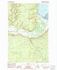
1986 Map of Skokomish Valley
USGS Topo · Published 1986About this map
The Skokomish Indian Reservation occupies the heart of this landscape, where the Skokomish River delta creates the Skokomish Flats at the head of Annas Bay. This 1980s survey illustrates a specialized local economy centered on water resources and public infrastructure, featuring the George Adams Salmon Hatchery, the Shelton Trout Hatchery, and a prominent Fish Hatchery near the river's main stem. The settlement pattern follows the Skokomish Valley Road, connecting the community at Potlatch with inland locations like Mohrweis and Brockdale. Institutional presence is notable through the Wash State Patrol Academy and the Tribal Center. Genealogists will find the exact locations of the Potlatch Cem and Skokomish Cem, alongside the Skokomish Comm Church and Skokomish Sch, providing a clear record of the community's social fabric during this era.
Find a feature on this map
57 named features on this map. Tap any name to fly to it.
Don’t see what you’re looking for? This feature index may not catch every label — zoom into the map to look around manually.
Map Details
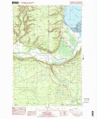
Editions of this 1986 Skokomish Valley Map
2 editions found
Other maps of this area

1939 · Shelton
USGS Topo · 1:62,500

1943 · Potlatch
USGS Topo · 1:62,500

1943 · Nahwatzel Lake
USGS Topo · 1:62,500

1952 · Potlatch
USGS Topo · 1:62,500

1953 · Mt Tebo
USGS Topo · 1:62,500

1953 · Shelton
USGS Topo · 1:62,500

1953 · Elma
USGS Topo · 1:62,500

1958 · Seattle
USGS Topo · 1:250,000

1962 · Seattle
USGS Topo · 1:250,000
1981 · Nahwatzel Lake
USGS Topo · 1:24,000