
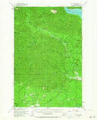
1953 Map of Mt Tebo
USGS Topo · Published 1955About this map
Olympic National Forest dominates this mid-century landscape, where industrial logging infrastructure meets the wilderness of the Mason Co and Grays Harbor Co border. The presence of logging reloads, including Fir Creek Reload and Bingham Cr Reload, alongside the Windy Siding, indicates an active timber economy during the early 1950s. Farther north, the map reveals a network of back-country shelters such as Camp Harps Shelter and Spider Lake Shelter, serving those navigating the high peaks of Mt Tebo, Capitol Peak, and Lightning Peak. The eastern edge is defined by the massive reservoir of Lake Cushman, while the South Fork Skokomish River and Vance Creek carve through the center of the sheet. This survey preserves the locations of early 20th-century work camps, such as Camp 3 (Site), and fire protection points like the Simpson Lookout and Le Bar Guard Sta.
Find a feature on this map
63 named features on this map. Tap any name to fly to it.
Don’t see what you’re looking for? This feature index may not catch every label — zoom into the map to look around manually.
Map Details
Editions of this 1953 Mt Tebo Map
Other maps of this area

1921 · Satsop
USGS Topo · 1:62,500

1938 · Mt Constance
USGS Topo · 1:125,000

1939 · Shelton
USGS Topo · 1:62,500

1941 · Mobray
USGS Topo · 1:62,500

1943 · Potlatch
USGS Topo · 1:62,500

1943 · Nahwatzel Lake
USGS Topo · 1:62,500

1943 · Mobray
USGS Topo · 1:62,500

1947 · The Brothers
USGS Topo · 1:62,500

1947 · Mt. Steel
USGS Topo · 1:62,500

1947 · Mt Christie
USGS Topo · 1:62,500