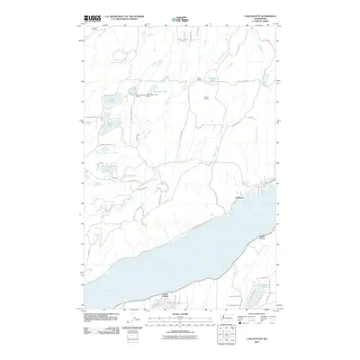
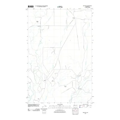
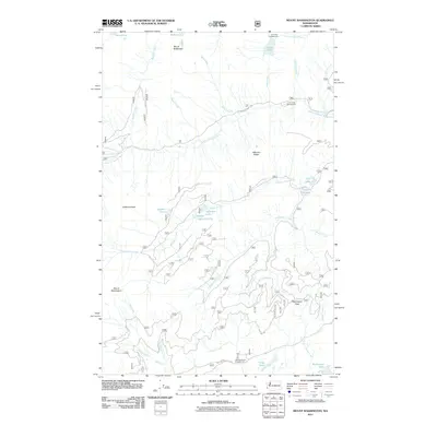
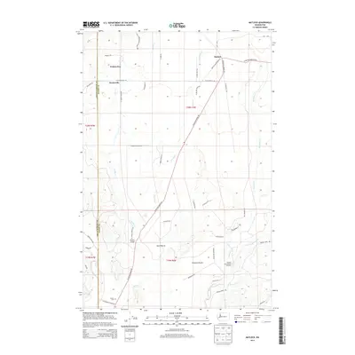
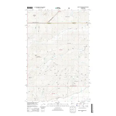
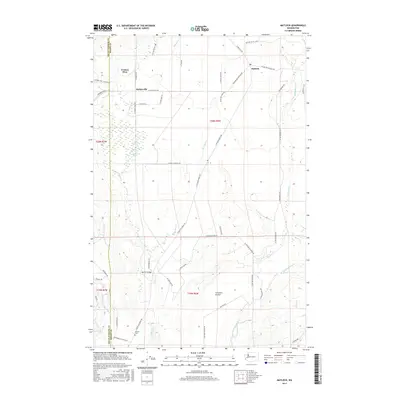
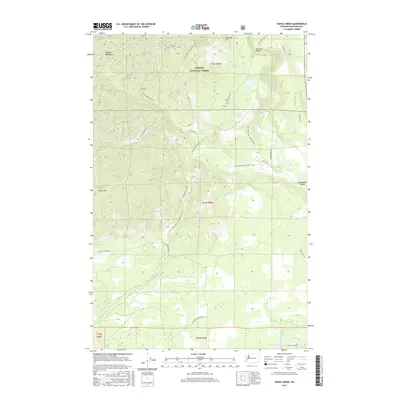
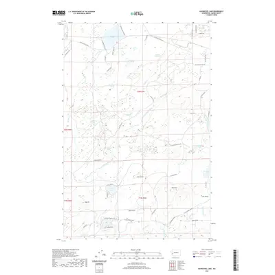
1953 Map of Mt Tebo
USGS Topo · Published 1964About this map
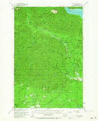
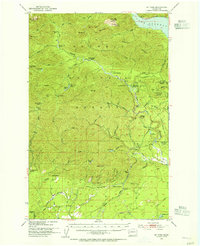
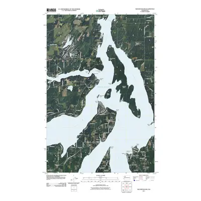
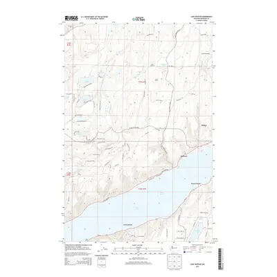
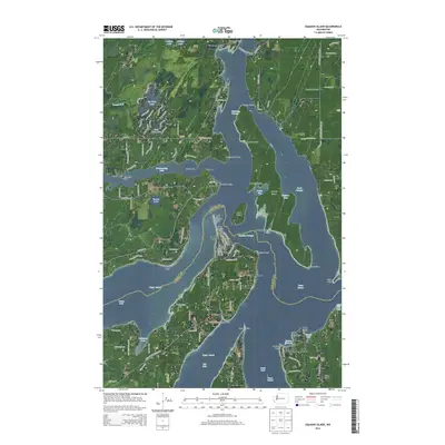
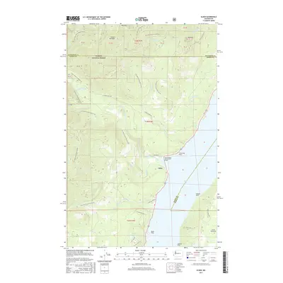
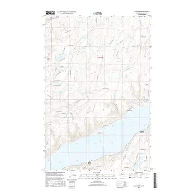
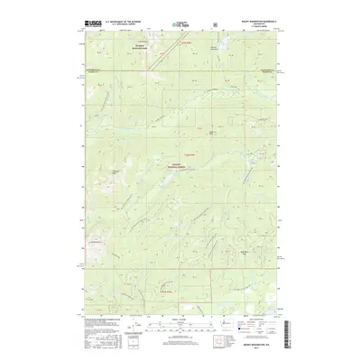
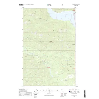
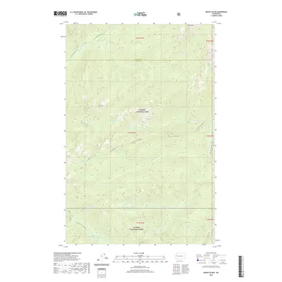
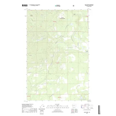
Olympic National Forest dominates this mid-century topographic study, revealing a landscape defined by timber operations and wilderness management. The map details the complex industrial geography of the area, including the Bingham Cr Reload and Fir Creek Reload sites, which emphasize the era's reliance on rail and truck log transport. The presence of Camp 3 (Site) and various back-country shelters like Camp Harps Shelter and Spider Lake Shelter reflect the dual identity of the region as both a working forest and a recreational frontier. To the northeast, the reservoir waters of Lake Cushman are bounded by high peaks such as Lightning Peak and Timber Mtn. The survey also marks the administrative infrastructure of the day, including the Le Bar Guard Sta and Intermount Guard Sta, which served as hubs for forest monitoring and fire prevention.
Find a feature on this map
69 named features on this map. Tap any name to fly to it.
Don’t see what you’re looking for? This feature index may not catch every label — zoom into the map to look around manually.
Map Details
Editions of this 1953 Mt Tebo Map
Historical Maps of Grays Harbor County Through Time
103 maps found

1943 Nahwatzel Lake
Mason County, WA

1943 Potlatch
Mason County, WA

1952 Potlatch
Mason County, WA

1953 Lake Wooten
Mason County, WA

1953 Mason Lake
Mason County, WA

1953 Mt Tebo
Mason County, WA

1959 Squaxin Island
Mason County, WA

1981 Matlock
Mason County, WA

1981 Nahwatzel Lake
Mason County, WA

1985 Eldon
Mason County, WA

1985 Lilliwaup
Mason County, WA

1985 Mt Washington
Mason County, WA

1986 Skokomish Valley
Mason County, WA

1990 Dry Bed Lakes
Mason County, WA

1990 Lightning Peak
Mason County, WA

1990 Mount Olson
Mason County, WA

1990 Mount Skokomish
Mason County, WA

1990 Mount Tebo
Mason County, WA

1990 Vance Creek
Mason County, WA

1997 Mason Lake
Mason County, WA

1997 Squaxin Island
Mason County, WA

1999 Lake Wooten
Mason County, WA

1999 Mount Olson
Mason County, WA
2011 Dry Bed Lakes
Mason County, WA
2011 Eldon
Mason County, WA
2011 Lake Wooten
Mason County, WA
2011 Lightning Peak
Mason County, WA
2011 Lilliwaup
Mason County, WA
2011 Mason Lake
Mason County, WA
2011 Matlock
Mason County, WA
2011 Mount Olson
Mason County, WA
2011 Mount Skokomish
Mason County, WA
2011 Mount Tebo
Mason County, WA
2011 Mount Washington
Mason County, WA
2011 Nahwatzel Lake
Mason County, WA
2011 Shelton Valley
Mason County, WA
2011 Skokomish Valley
Mason County, WA
2011 Squaxin Island
Mason County, WA
2011 Vance Creek
Mason County, WA
2014 Dry Bed Lakes
Mason County, WA
2014 Eldon
Mason County, WA
2014 Lake Wooten
Mason County, WA
2014 Lightning Peak
Mason County, WA
2014 Lilliwaup
Mason County, WA
2014 Mason Lake
Mason County, WA
2014 Matlock
Mason County, WA
2014 Mount Olson
Mason County, WA
2014 Mount Skokomish
Mason County, WA
2014 Mount Tebo
Mason County, WA
2014 Mount Washington
Mason County, WA
2014 Nahwatzel Lake
Mason County, WA
2014 Shelton Valley
Mason County, WA
2014 Skokomish Valley
Mason County, WA
2014 Squaxin Island
Mason County, WA
2014 Vance Creek
Mason County, WA
2017 Dry Bed Lakes
Mason County, WA
2017 Eldon
Mason County, WA
2017 Lake Wooten
Mason County, WA
2017 Lightning Peak
Mason County, WA
2017 Lilliwaup
Mason County, WA
2017 Mason Lake
Mason County, WA
2017 Matlock
Mason County, WA
2017 Mount Olson
Mason County, WA
2017 Mount Skokomish
Mason County, WA
2017 Mount Tebo
Mason County, WA
2017 Mount Washington
Mason County, WA
2017 Nahwatzel Lake
Mason County, WA

2017 Shelton Valley
Mason County, WA
2017 Skokomish Valley
Mason County, WA
2017 Squaxin Island
Mason County, WA
2017 Vance Creek
Mason County, WA
2020 Dry Bed Lakes
Mason County, WA
2020 Eldon
Mason County, WA
2020 Lake Wooten
Mason County, WA
2020 Lightning Peak
Mason County, WA
2020 Lilliwaup
Mason County, WA
2020 Mason Lake
Mason County, WA
2020 Matlock
Mason County, WA
2020 Mount Olson
Mason County, WA
2020 Mount Skokomish
Mason County, WA
2020 Mount Tebo
Mason County, WA
2020 Mount Washington
Mason County, WA
2020 Nahwatzel Lake
Mason County, WA
2020 Shelton Valley
Mason County, WA
2020 Skokomish Valley
Mason County, WA
2020 Squaxin Island
Mason County, WA
2020 Vance Creek
Mason County, WA

2023 Dry Bed Lakes
Mason County, WA

2023 Eldon
Mason County, WA

2023 Lake Wooten
Mason County, WA

2023 Lightning Peak
Mason County, WA

2023 Lilliwaup
Mason County, WA

2023 Mason Lake
Mason County, WA

2023 Matlock
Mason County, WA

2023 Mount Olson
Mason County, WA

2023 Mount Skokomish
Mason County, WA

2023 Mount Tebo
Mason County, WA

2023 Mount Washington
Mason County, WA

2023 Nahwatzel Lake
Mason County, WA

2023 Shelton Valley
Mason County, WA

2023 Skokomish Valley
Mason County, WA

2023 Squaxin Island
Mason County, WA

2023 Vance Creek
Mason County, WA