Old Maps of Dexter by the Sea, Washington for Academic Research
Study the evolution of Dexter by the Sea with 12 high-resolution historic maps. Whether you're teaching, researching, or modeling changes in land use, these maps provide essential visual documentation of urban, environmental, and geographic change.
- Analyze long-term change: Track patterns in development, transportation, and natural features.
- Ideal for environmental or urban studies: Support academic projects with primary historical map data.
- Use in the classroom or lab: Educators and researchers rely on these maps to bring historical context to life.
These maps are a powerful tool for teaching, research, and visualizing how Dexter by the Sea has changed over the decades.
Dexter by the Sea, WA maps
(12)- 1938 Map of Cape Shoalwater
 1938 Cape Shoalwater1938 Print · USGSThe Washington coast in the late thirties reveals a thriving maritime and shellfish economy along the narrow peninsula between the ocean and bay. Genealogists and historians can trace family properties and coastal camps such as Oysterville, Signodson Clam Camp, and Nahcotta.
 - 1943 Map of Copalis Beach
 1943 Copalis Beach1943 Print · USGSThe Washington coast in the 1940s is detailed here from the Olympic Peninsula to the Columbia River. Trace old beach settlements like Moclips and Copalis Beach alongside landmarks like the Willapa Bay Lighthouse.
 - 1951 Map of Copalis Beach
 1951 Copalis Beach1951 Print · USGSThe Olympic Peninsula's rugged coast and tribal lands are meticulously detailed in the early 1950s. Genealogists and historians can trace the foundations of coastal communities from Taholah to La Push or locate early markers like the James Island Lighthouse.
 - 1956 Map of North Cove, 1959 Print
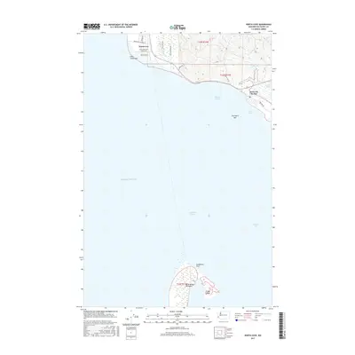
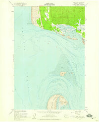 1956 North Cove1959 Print · USGSCoastal Washington in the mid-fifties reveals a landscape of shifting tides and small seaside communities. Trace the vanished or changed shorelines near Dexter by the Sea, North Cove, and the historic Georgetown Cemetery.5 unique versions available
 - 1957 Map of Copalis Beach, 1968 Print
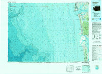
 1957 Copalis Beach1968 Print · USGSThe Washington coast during the late fifties reveals a landscape of tribal reservations and timber towns linked by the Northern Pacific RR. Trace family history and land patterns near Forks Cemetery, the shingle mill, or coastal landings like Taholah and Oysterville.2 unique versions available
 - 1963 Map of Copalis Beach
 1963 Copalis Beach1963 Print · USGSThe Washington coast in the early sixties reveals a landscape of massive timber reserves, indigenous lands, and quiet seaside villages. Genealogists and historians can trace the foundations of coastal life through sites like Lone Fir Cemetery, the Dismantled RR, and the historic oyster beds of Oysterville.
 - 1989 Map of Westport
 1989 Westport1989 Print · USGSThe Washington coast and the mouth of Grays Harbor are captured in the late eighties, documenting the maritime infrastructure and coastal settlements of the era. Researchers can trace the development of Westport, Ocean Shores, and historic waterfronts like Oysterville or Bay City.
 - 2011 Map of North Cove, 2011 Print
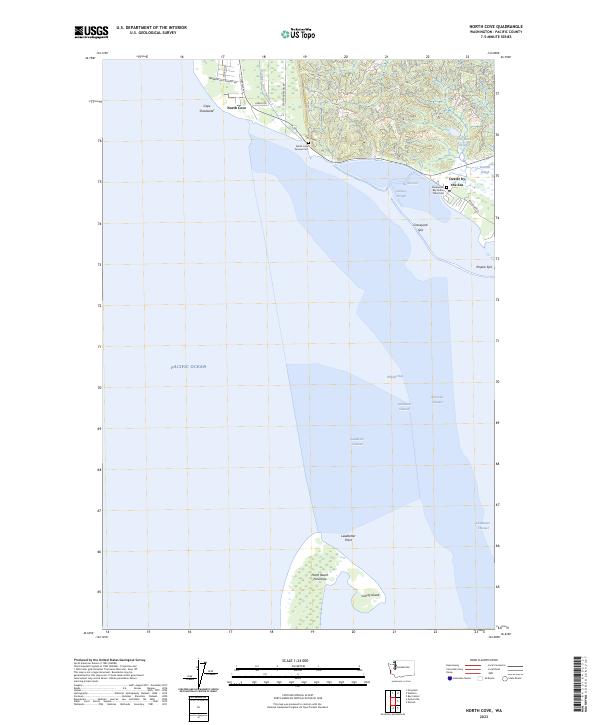
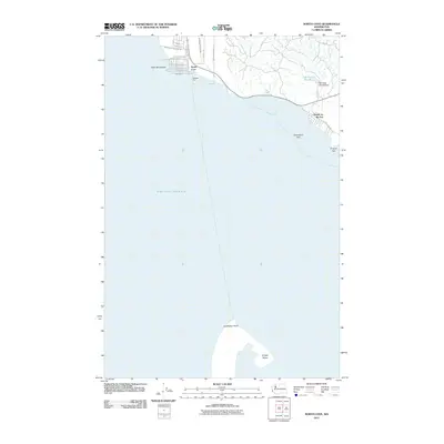 2011 North Cove2011 Print · USGSCovers Dexter by the Sea, including North Cove, Pacific County, and other nearby areas
 - 2013 Map of North Cove, 2013 Print
 2013 North Cove2013 Print · USGSCovers Dexter by the Sea, including North Cove, Pacific County, and other nearby areas
 - 2017 Map of North Cove, 2017 Print
 2017 North Cove2017 Print · USGSCovers Dexter by the Sea, including North Cove, Pacific County, and other nearby areas
 - 2020 Map of North Cove, 2020 Print
 2020 North Cove2020 Print · USGSCovers Dexter by the Sea, including North Cove, Pacific County, and other nearby areas
 - 2023 Map of North Cove, 2023 Print
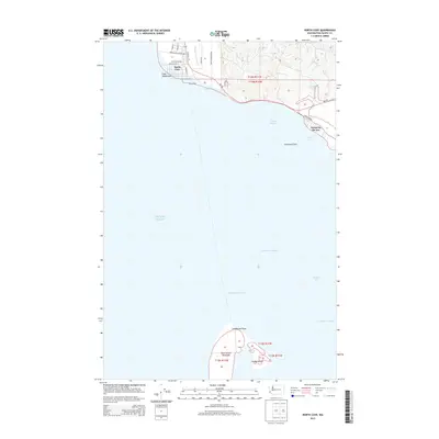
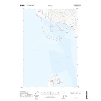
 2023 North Cove2023 Print · USGSThe northern reaches of Willapa Bay and the Pacific coast are captured here in a moment of modern coastal transition. Researchers can trace land use and local heritage at North Cove Pioneer Cem, Dexter by the Sea, and Graveyard Spit.
End of results
Showing maps 1-12 of 12
Top cities near Dexter by the Sea
- Aberdeen historical maps
- Ocean Shores historical maps
- Westport historical maps
- South Bend historical maps
- Cosmopolis historical maps
- Grayland historical maps
See more
Frequently asked questions
- What are the different types of historical maps available for Dexter by the Sea?
- What is the oldest map of Dexter by the Sea?
- Where can I purchase historical maps of Dexter by the Sea for my home or office?
- Where can I download high-res historical maps of Dexter by the Sea?
- Are there historical topographic maps available for Dexter by the Sea?
- Is there historical aerial imagery available for Dexter by the Sea?
- Where are historical maps of Dexter by the Sea sourced from?