1970s Maps of San Juan County, Washington
Explore 14 historic maps of San Juan County from the 1970s. These maps offer a rare glimpse into what life looked like during the 1970s — showing old roads, neighborhoods, homes, and landmarks that have changed or disappeared over time.
Whether you're researching your family's past, planning a metal detecting trip, or studying how San Juan County's landscape evolved across the 1970s, these high-resolution maps are a powerful tool for exploring the history of this region.
- Focus on a specific era: All maps on this page are from the 1970s, giving you a focused view of this time period.
- See what’s changed: Compare century-old streets, trails, and buildings to today's modern landscape using overlays and satellite layers.
- Research with precision: Use these maps for genealogy, historical research, land use analysis, or educational projects.
- View, download, or print: Maps are fully viewable online in high resolution, and can be downloaded or printed for your own records.
Start exploring San Juan County's history through authentic maps from the 1970s. This is your window into the past.
San Juan County, WA maps
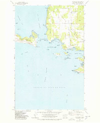
(14)- 1973 Map of Cypress Island, 1977 Print
 1973 Cypress Island1977 Print · USGSThe northern San Juan Islands are captured in the early 1970s, from the rugged interior of Cypress Island to the growing docks of Anacortes. Researchers can trace the layout of small settlements like Urban and Indian Village or locate local landmarks such as Eden Cem and the Sinclair Island Light.2 unique versions available
 - 1973 Map of Lopez Pass, 1977 Print
 1973 Lopez Pass1977 Print · USGSThe eastern shores of the San Juan archipelago are captured here in the early 1970s, showing a landscape defined by saltwater sounds and rocky headlands. Researchers can trace the boundaries of the San Juan Islands National Wildlife Refuge and locate remote landmarks like Davidson Rock Light and Chadwick Hill.2 unique versions available
 - 1973 Map of Sucia Island, 1977 Print
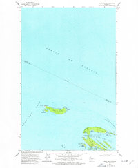 1973 Sucia Island1977 Print · USGSThe northern San Juan Islands are captured in the early 1970s, showcasing the maritime isolation and nascent parklands of the era. Researchers can locate the Patos Light on the U S Coast Guard Reservation or trace the shoreline of Sucia Island State Park.2 unique versions available
 - 1973 Map of Shaw Island, 1977 Print
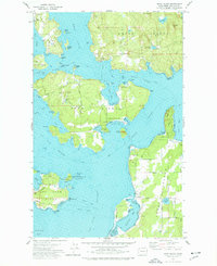 1973 Shaw Island1977 Print · USGSThe San Juan Islands in the early seventies remain a quiet network of maritime communities and protected shorelines. Researchers can trace historic ferry routes and find local landmarks like the Shaw Island Sch, Shaw Co Park, and the Orcas landing.2 unique versions available
 - 1973 Map of Blakely Island, 1977 Print
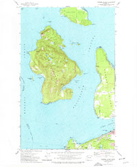
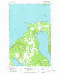
 1973 Blakely Island1977 Print · USGSThe central San Juan Islands come into focus in the early seventies, showing a maritime landscape of isolated settlements and protected wilderness. Local historians can trace the early footprints of Thatcher and Decatur, alongside landmarks like Blakely Peak and Spencer Spit State Park.3 unique versions available
 - 1975 Map of Bellingham, 1977 Print
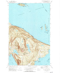
 1975 Bellingham1977 Print · USGSNorthwest Washington in the mid-seventies is captured here, from the Canadian border at Blaine to the San Juan Islands. Researchers can trace tribal lands on the Lummi Indian Reservation, find rural settlements like Cokedale, or follow the Burlington Northern rail lines.
 - 1975 Map of Port Townsend, 1977 Print
 1975 Port Townsend1977 Print · USGSThe northern Puget Sound in the mid-seventies shows a landscape of military readiness and maritime industry. Researchers can trace the extensive Whidbey Island Naval Air Station or locate historic coastal defenses at Fort Casey Military Res and Fort Ebey Military Res.
 - 1977 Map of Richardson, 1978 Print
 1977 Richardson1978 Print · USGSThe San Juan Islands are captured in the late seventies as a landscape of maritime history and budding recreation. Genealogists and researchers can trace the shores of Richardson or explore landmarks like Mt Finlayson and the San Juan Island National Historical Park.2 unique versions available
 - 1977 Map of Eastsound, 1978 Print
 1977 Eastsound1978 Print · USGSOrcas Island in the late seventies is a landscape of protected parks and coastal settlements. Genealogists and island historians can locate the Woodlawn Cem, Orcas Island Sch, and the grounds of Camp Orkila.2 unique versions available
 - 1978 Map of Lummi Island
 1978 Lummi Island1978 Print · USGSLummi Island and the surrounding waters of the Rosario Strait are captured in the late seventies, showing a landscape of coastal settlements and rugged topography. Researchers can trace land use through the Loganita Lodge grounds, the Cem near Lovers Bluff, and the tidal flats of The Portage.2 unique versions available
 - 1978 Map of Mt Constitution
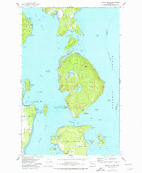
 1978 Mt Constitution1978 Print · USGSOrcas Island in the late 1970s reveals a landscape of high summits and coastal retreats. Genealogists and historians can trace family locations near Buckhorn or the Olga-Doe Bay Cem and locate landmarks like the Prospect and the summit Lookout Tower.3 unique versions available
 - 1978 Map of Smith Island, 1981 Print
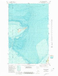 1978 Smith Island1981 Print · USGSThe eastern reaches of the Strait of Juan de Fuca are documented here in the late seventies, showing the isolated Smith Island and its surrounding waters. Trace the maritime landscape of the San Juan Islands National Wildlife Refuge, including a Cistern and Light on the island.
 - 1978 Map of Deception Pass, 1986 Print
 1978 Deception Pass1986 Print · USGSThe islands of Fidalgo and Whidbey meet at the turbulent waters of Deception Pass during the late seventies. Researchers can trace local landmarks like the Cemetery, Mt Erie, and the coastal Coast Guard Res.
 - 1979 Map of Port Angeles
 1979 Port Angeles1979 Print · USGSThe northern Olympic Peninsula and southern Vancouver Island are captured here in the late seventies. Family historians can trace the rail networks of the Esquimalt and Nanaimo Railway or locate old coastal settlements like Sooke, Joyce, and Agnew.
End of results
Showing maps 1-14 of 14
Top cities of San Juan County
Frequently asked questions
- What are the different types of historical maps available for San Juan County?
- What is the oldest map of San Juan County?
- Where can I purchase historical maps of San Juan County for my home or office?
- Where can I download high-res historical maps of San Juan County?
- Are there historical topographic maps available for San Juan County?
- Is there historical aerial imagery available for San Juan County?
- Where are historical maps of San Juan County sourced from?