2020s Maps of San Juan County, Washington
Explore 18 historic maps of San Juan County from the 2020s. These maps offer a rare glimpse into what life looked like during the 2020s — showing old roads, neighborhoods, homes, and landmarks that have changed or disappeared over time.
Whether you're researching your family's past, planning a metal detecting trip, or studying how San Juan County's landscape evolved across the 2020s, these high-resolution maps are a powerful tool for exploring the history of this region.
- Focus on a specific era: All maps on this page are from the 2020s, giving you a focused view of this time period.
- See what’s changed: Compare century-old streets, trails, and buildings to today's modern landscape using overlays and satellite layers.
- Research with precision: Use these maps for genealogy, historical research, land use analysis, or educational projects.
- View, download, or print: Maps are fully viewable online in high resolution, and can be downloaded or printed for your own records.
Start exploring San Juan County's history through authentic maps from the 2020s. This is your window into the past.
San Juan County, WA maps
(18)- 2023 Map of Smith Island, 2023 Print
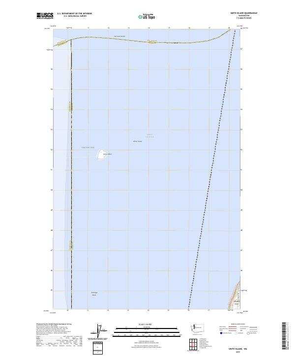 2023 Smith Island2023 Print · USGSThe isolated outcroppings of the San Juan Islands are documented here in the early twenty-first century, surrounded by the Strait of Juan de Fuca. Researchers can trace the boundaries of the San Juan Islands National Wildlife Refuge at Smith Island and Minor Island.
 - 2023 Map of Roche Harbor OE S, 2023 Print
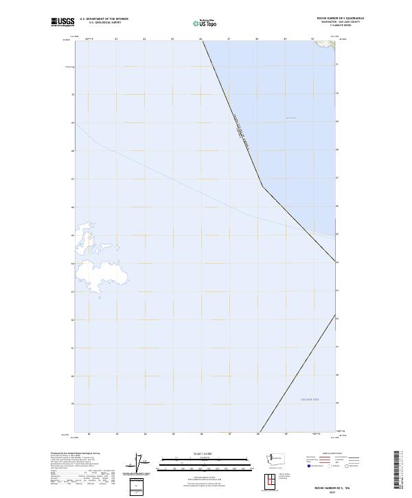 2023 Roche Harbor OE S2023 Print · USGSThe maritime border between Washington and British Columbia is documented in this recent survey of the archipelago. Trace the international boundary as it navigates through the Haro Strait and the open Salish Sea.
 - 2023 Map of False Bay, 2023 Print
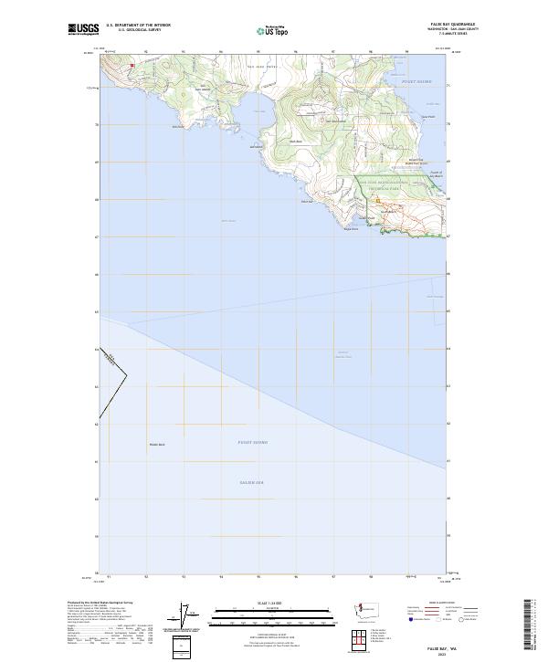 2023 False Bay2023 Print · USGSSan Juan Island's southern shoreline is captured in this modern survey of the Salish Sea. Researchers can trace conservation boundaries and coastal landmarks from Burden Field (Rabbit Run) Airport to the San Juan Island National Historical Park.
 - 2023 Map of Friday Harbor, 2023 Print
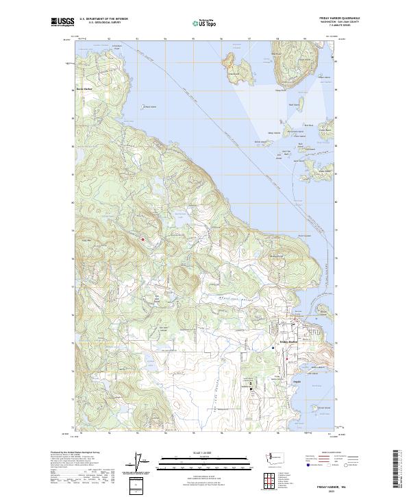 2023 Friday Harbor2023 Print · USGSSan Juan Island and its surrounding archipelago are shown here in the early 2020s, centered on the bustling port of Friday Harbor. Researchers can trace the layout of island life from the San Juan County Courthouse to the coastal settlement at Argyle and the grounds of San Juan Cem.
 - 2023 Map of Waldron Island, 2023 Print
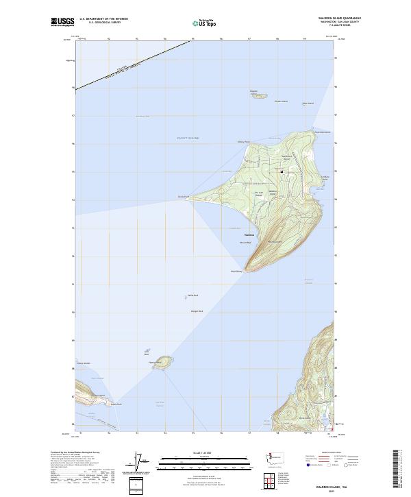 2023 Waldron Island2023 Print · USGSWaldron Island and its surrounding archipelago appear here in high detail during the early twenty-first century. Researchers can trace the local landscape from the Waldron Cem to the Waldronaire Airport, or locate small landmarks like Mount Cement and Mouatt Reef.
 - 2023 Map of Stuart Island, 2023 Print
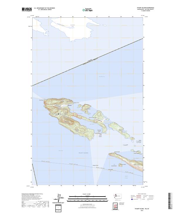 2023 Stuart Island2023 Print · USGSThe San Juan Islands archipelago appears here in modern detail, illustrating the isolated settlement of Prevost and the critical Anacortes - Sidney Ferry route. Genealogists and historians can locate the Stuart Island Cem and landmarks like Lofgren Mtn and Turn Point.
 - 2023 Map of Roche Harbor, 2023 Print
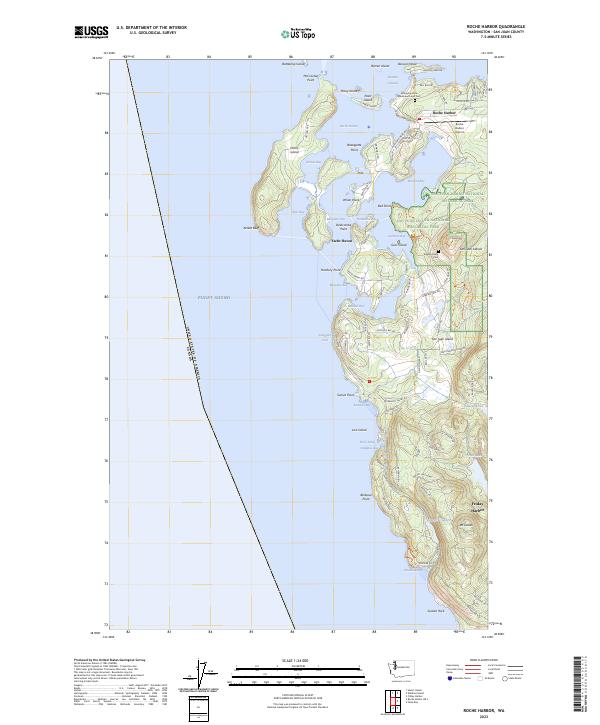 2023 Roche Harbor2023 Print · USGSSan Juan Island's northern coast is shown in high detail at the dawn of the 2020s, highlighting the intersection of maritime heritage and preserved wilderness. Trace historic sites like the Afterglow Vista Mausoleum or navigate the shoreline from Mosquito Pass to Yacht Haven.
 - 2023 Map of Mount Constitution, 2023 Print
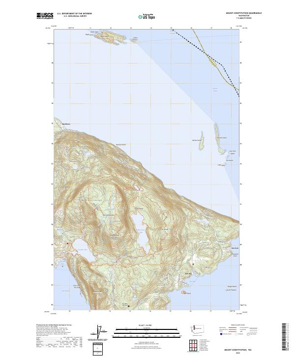 2023 Mount Constitution2023 Print · USGSCovers San Juan County, including Buckhorn, Sea Acre, and other nearby areas
 - 2023 Map of Shaw Island, 2023 Print
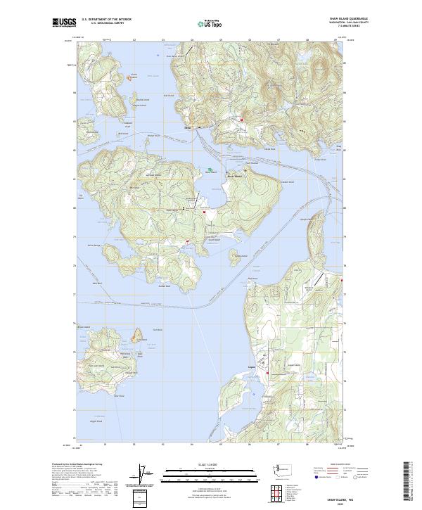 2023 Shaw Island2023 Print · USGSThe San Juan Islands are shown in great detail in this 2023 survey, from the protected San Juan Islands Wilderness to the quiet roads of Shaw Island. Trace family-named landmarks and local history at Shaw Island Cem or the Wilding Farm Airport.
 - 2023 Map of Lummi Bay OE W, 2023 Print
 2023 Lummi Bay OE W2023 Print · USGSThe maritime reaches of the northern Salish Sea are charted in this contemporary survey, capturing the aquatic intersection of two counties. Researchers can trace the submerged contours of Alden Bank and the coastal edge of Birch Bay.
 - 2023 Map of Sucia Island, 2023 Print
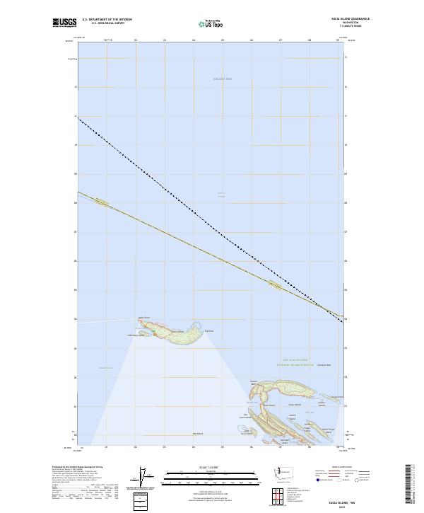 2023 Sucia Island2023 Print · USGSThe northernmost San Juan Islands appear in high detail at the start of the 2020s, showing the intersection of maritime passage and protected wilderness. Trace the rocky shorelines of Patos Island and Sucia Island or locate isolated points like Alden Point and Toe Point.
 - 2023 Map of Cypress Island, 2023 Print
 2023 Cypress Island2023 Print · USGSThe northern Puget Sound islands are surveyed here in the early twenty-first century, showing the ferry routes and remote harbor settlements of Skagit County. Researchers can trace land markers like Edens Cem on Guemes Island or the maritime reaches of Eagle Harbor and Indian Village.
 - 2023 Map of Richardson, 2023 Print
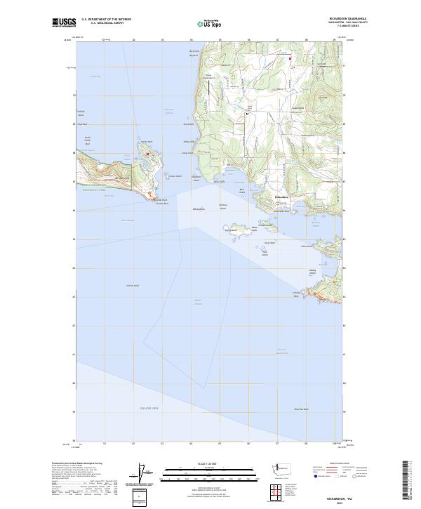 2023 Richardson2023 Print · USGSThe southern San Juan Islands are mapped here in the 2020s, showing the intricate coastline and interior of Lopez Island. Researchers can trace land use around the Richardson settlement, Lopez Hill, and historical sites near the Cattle Point lighthouse area.
 - 2023 Map of Lopez Pass, 2023 Print
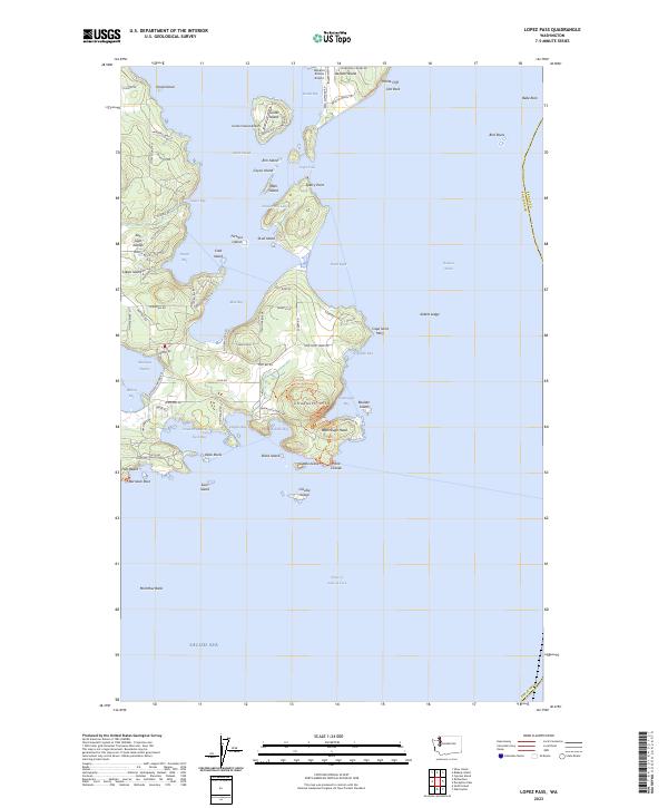 2023 Lopez Pass2023 Print · USGSThe San Juan Islands are captured in this modern survey of the archipelago's southeastern reaches. Researchers can trace land use near Decatur Shores Airport or locate landmarks like Watmough Head and Cape Saint Mary.
 - 2023 Map of Lummi Island, 2023 Print
 2023 Lummi Island2023 Print · USGSLummi Island and the surrounding San Juan archipelago are shown in high detail during the early 2020s, highlighting the island's coastal roads and maritime landmarks. Trace family history at the Lummi Island Cem or explore the geography of Village Point, Gooseberry Point, and Portage Island.
 - 2023 Map of Deception Pass, 2023 Print
 2023 Deception Pass2023 Print · USGSThe northern tip of Whidbey Island and the southern reaches of Anacortes meet at this famous maritime passage. Trace the residential growth at Anaco Beach or explore the protected lands of Burrows Island and the heights of Mt Erie.
 - 2023 Map of Blakely Island, 2023 Print
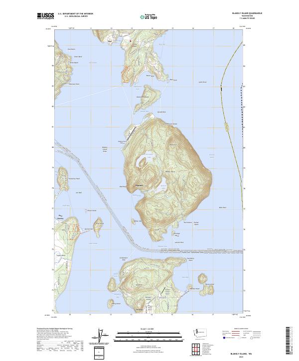 2023 Blakely Island2023 Print · USGSThe eastern San Juan Islands are mapped here in the modern era, showing the maritime networks and private airstrips that sustain these communities. Genealogists and local historians can trace the settlements of Thatcher and Decatur or locate family landmarks near Horseshoe Lake.
 - 2023 Map of Eastsound, 2023 Print
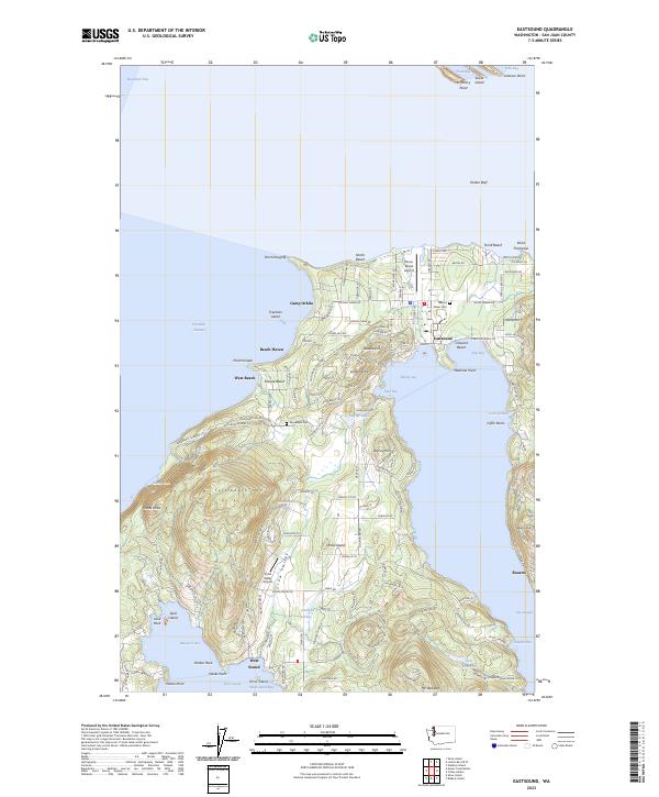 2023 Eastsound2023 Print · USGSOrcas Island and its surrounding waters are charted here in the early twenty-first century, showing the heart of the San Juan archipelago. Genealogists and historians can trace cemetery sites like Woodlawn Cem or investigate coastal settlements at Eastsound and West Sound.
End of results
Showing maps 1-18 of 18
Top cities of San Juan County
Frequently asked questions
- What are the different types of historical maps available for San Juan County?
- What is the oldest map of San Juan County?
- Where can I purchase historical maps of San Juan County for my home or office?
- Where can I download high-res historical maps of San Juan County?
- Are there historical topographic maps available for San Juan County?
- Is there historical aerial imagery available for San Juan County?
- Where are historical maps of San Juan County sourced from?