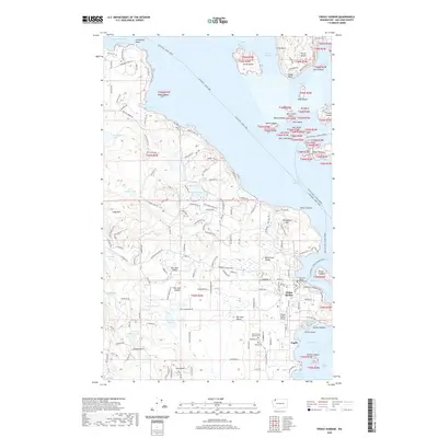
2020 Map of Friday Harbor
USGS Topo · Published 2020About this map
Friday Harbor serves as the focal point of this maritime landscape on San Juan Island, where the town's grid meets the protected waters of its namesake bay. As the county seat, the San Juan County Courthouse stands near the harbor's edge, anchoring a community defined by its connection to the surrounding archipelago. The map illustrates a dense network of island roads like Roche Harbor Rd and Beaverton Valley Rd that link the central village to outlying geographic features including the heights of Cady Mtn and the pastoral stretches of San Juan Valley.
Find a feature on this map
168 named features on this map. Tap any name to fly to it.
Don’t see what you’re looking for? This feature index may not catch every label — zoom into the map to look around manually.
Map Details
Editions of this 2020 Friday Harbor Map
This is the sole edition of this map. No revisions or reprints were ever made.
Other maps of this area

1943 · Richardson
USGS Topo · 1:62,500

1943 · Orcas Island
USGS Topo · 1:62,500

1953 · Stuart Island
USGS Topo · 1:24,000

1954 · Roche Harbor
USGS Topo · 1:24,000

1954 · Waldron Island
USGS Topo · 1:24,000

1954 · Friday Harbor
USGS Topo · 1:24,000

1954 · False Bay
USGS Topo · 1:24,000

1957 · Richardson
USGS Topo · 1:62,500

1957 · Orcas Island
USGS Topo · 1:62,500

1957 · Victoria
USGS Topo · 1:250,000