
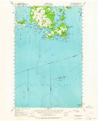
1957 Map of Richardson
USGS Topo · Published 1958About this map
The settlement of Richardson and the surrounding coastline of south Lopez Island define this 1957 coastal survey. This era showcases the rural island infrastructure before modern development, featuring the Lopez Sch and a local Cemetery centrally located inland. Navigational markers like the Cattle Point Beacon and the Smith Island Beacon emphasize the area's importance for maritime traffic through the Middle Channel and Strait of Juan de Fuca.
Find a feature on this map
82 named features on this map. Tap any name to fly to it.
Don’t see what you’re looking for? This feature index may not catch every label — zoom into the map to look around manually.
Map Details
Editions of this 1957 Richardson Map
2 editions found
Other maps of this area

1938 · Dungeness
USGS Topo · 1:62,500

1939 · Port Townsend
USGS Topo · 1:62,500

1939 · Dungeness
USGS Topo · 1:62,500

1939 · Coupeville
USGS Topo · 1:62,500

1943 · Richardson
USGS Topo · 1:62,500

1943 · Orcas Island
USGS Topo · 1:62,500

1943 · Deception Pass
USGS Topo · 1:62,500

1943 · Anacortes
USGS Topo · 1:62,500

1951 · Deception Pass
USGS Topo · 1:62,500

1951 · Anacortes
USGS Topo · 1:62,500