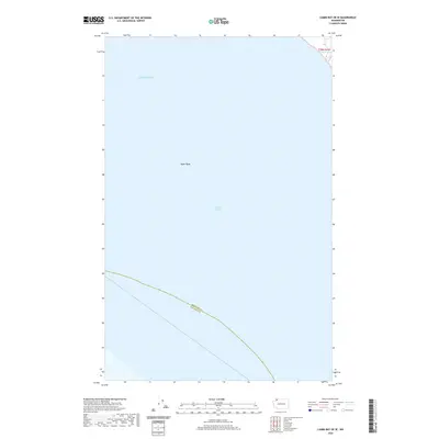
2020 Map of Lummi Bay OE W
USGS Topo · Published 2020About this map
The Salish Sea and the Strait of Georgia dominate this coastal expanse, capturing the maritime geography of the Pacific Northwest in the early twenty-first century. The map focuses on the submerged topography of the Alden Bank, a notable bathymetric feature within these shared waters. Along the southern edge, a diagonal boundary line marks the division between Whatcom County and San Juan County, tracing a administrative path through the open water. A small sliver of shoreline in the northeast corner near t39n r1w indicates the transition to terrestrial survey grids, though the primary character of this sheet is defined by its vast aquatic reaches and the essential international and regional waterways that serve the Salish Sea ecosystem.
Find a feature on this map
5 named features on this map. Tap any name to fly to it.
Don’t see what you’re looking for? This feature index may not catch every label — zoom into the map to look around manually.
Map Details
Editions of this 2020 Lummi Bay OE W Map
This is the sole edition of this map. No revisions or reprints were ever made.
Other maps of this area

1907 · Blaine
USGS Topo · 1:62,500

1943 · Orcas Island
USGS Topo · 1:62,500

1943 · Anacortes
USGS Topo · 1:62,500

1951 · Anacortes
USGS Topo · 1:62,500

1952 · Birch Point
USGS Topo · 1:24,000

1952 · Lummi Bay
USGS Topo · 1:24,000

1952 · Blaine
USGS Topo · 1:24,000

1952 · Blaine
USGS Topo · 1:62,500

1957 · Orcas Island
USGS Topo · 1:62,500

1957 · Victoria
USGS Topo · 1:250,000