Old Maps of Waldron, Washington for Academic Research
Study the evolution of Waldron with 9 high-resolution historic maps. Whether you're teaching, researching, or modeling changes in land use, these maps provide essential visual documentation of urban, environmental, and geographic change.
- Analyze long-term change: Track patterns in development, transportation, and natural features.
- Ideal for environmental or urban studies: Support academic projects with primary historical map data.
- Use in the classroom or lab: Educators and researchers rely on these maps to bring historical context to life.
These maps are a powerful tool for teaching, research, and visualizing how Waldron has changed over the decades.
Waldron, WA maps
(9)- 1954 Map of Waldron Island, 1957 Print
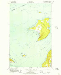 1954 Waldron Island1957 Print · USGSThe San Juan Islands remained a quiet maritime frontier in the mid-fifties, dominated by rocky shorelines and international waters. Trace the layout of the Waldron settlement, locate the island Cemetery, or find the Abandoned Quarry on the nearby cliffs of Orcas Island.4 unique versions available
 - 1957 Map of Victoria, 1960 Print
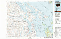
 1957 Victoria1960 Print · USGSThe San Juan Islands and the North Cascades coastline are shown in detail during the late fifties, a period of significant military and industrial presence. Researchers can trace historic rail lines like the Great Northern or locate sites such as the Whidbey Island Naval Air Sta and Friday Harbor.4 unique versions available
 - 1981 Map of Roche Harbor
 1981 Roche Harbor1981 Print · USGSThe maritime boundary between the Gulf Islands and San Juans was well-established by the early eighties. Researchers can trace transportation routes like the Canadian Pacific Railway and find coastal settlements from Sidney to Ganges.2 unique versions available
 - 1997 Map of Waldron Island, 2003 Print
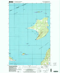 1997 Waldron Island2003 Print · USGSWaldron Island remains an isolated community in the late nineties, anchored by its small post office and local boat docks. Researchers can trace land use through features like Sawmill Corner, the local Cem, and the Landing Strip.
 - 2011 Map of Waldron Island, 2011 Print
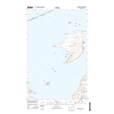
 2011 Waldron Island2011 Print · USGSCovers Waldron, including Southern Gulf Islands Electoral Area, San Juan County, and other nearby areas
 - 2014 Map of Waldron Island, 2014 Print
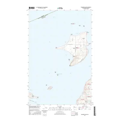
 2014 Waldron Island2014 Print · USGSCovers Waldron, including Southern Gulf Islands Electoral Area, San Juan County, and other nearby areas
 - 2017 Map of Waldron Island, 2017 Print
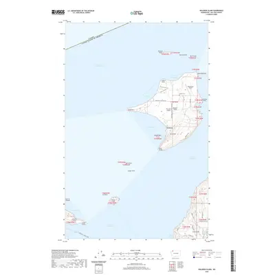
 2017 Waldron Island2017 Print · USGSCovers Waldron, including Southern Gulf Islands Electoral Area, San Juan County, and other nearby areas
 - 2020 Map of Waldron Island, 2020 Print
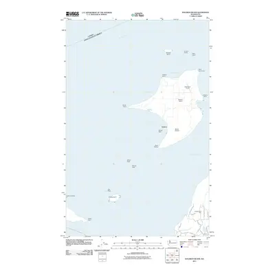
 2020 Waldron Island2020 Print · USGSCovers Waldron, including Southern Gulf Islands Electoral Area, San Juan County, and other nearby areas
 - 2023 Map of Waldron Island, 2023 Print
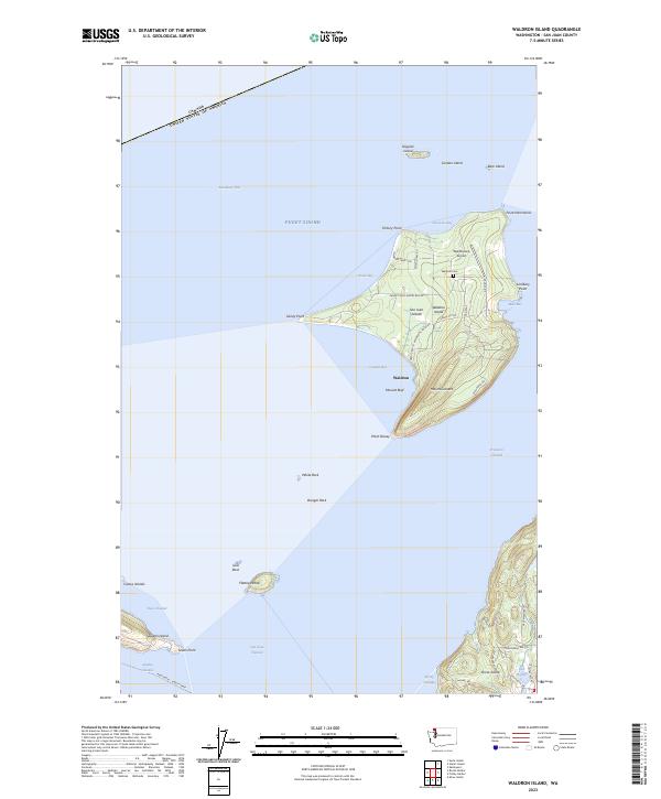 2023 Waldron Island2023 Print · USGSWaldron Island and its surrounding archipelago appear here in high detail during the early twenty-first century. Researchers can trace the local landscape from the Waldron Cem to the Waldronaire Airport, or locate small landmarks like Mount Cement and Mouatt Reef.
End of results
Showing maps 1-9 of 9
Top cities near Waldron
Frequently asked questions
- What are the different types of historical maps available for Waldron?
- What is the oldest map of Waldron?
- Where can I purchase historical maps of Waldron for my home or office?
- Where can I download high-res historical maps of Waldron?
- Are there historical topographic maps available for Waldron?
- Is there historical aerial imagery available for Waldron?
- Where are historical maps of Waldron sourced from?