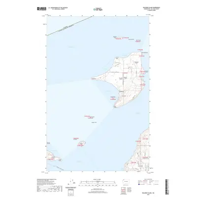
2020 Map of Waldron Island
USGS Topo · Published 2020About this map
Waldron Island sits at the northern edge of the archipelago, just south of the maritime border where the United States of America meets British Columbia. This island community, centered around the settlement of Waldron, maintains a network of rural roads such as Cowlitz Bay Rd and Mountain Rd that connect the small harbor at Cowlitz Bay with inland landmarks. The landscape is dominated by the prominence of Mt Cement and terminates at rocky outcrops like Point Disney and Fishery Point. To the east, the Waldronaire Airport and the Waldron Cem reflect the essential infrastructure of this isolated locale. The surrounding waters of Boundary Pass and President Channel are dotted with smaller landforms, including Skipjack Island, Gull Rock, and Flattop Island, while the southern reaches of the map capture the northern coastline of Orcas Island near Deer Harbor.
Find a feature on this map
54 named features on this map. Tap any name to fly to it.
Don’t see what you’re looking for? This feature index may not catch every label — zoom into the map to look around manually.
Map Details
Editions of this 2020 Waldron Island Map
This is the sole edition of this map. No revisions or reprints were ever made.
Other maps of this area

1943 · Orcas Island
USGS Topo · 1:62,500

1953 · Stuart Island
USGS Topo · 1:24,000

1954 · Roche Harbor
USGS Topo · 1:24,000

1954 · Waldron Island
USGS Topo · 1:24,000

1954 · Friday Harbor
USGS Topo · 1:24,000

1957 · Orcas Island
USGS Topo · 1:62,500

1957 · Victoria
USGS Topo · 1:250,000

1973 · Sucia Island
USGS Topo · 1:24,000

1973 · Shaw Island
USGS Topo · 1:24,000

1975 · Bellingham
USGS Topo · 1:100,000