Old Maps of Clearidge, Anacortes for Metal Detecting
Plan your next treasure hunt with 11 historic maps of Clearidge. Find old homesites, ghost towns, trails, and gathering spots that may be lost to time — perfect for identifying promising metal detecting locations.
- Locate forgotten sites: Uncover places like long-lost settlements, abandoned rail lines, or gathering spots.
- Plan better hunts: Use map overlays combined with LiDAR or satellite views to narrow in on historically rich areas.
- Made for detectorists: Thousands of hobbyists use these maps to discover relics, coins, and hidden history.
Use these historic maps to boost your research and find new opportunities beneath the surface of Clearidge.
Clearidge, Anacortes maps
(11)- 1943 Map of Anacortes
 1943 Anacortes1943 Print · USGSThe San Juan Islands and Skagit coastline appear here in the early 1940s, during an era of remote island schoolhouses and ferry reliance. Genealogists can locate family landmarks like Eden Cem and Guemes Sch, or trace the waterfront of Anacortes and South Bellingham.
 - 1951 Map of Anacortes, 1953 Print
 1951 Anacortes1953 Print · USGSThe northern Puget Sound islands and the city of Anacortes are captured here in the early fifties during a period of steady coastal growth. Researchers can locate vanished landmarks and family roots at Eden Cem, Sinclair Sch, and the Lummi Indian Reservation.2 unique versions available
 - 1957 Map of Victoria, 1960 Print
 1957 Victoria1960 Print · USGSThe San Juan Islands and the North Cascades coastline are shown in detail during the late fifties, a period of significant military and industrial presence. Researchers can trace historic rail lines like the Great Northern or locate sites such as the Whidbey Island Naval Air Sta and Friday Harbor.4 unique versions available
 - 1973 Map of Cypress Island, 1977 Print
 1973 Cypress Island1977 Print · USGSThe northern San Juan Islands are captured in the early 1970s, from the rugged interior of Cypress Island to the growing docks of Anacortes. Researchers can trace the layout of small settlements like Urban and Indian Village or locate local landmarks such as Eden Cem and the Sinclair Island Light.2 unique versions available
 - 1975 Map of Bellingham, 1977 Print
 1975 Bellingham1977 Print · USGSNorthwest Washington in the mid-seventies is captured here, from the Canadian border at Blaine to the San Juan Islands. Researchers can trace tribal lands on the Lummi Indian Reservation, find rural settlements like Cokedale, or follow the Burlington Northern rail lines.
 - 1997 Map of Cypress Island, 2003 Print
 1997 Cypress Island2003 Print · USGSThe northern Puget Sound islands are frozen in time just before the turn of the millennium, showing a maritime landscape of isolated island settlements and coastal hubs. Trace family history and local landmarks from the Eden Cem on Guemes Island to the small community of Urban on Sinclair Island.
 - 2011 Map of Cypress Island, 2011 Print
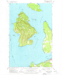
 2011 Cypress Island2011 Print · USGSCovers Clearidge, including Anacortes, Indian Village, and other nearby areas
 - 2014 Map of Cypress Island, 2014 Print
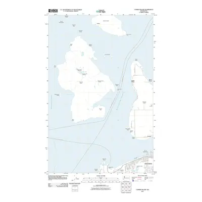
 2014 Cypress Island2014 Print · USGSCovers Clearidge, including Anacortes, Indian Village, and other nearby areas
 - 2017 Map of Cypress Island, 2017 Print
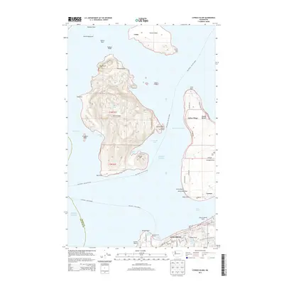
 2017 Cypress Island2017 Print · USGSCovers Clearidge, including Anacortes, Indian Village, and other nearby areas
 - 2020 Map of Cypress Island, 2020 Print
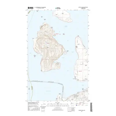
 2020 Cypress Island2020 Print · USGSCovers Clearidge, including Anacortes, Indian Village, and other nearby areas
 - 2023 Map of Cypress Island, 2023 Print
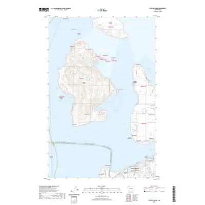
 2023 Cypress Island2023 Print · USGSThe northern Puget Sound islands are surveyed here in the early twenty-first century, showing the ferry routes and remote harbor settlements of Skagit County. Researchers can trace land markers like Edens Cem on Guemes Island or the maritime reaches of Eagle Harbor and Indian Village.
End of results
Showing maps 1-11 of 11
Frequently asked questions
- What are the different types of historical maps available for Clearidge?
- What is the oldest map of Clearidge?
- Where can I purchase historical maps of Clearidge for my home or office?
- Where can I download high-res historical maps of Clearidge?
- Are there historical topographic maps available for Clearidge?
- Is there historical aerial imagery available for Clearidge?
- Where are historical maps of Clearidge sourced from?