Old Maps of Stevenson, Washington for Academic Research
Study the evolution of Stevenson with 17 high-resolution historic maps. Whether you're teaching, researching, or modeling changes in land use, these maps provide essential visual documentation of urban, environmental, and geographic change.
- Analyze long-term change: Track patterns in development, transportation, and natural features.
- Ideal for environmental or urban studies: Support academic projects with primary historical map data.
- Use in the classroom or lab: Educators and researchers rely on these maps to bring historical context to life.
These maps are a powerful tool for teaching, research, and visualizing how Stevenson has changed over the decades.
Stevenson, WA maps
(17)- 1926 Map of Hood River, 1955 Print
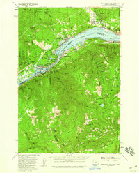
 1926 Hood River1955 Print · USGSThe Columbia River Gorge in the mid-twenties shows a landscape defined by competing railroads and early trans-river engineering. Trace the rail lines between Stevenson and Hood River, or locate historic sites like Hemlock Sch and the Bridge of the Gods.
 - 1929 Map of Hood River
 1929 Hood River1929 Print · USGSThe Columbia River Gorge and Hood River Valley are captured here in the late twenties during a period of significant infrastructure growth. Researchers can trace the early rail networks, find remote forest outposts like Race Track Ranger Sta, and locate vanished landmarks such as the Government Sprs Hotel.3 unique versions available
 - 1953 Map of The Dalles, 1965 Print
 1953 The Dalles1965 Print · USGSThe Columbia River Gorge at mid-century shows a region being transformed by massive hydroelectric dams and a growing highway network. Researchers can trace the development of The Dalles Dam, locate the Maryhill Museum, and find old rail stops in Rufus, Wishram, and Arlington.3 unique versions available
 - 1956 Map of The Dalles
 1956 The Dalles1956 Print · USGSThe Columbia River Gorge and the high Cascades are captured in the mid-1950s, showing a vital corridor of rail and road. Researchers can trace the original path of The Old Oregon Trail or locate historical landmarks like the Maryhill Museum and Mount Hood.
 - 1957 Map of The Dalles
 1957 The Dalles1957 Print · USGSThe Columbia River Gorge and the high plateaus of the mid-1950s come alive on this detailed survey of northern Oregon and southern Washington. Researchers can trace the path of the Oregon Trail and The Old Barlow Road alongside river towns like The Dalles and Wishram.
 - 1957 Map of Bonneville Dam, 1959 Print
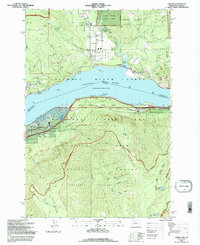
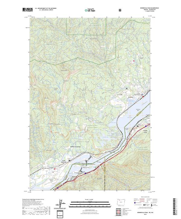
 1957 Bonneville Dam1959 Print · USGSThe Columbia River Gorge in the late fifties was a landscape of industrial power and remote forest trails. Map collectors can trace the mid-century footprints of Stevenson and Cascade Locks or locate landmarks like St Martins Hot Springs and the Bridge of the Gods.2 unique versions available
 - 1979 Map of Bonneville Dam
 1979 Bonneville Dam1979 Print · USGSThe Columbia River Gorge in the late seventies reveals a landscape of massive hydroelectric works and timbered peaks. Genealogists and historians can trace the riverside towns of Stevenson and Cascade Locks or locate the site of the Bonneville Dam.
 - 1982 Map of Hood River, 1983 Print
 1982 Hood River1983 Print · USGSThe Columbia River Gorge in the early eighties shows a landscape shaped by massive hydroelectric projects and deep-rooted timber communities. Researchers can trace the rail-and-river network through Cascade Locks and The Dalles Dam, or explore the terrain of Gifford Pinchot National Forest.
 - 1994 Map of Carson, 1996 Print
 1994 Carson1996 Print · USGSThe Columbia River Gorge in the mid-nineties shows the vital intersection of Pacific Northwest timber lands and major transport corridors. Trace the paths of the Union Pacific Railroad and Pacific Crest National Scenic Trail past Carson and Wyeth.
 - 1994 Map of Bonneville Dam, 1996 Print
 1994 Bonneville Dam1996 Print · USGSThe Columbia River Gorge in the mid-nineties shows a landscape defined by massive hydropower and river traffic. Researchers can trace the engineering footprint of Bonneville Dam, find the Iman Cem, and follow the Bridge of the Gods into Cascade Locks.
 - 2011 Map of Bonneville Dam, 2011 Print
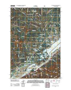 2011 Bonneville Dam2011 Print · USGSCovers Stevenson, including Cascade Locks, North Bonneville, and other nearby areas
 - 2014 Map of Bonneville Dam, 2014 Print
 2014 Bonneville Dam2014 Print · USGSCovers Stevenson, including Cascade Locks, North Bonneville, and other nearby areas
 - 2017 Map of Bonneville Dam, 2017 Print
 2017 Bonneville Dam2017 Print · USGSCovers Stevenson, including Cascade Locks, North Bonneville, and other nearby areas
 - 2020 Map of Bonneville Dam, 2020 Print
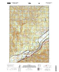 2020 Bonneville Dam2020 Print · USGSCovers Stevenson, including Cascade Locks, North Bonneville, and other nearby areas
 - 2023 Map of Bonneville Dam, 2023 Print
 2023 Bonneville Dam2023 Print · USGSCovers Stevenson, including Cascade Locks, North Bonneville, and other nearby areas
 - 2023 Map of Carson, 2023 Print
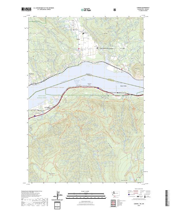 2023 Carson2023 Print · USGSIn the heart of the Columbia Gorge during the 2020s, the river connects the communities of Carson and Cascade Locks. Genealogists can locate numerous local burial grounds such as Old Carson Cem and Wind River Cem near the Wind River confluence.
 - 2024 Map of Bonneville Dam, 2024 Print
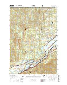
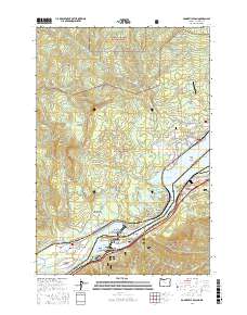
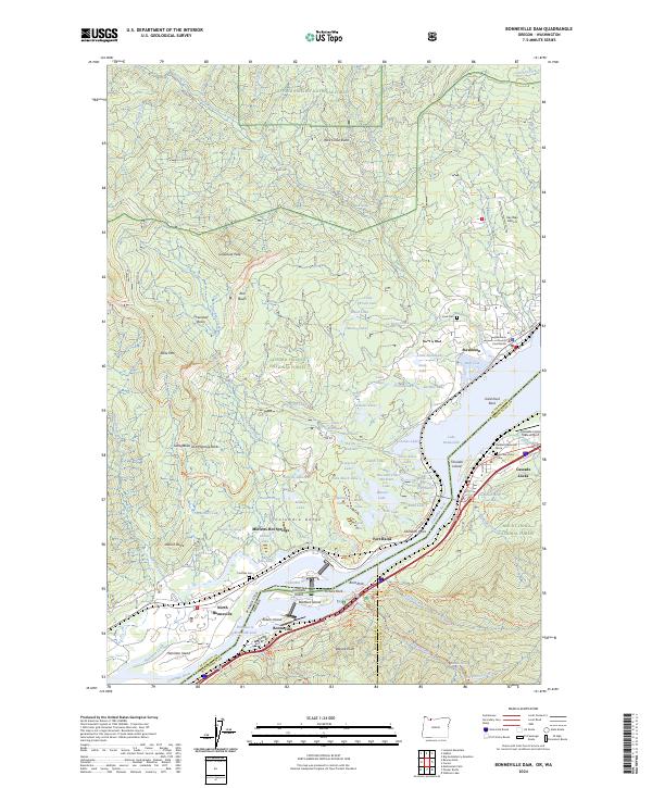 2024 Bonneville Dam2024 Print · USGSThe Columbia River Gorge comes to life on this map, showing the towns of Stevenson and North Bonneville along the river's edge. Researchers can locate specific sites like Iman Cem, Fort Rains, and the Freddie Masterson Grave amidst the sprawling forest terrain.
End of results
Showing maps 1-17 of 17
Top cities near Stevenson
Frequently asked questions
- What are the different types of historical maps available for Stevenson?
- What is the oldest map of Stevenson?
- Where can I purchase historical maps of Stevenson for my home or office?
- Where can I download high-res historical maps of Stevenson?
- Are there historical topographic maps available for Stevenson?
- Is there historical aerial imagery available for Stevenson?
- Where are historical maps of Stevenson sourced from?