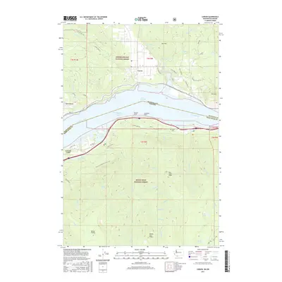
2017 Map of Carson
USGS Topo · Published 2017About this map
Lake Bonneville and the Columbia River dominate this 2017 survey, marking the state boundary between Carson, Washington and the forested slopes of Oregon. The landscape is defined by the massive reach of the Gifford Pinchot National Forest to the north and the Mount Hood National Forest to the south. This era shows the continued importance of the river corridor for transportation and recreation, with the Pacific Crest National Scenic Trail winding through the high elevations of the southern section. Notable points of interest include the historic Saint Martins Hot Springs and local burial grounds such as McQuinn Cem and Wyeth Cem. The map illustrates a complex geography of ridges and plateaus, from Buck Mtn in the north to the Benson Plateau in the south, separated by the deep gorge of the Columbia. Smaller settlements like Stevenson and Cascade Locks anchor the riverbanks, connected by infrastructure such as Nick Eaton Way and Hot Springs Ave.
Find a feature on this map
75 named features on this map. Tap any name to fly to it.
Don’t see what you’re looking for? This feature index may not catch every label — zoom into the map to look around manually.
Map Details
Editions of this 2017 Carson Map
This is the sole edition of this map. No revisions or reprints were ever made.
Other maps of this area

1926 · Hood River
USGS Topo · 1:125,000

1929 · Hood River
USGS Topo · 1:125,000

1953 · The Dalles
USGS Topo · 1:250,000

1956 · The Dalles
USGS Topo · 1:250,000

1957 · The Dalles
USGS Topo · 1:250,000

1957 · Bonneville Dam
USGS Topo · 1:62,500

1957 · Wind River
USGS Topo · 1:62,500

1957 · Willard
USGS Topo · 1:62,500

1957 · Hood River
USGS Topo · 1:62,500
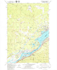
1979 · Bonneville Dam
USGS Topo · 1:24,000