
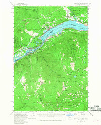
1957 Map of Bonneville Dam
USGS Topo · Published 1959About this map
Bonneville Dam and the Bridge of the Gods anchor this 1950s survey of the Columbia River Gorge, depicting the critical infrastructure and recreational landscape of the mid-century. The map shows the river corridor as a hub of heavy transport, with the Union Pacific and Spokane Portland and Seattle railroads lining opposite banks. Beyond the industrial and transit arteries, the map reveals a densely managed forest environment across the Gifford Pinchot and Mount Hood National Forest, connected by the Skyline Trail.
Find a feature on this map
79 named features on this map. Tap any name to fly to it.
Don’t see what you’re looking for? This feature index may not catch every label — zoom into the map to look around manually.
Map Details
Editions of this 1957 Bonneville Dam Map
2 editions found
Other maps of this area

1916 · Estacada
USGS Topo · 1:125,000

1924 · Mount Hood
USGS Topo · 1:125,000

1926 · Hood River
USGS Topo · 1:125,000

1927 · Mount Hood
USGS Topo · 1:125,000

1929 · Hood River
USGS Topo · 1:125,000

1940 · Lookout Mtn
USGS Topo · 1:62,500

1948 · Vancouver
USGS Topo · 1:250,000

1950 · Vancouver
USGS Topo · 1:250,000

1950 · Vancouver
USGS Topo · 1:250,000

1953 · Lookout Mtn
USGS Topo · 1:62,500