
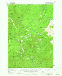
1957 Map of Wind River
USGS Topo · Published 1959About this map
Stabler serves as a primary settlement node along the Wind River within the Gifford Pinchot National Forest during the late 1950s. The landscape is defined by the intersection of forest management and early recreational development, featuring numerous established sites like Government Mineral Springs and Little Soda Springs Forest Camp. This era of the Wind River Experimental Forest highlights the region's focus on silviculture and natural resource study, evidenced by specialized infrastructure such as the Fish Hatchery and the Hemlock Ranger Sta. at the edge of the Wind River Natural Area.
Find a feature on this map
102 named features on this map. Tap any name to fly to it.
Don’t see what you’re looking for? This feature index may not catch every label — zoom into the map to look around manually.
Map Details
Editions of this 1957 Wind River Map
Other maps of this area

1919 · Mount St Helens
USGS Topo · 1:125,000

1926 · Steamboat Mtn
USGS Topo · 1:125,000

1926 · Hood River
USGS Topo · 1:125,000

1929 · Hood River
USGS Topo · 1:125,000

1931 · Steamboat Mtn
USGS Topo · 1:125,000

1940 · Lookout Mtn
USGS Topo · 1:62,500

1948 · Vancouver
USGS Topo · 1:250,000

1950 · Vancouver
USGS Topo · 1:250,000

1950 · Vancouver
USGS Topo · 1:250,000

1950 · Yakima
USGS Topo · 1:250,000