Old Maps of Tyler, Washington for Metal Detecting
Plan your next treasure hunt with 10 historic maps of Tyler. Find old homesites, ghost towns, trails, and gathering spots that may be lost to time — perfect for identifying promising metal detecting locations.
- Locate forgotten sites: Uncover places like long-lost settlements, abandoned rail lines, or gathering spots.
- Plan better hunts: Use map overlays combined with LiDAR or satellite views to narrow in on historically rich areas.
- Made for detectorists: Thousands of hobbyists use these maps to discover relics, coins, and hidden history.
Use these historic maps to boost your research and find new opportunities beneath the surface of Tyler.
Tyler, WA maps
(10)- 1954 Map of Sprague, 1956 Print
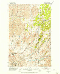 1954 Sprague1956 Print · USGSEastern Washington’s Channeled Scablands are captured in the mid-1950s, showing a complex network of four major railroads crossing the rocky terrain. Genealogists and rail historians can trace the foundations of Sprague, the community at Fishtrap, and the Aban'd Sch near Tyler.2 unique versions available
 - 1955 Map of Spokane, 1965 Print
 1955 Spokane1965 Print · USGSInland Empire life in the fifties and sixties centers on the growth of Spokane and the heavy mining industry of northern Idaho. Trace mid-century landmarks like Fairchild Air Force Base, the Bunker Hill Mine, and early campuses such as Gonzaga University.2 unique versions available
 - 1958 Map of Spokane
 1958 Spokane1958 Print · USGSThe Inland Empire is shown at a mid-century peak of industrial and military activity, from the rail hubs of Spokane to the deep silver mines of northern Idaho. Researchers can trace the sprawling rail lines of the Union Pacific RR or locate landmarks like Fairchild Air Force Base and the Bunker Hill Smelter & Mine.
 - 1980 Map of Tyler, 1981 Print
 1980 Tyler1981 Print · USGSSpokane and Lincoln Counties are captured here in the early 1980s as modern highway interchanges began to reshape the old prairie settlements. Genealogists can locate Rockdale Cem and trace the rail-side growth of Tyler and Fishtrap.
 - 1984 Map of Rosalia
 1984 Rosalia1984 Print · USGSThe Palouse region of Eastern Washington and the Idaho borderlands are shown here in the mid-1980s, a landscape of rolling wheat fields and vital rail corridors. Genealogists and historians can trace the early layout of Cheney, the rail junctions at Rosalia, and the distinct topography of Steptoe Butte.
 - 2011 Map of Tyler, 2011 Print
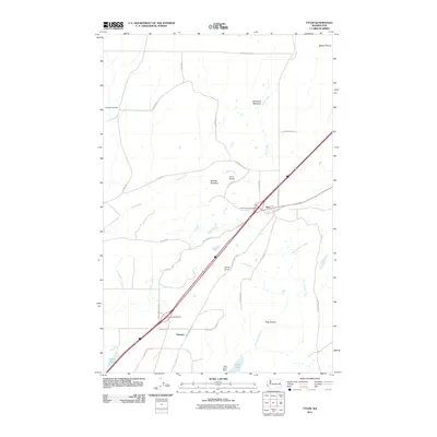 2011 Tyler2011 Print · USGSCovers Tyler, including Spokane County, Lincoln County, and other nearby areas
 - 2014 Map of Tyler, 2014 Print
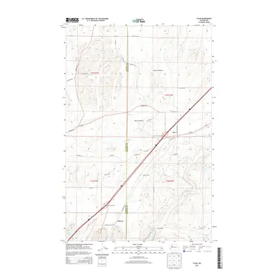 2014 Tyler2014 Print · USGSCovers Tyler, including Spokane County, Lincoln County, and other nearby areas
 - 2017 Map of Tyler, 2017 Print
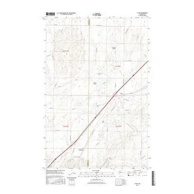 2017 Tyler2017 Print · USGSCovers Tyler, including Spokane County, Lincoln County, and other nearby areas
 - 2020 Map of Tyler, 2020 Print
 2020 Tyler2020 Print · USGSCovers Tyler, including Spokane County, Lincoln County, and other nearby areas
 - 2023 Map of Tyler, 2023 Print
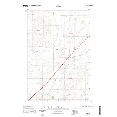
 2023 Tyler2023 Print · USGSSpokane and Lincoln counties meet in this modern survey of the high plateau and meadowlands. Genealogists and local historians can trace the rural layout of Fishtrap and Tyler, locate family plots at Rockdale Cem, or scout the banks of Rock Creek.
End of results
Showing maps 1-10 of 10
Top cities near Tyler
- Spokane historical maps
- Cheney historical maps
- Airway Heights historical maps
- Medical Lake historical maps
- Sprague historical maps
- Espanola historical maps
Frequently asked questions
- What are the different types of historical maps available for Tyler?
- What is the oldest map of Tyler?
- Where can I purchase historical maps of Tyler for my home or office?
- Where can I download high-res historical maps of Tyler?
- Are there historical topographic maps available for Tyler?
- Is there historical aerial imagery available for Tyler?
- Where are historical maps of Tyler sourced from?