Old Maps of Turk, Washington for Genealogy
Trace your family roots with 11 historic maps of Turk. These high-res maps reveal old neighborhoods, homesites, landmarks, and streets — helping you uncover where your ancestors lived and how the area evolved over time.
- Explore historic neighborhoods: Identify where your relatives may have lived in the 1800s or 1900s.
- Compare maps over time: Trace the changes in streets, buildings, and landmarks for multi-generational research.
- Perfect for genealogy & ancestry research: Used by family historians and researchers to map out lineage and migration.
These maps are an incredible resource for exploring your personal connection to Turk's past.
Turk, WA maps
(11)- 1948 Map of Hunters, 1960 Print
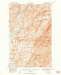
 1948 Hunters1960 Print · USGSIn the late 1940s, this portion of Stevens County shows the impact of the newly created Lake Roosevelt on the Columbia River valley. Researchers can trace remote mining operations like the Cleveland Mine and Germania Mine or locate family roots near the Enterprise Cem and Cedonia Sch.2 unique versions available
 - 1950 Map of Hunters
 1950 Hunters1950 Print · USGSStevens County is shown in the early postwar years as a rugged mining and ranching corridor between the Columbia River and the high peaks. Genealogists and researchers can locate family-named landmarks and rural centers like the Greenwood Grange, Enterprise Cemetery, and several remote operations including the Cleveland Mine.2 unique versions available
 - 1954 Map of Okanogan, 1964 Print
 1954 Okanogan1964 Print · USGSNorth Central Washington’s interior comes into focus during the mid-fifties, showing the rise of the Columbia River reservoir system. Genealogists and historians can trace the Great Northern rail line and locate historical mining operations at the Mountain Lion Mine or Gold Hill Mine.2 unique versions available
 - 1958 Map of Okanogan
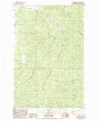
 1958 Okanogan1958 Print · USGSThe Okanogan River valley and the Colville Indian Reservation are shown here in the late fifties, during a period of established river and rail commerce. Researchers can trace the Great Northern line through Oroville or locate landmarks like the Knowlton School and Orient Ranger Station.
 - 1984 Map of Nespelem
 1984 Nespelem1984 Print · USGSThe Colville Indian Reservation and the Columbia River valley are shown here in the mid-1980s, just as modern recreation was shaping the landscape. Genealogists and researchers can locate old communities like Inchelium and Keller or trace mining history at the Germania Mine.
 - 1985 Map of Adams Mtn
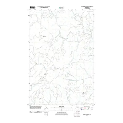
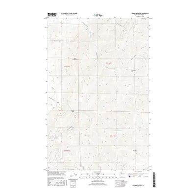
 1985 Adams Mtn1985 Print · USGSStevens County mining country is captured in the mid-1980s, revealing a landscape of high-altitude claims and creek-side settlements. Researchers can trace historic operations at the Cleveland Mine, the small community of Turk, and the border of the Spokane Indian Reservation.2 unique versions available
 - 2011 Map of Adams Mountain, 2011 Print
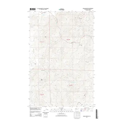
 2011 Adams Mountain2011 Print · USGSCovers Turk, including Deer Trail, Stevens County, and other nearby areas
 - 2014 Map of Adams Mountain, 2014 Print
 2014 Adams Mountain2014 Print · USGSCovers Turk, including Deer Trail, Stevens County, and other nearby areas
 - 2017 Map of Adams Mountain, 2017 Print
 2017 Adams Mountain2017 Print · USGSCovers Turk, including Deer Trail, Stevens County, and other nearby areas
 - 2020 Map of Adams Mountain, 2020 Print
 2020 Adams Mountain2020 Print · USGSCovers Turk, including Deer Trail, Stevens County, and other nearby areas
 - 2023 Map of Adams Mountain, 2023 Print
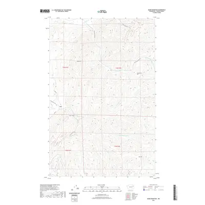
 2023 Adams Mountain2023 Print · USGSIn the high country of Stevens County during the early twenty-first century, this map shows the intersection of mountain timberlands and rural valley life. Researchers can trace the old road to Turk and the paths leading toward the Cleveland Mine Rd or the heights of Adams Mtn.
End of results
Showing maps 1-11 of 11
Frequently asked questions
- What are the different types of historical maps available for Turk?
- What is the oldest map of Turk?
- Where can I purchase historical maps of Turk for my home or office?
- Where can I download high-res historical maps of Turk?
- Are there historical topographic maps available for Turk?
- Is there historical aerial imagery available for Turk?
- Where are historical maps of Turk sourced from?