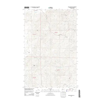
2014 Map of Adams Mountain
USGS Topo · Published 2014About this map
Adams Mtn and the surrounding peaks of Stevens County define this high-elevation landscape, where deep drainages like Cedar Canyon cut through the rugged terrain of eastern Washington. The map provides a detailed view of local infrastructure connecting small settlements such as Turk and Deer Trail, centered around the intersection of Springdale Hunters Rd and several primitive mountain tracks. In the southern portion of the quadrangle, the boundary of the Spokane Indian Reservation appears near the headwaters of O-Ra-Pak-En Cr, marking a transition from public lands to tribal territory. Water systems are prominent, with the forks of Hunter Cr and Middle Fork Chamokane Cr flowing through the timbered slopes. Evidence of the region’s extractive history is preserved in names like Cleveland Mine Rd, which leads toward the higher elevations of Huckleberry Mtn.
Find a feature on this map
25 named features on this map. Tap any name to fly to it.
Don’t see what you’re looking for? This feature index may not catch every label — zoom into the map to look around manually.
Map Details
Editions of this 2014 Adams Mountain Map
This is the sole edition of this map. No revisions or reprints were ever made.
Other maps of this area

1927 · Chewelah
USGS Topo · 1:125,000

1930 · Chewelah
USGS Topo · 1:125,000

1944 · Wellpinit
USGS Topo · 1:62,500

1948 · Hunters
USGS Topo · 1:62,500

1948 · Turtle Lake
USGS Topo · 1:62,500

1950 · Turtle Lake
USGS Topo · 1:62,500

1950 · Hunters
USGS Topo · 1:62,500

1953 · Wellpinit
USGS Topo · 1:62,500

1953 · Ritzville
USGS Topo · 1:250,000

1954 · Okanogan
USGS Topo · 1:250,000