1960s Maps of Walla Walla County, Washington
Explore 34 historic maps of Walla Walla County from the 1960s. These maps offer a rare glimpse into what life looked like during the 1960s — showing old roads, neighborhoods, homes, and landmarks that have changed or disappeared over time.
Whether you're researching your family's past, planning a metal detecting trip, or studying how Walla Walla County's landscape evolved across the 1960s, these high-resolution maps are a powerful tool for exploring the history of this region.
- Focus on a specific era: All maps on this page are from the 1960s, giving you a focused view of this time period.
- See what’s changed: Compare century-old streets, trails, and buildings to today's modern landscape using overlays and satellite layers.
- Research with precision: Use these maps for genealogy, historical research, land use analysis, or educational projects.
- View, download, or print: Maps are fully viewable online in high resolution, and can be downloaded or printed for your own records.
Start exploring Walla Walla County's history through authentic maps from the 1960s. This is your window into the past.
Walla Walla County, WA maps
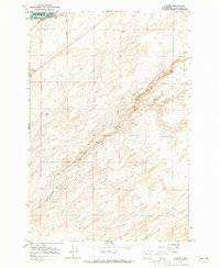
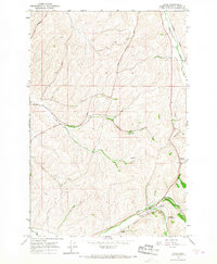
(34)- 1964 Map of Wallula, 1965 Print
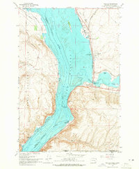 1964 Wallula1965 Print · USGSThe Columbia River corridor was a bustling hub of rail and river commerce in the mid-1960s as several major railroads converged at the Wallula Gap. Local historians can trace the industrial footprint of Attalia, find the Fort Walla Walla Historical Monument, and locate the Gaging Station Madame Dorion Bridge crossing the Walla Walla River.2 unique versions available
 - 1964 Map of Zangar Junction, 1965 Print
 1964 Zangar Junction1965 Print · USGSThe Walla Walla River valley at the Washington-Oregon border was a vital transport corridor in the 1960s. Researchers can trace the intersection of the Union Pacific and Northern Pacific at Zangar Junction or locate water sources like Warm Springs.3 unique versions available
 - 1964 Map of Levey SW, 1965 Print
 1964 Levey SW1965 Print · USGSThe Franklin County interior in the 1960s shows a landscape of shifting sands and heavy river infrastructure. Researchers can trace the Spokane Portland and Seattle rail line and the footprint of the Ice Harbor Dam along the Snake River.3 unique versions available
 - 1964 Map of Levey SE, 1965 Print
 1964 Levey SE1965 Print · USGSThe Snake River corridor in the mid-sixties reveals a landscape reshaped by the waters of Lake Sacajawea. Genealogists and historians can trace rail-side settlements like Levey, Redd, and Ash alongside landmarks such as Fishhook Park and Levey Landing.
 - 1964 Map of Slater, 1965 Print
 1964 Slater1965 Print · USGSThe Walla Walla County landscape in the mid-1960s reveals a critical junction of rail and river commerce near the Snake River. Genealogists and local historians can trace the paths of the Union Pacific and Northern Pacific through the settlements of Slater and Le Grow.2 unique versions available
 - 1964 Map of Humorist, 1965 Print
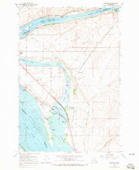 1964 Humorist1965 Print · USGSThe confluence of the Snake and Columbia rivers in the mid-sixties reveals a landscape reshaped by massive dam projects and wildlife conservation. Trace the intersection of the Northern Pacific rail lines near Humorist or explore the marshlands of the Mc Nary National Wildlife Refuge.2 unique versions available
 - 1964 Map of Pasco, 1966 Print
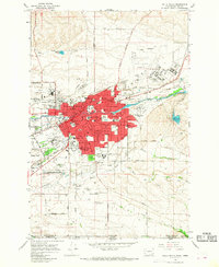
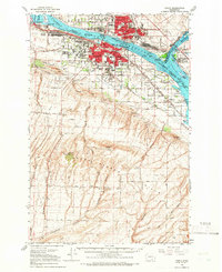 1964 Pasco1966 Print · USGSThe Tri-Cities region underwent significant postwar transformation as irrigation and infrastructure reshaped the Columbia Basin in the 1960s. Researchers can trace the development of Pasco and Kennewick, locating sites like Vista Field and Desert Lawn Memorial Park.
 - 1964 Map of Pasco, 1967 Print
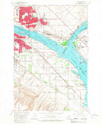 1964 Pasco1967 Print · USGSThe Tri-Cities region underwent significant transformation in the mid-sixties as the newly formed Lake Wallula reshaped the riverfronts. Genealogists and historians can trace the development of PASCO and KENNEWICK, locating long-standing landmarks like City View Cem and the Port of Pasco.2 unique versions available
 - 1966 Map of Dixie, 1967 Print
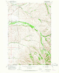
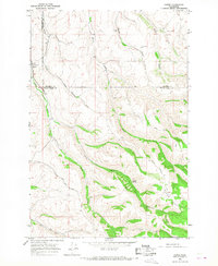
 1966 Dixie1967 Print · USGSWalla Walla County's wheat country is captured in the mid-sixties, showing a landscape of rail-connected grain hubs and valley farms. Genealogists and historians can trace the Northern Pacific line through Dixie, Bolles, and Minnick, identifying long-standing Grain Elevators and rural roads.2 unique versions available
 - 1966 Map of Page, 1967 Print
 1966 Page1967 Print · USGSIn the mid-1960s, this portion of Walla Walla County shows the vital rail-and-river network of the Columbia Basin. Researchers can trace the legacy of grain transport through Grain Elevators at Hatch and small settlements like Adkins and Votaw.
 - 1966 Map of Juniper Canyon, 1967 Print
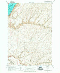 1966 Juniper Canyon1967 Print · USGSUmatilla County's high plateau meets the Columbia River in the mid-1960s, showing a landscape defined by deep canyon systems and river-borne transport. Researchers can trace the Union Pacific rail line and locate rural features like the Grain Elevator or Pearson.2 unique versions available
 - 1966 Map of Snake River, 1967 Print
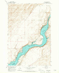
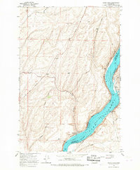 1966 Snake River1967 Print · USGSThe Snake River valley underwent a massive transformation in the mid-sixties as the reservoir of Lake Sacagawea filled the canyon floor. Researchers can trace the industrial infrastructure of the day, from the Snake River Grain Elevator to rural outposts like Walker and Sheffler.
 - 1966 Map of Buroker, 1967 Print
 1966 Buroker1967 Print · USGSThe rural agricultural landscape of Walla Walla County and Umatilla County is frozen in time during the mid-sixties. Genealogists and local historians can trace family land via the Donation Land Claim Boundary and locate early rail stops like Sapolil, Harbert, and Kibler.2 unique versions available
 - 1966 Map of Touchet, 1967 Print
 1966 Touchet1967 Print · USGSThe Walla Walla Valley in the mid-sixties reveals a landscape defined by riverside settlements and extensive irrigation. Trace the path of the Union Pacific through Touchet or locate the network of canals like the North Side Touchet Ditch.
 - 1966 Map of Rulo, 1967 Print
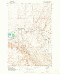
 1966 Rulo1967 Print · USGSWalla Walla County is captured in the mid-1960s as a vital agricultural and rail corridor. You can trace the path of the Northern Pacific Sudbury Branch through Rulo and locate rural landmarks like Luckenbill Bridge and various Grain Elevators.
 - 1966 Map of Coppei, 1967 Print
 1966 Coppei1967 Print · USGSWalla Walla and Columbia counties are shown here in the mid-1960s, where the grain-heavy economy meets the headwaters of the Blue Mountains. Locate Bundy Hollow Cem, the Northern Pacific tracks at Coppei, and high-country routes like Lewis Peak Road.2 unique versions available
 - 1966 Map of Hadley, 1967 Print
 1966 Hadley1967 Print · USGSWalla Walla County's wheat country comes into focus in the mid-1960s, showing a landscape shaped by rail transport and agriculture. Genealogists and researchers can trace the rail sidings at Hadley and Thiel or locate landmarks like the Fire Station and Grain Elevators.
 - 1966 Map of Valley Grove, 1967 Print
 1966 Valley Grove1967 Print · USGSWalla Walla County grain country is captured in the mid-sixties, showing a landscape defined by the Union Pacific rail line. Researchers can trace rural infrastructure from the Grain Elevators at Valley Grove to the remote Spring Valley homesteads.
 - 1966 Map of Kooskooskie, 1968 Print
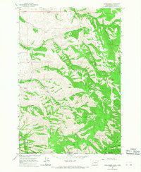 1966 Kooskooskie1968 Print · USGSThe Walla Walla valley meets the high ridges of the Blue Mountains in the mid-1960s. Trace the path of the Railroad through Kooskooskie or follow the Blue Creek Trail past landmarks like Five Points and Stewart Cabin.3 unique versions available
 - 1966 Map of Eureka, 1968 Print
 1966 Eureka1968 Print · USGSWalla Walla County's agricultural heartland is captured in the mid-1960s, showing the vital rail and grain infrastructure of the era. Genealogists and historians can trace the Northern Pacific line through small centers like Eureka and Lamar or locate family sites along Alonzo Road.
 - 1966 Map of Elwood, 1968 Print
 1966 Elwood1968 Print · USGSWalla Walla County is captured in the mid-1960s at a vital junction of the Snake River and several major railroads. Genealogists and historians can trace family-named routes and rail sidings at Elwood, Walker, and the broad expanse of Eureka Flat.
 - 1966 Map of Lowden, 1968 Print
 1966 Lowden1968 Print · USGSThe Walla Walla Valley at the Oregon-Washington border in the mid-sixties reveals a sophisticated irrigation network supporting the local agricultural economy. Researchers can trace historic family lands along Frog Hollow Road, the rail corridor of the Union Pacific, and the site of the Frenchtown Monument.
 - 1966 Map of Walla Walla, 1968 Print
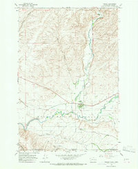
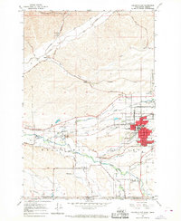
 1966 Walla Walla1968 Print · USGSMid-century Walla Walla is captured here during a period of steady growth and institutional expansion across the valley. Researchers can trace the layout of Whitman College, the State Penitentiary, and several local landmarks like Mtn View Cemetery and the County Fairgrounds.2 unique versions available
 - 1966 Map of College Place, 1968 Print
 1966 College Place1968 Print · USGSCollege Place and the Walla Walla River valley are shown in the mid-sixties at the height of their rail-and-river agricultural economy. Researchers can locate the Whitman Mission National Historic Site, trace old rail sidings at Sudbury, and find local landmarks like Valley Chapel and Mt Hope Cem.2 unique versions available
 - 1966 Map of Welland, 1968 Print
 1966 Welland1968 Print · USGSWalla Walla County grain country is captured here in the mid-sixties, showing the intersection of heavy rail and river valley agriculture. Trace the Northern Pacific line through Welland or locate rural landmarks like the Grain Elevator and Ninemile Canyon.
Showing maps 1-25 of 34
Top cities of Walla Walla County
- Walla Walla historical maps
- College Place historical maps
- Burbank historical maps
- Waitsburg historical maps
- Prescott historical maps
Frequently asked questions
- What are the different types of historical maps available for Walla Walla County?
- What is the oldest map of Walla Walla County?
- Where can I purchase historical maps of Walla Walla County for my home or office?
- Where can I download high-res historical maps of Walla Walla County?
- Are there historical topographic maps available for Walla Walla County?
- Is there historical aerial imagery available for Walla Walla County?
- Where are historical maps of Walla Walla County sourced from?