2020s Maps of Oakesdale, Washington
Explore 4 historic maps of Oakesdale from the 2020s. These maps offer a rare glimpse into what life looked like during the 2020s — showing old roads, neighborhoods, homes, and landmarks that have changed or disappeared over time.
Whether you're researching your family's past, planning a metal detecting trip, or studying how Oakesdale's landscape evolved across the 2020s, these high-resolution maps are a powerful tool for exploring the history of this region.
- Focus on a specific era: All maps on this page are from the 2020s, giving you a focused view of this time period.
- See what’s changed: Compare century-old streets, trails, and buildings to today's modern landscape using overlays and satellite layers.
- Research with precision: Use these maps for genealogy, historical research, land use analysis, or educational projects.
- View, download, or print: Maps are fully viewable online in high resolution, and can be downloaded or printed for your own records.
Start exploring Oakesdale's history through authentic maps from the 2020s. This is your window into the past.
Oakesdale, WA maps
(4)- 2023 Map of Oakesdale, 2023 Print
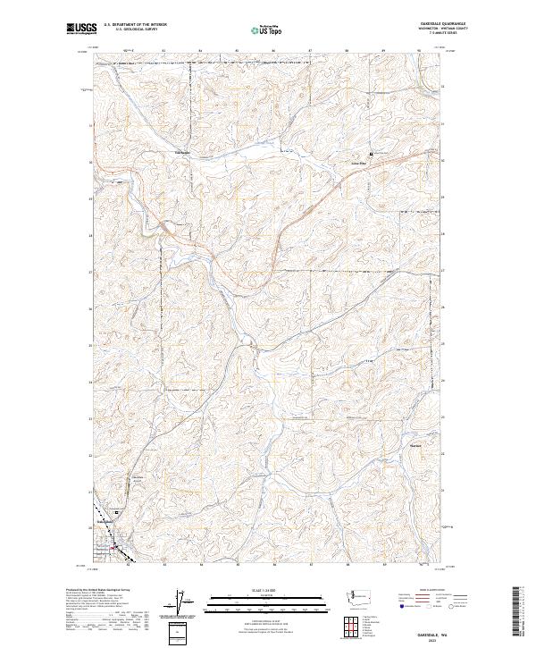 2023 Oakesdale2023 Print · USGSWhitman County's agricultural heartland appears in this modern survey, showcasing the enduring settlement patterns of the Palouse. Genealogists and researchers can locate family sites near Oakesdale Cem, the hamlet of Lone Pine, or the rail-to-trail path of the Palouse To Cascades State Park Trl.
 - 2023 Map of Rosalia, 2023 Print
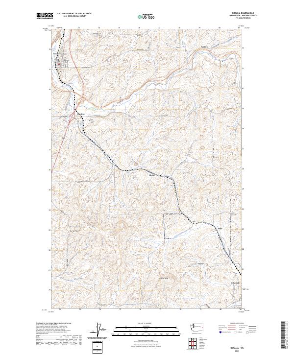 2023 Rosalia2023 Print · USGSWhitman County agriculture and transportation are showcased here in the early twenty-first century. Genealogists and local historians can locate Holy Rosary Cem, trace the course of the Palouse To Cascades State Park Trl, and find rural settlements like McCoy and Flaig.
 - 2023 Map of Steptoe, 2023 Print
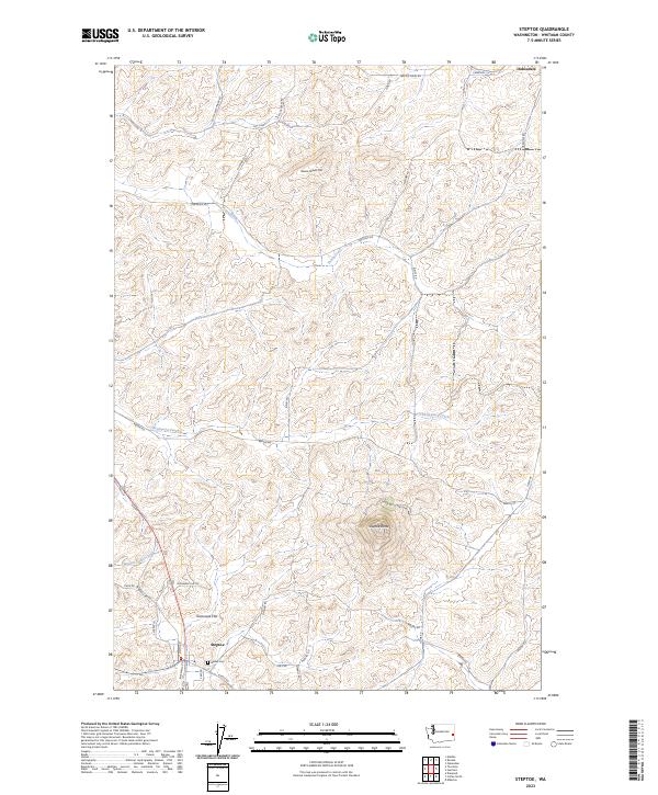 2023 Steptoe2023 Print · USGSWhitman County's Palouse hills are captured here in recent years, centered on the dramatic rise of the local butte. Genealogists and hikers can trace the areas surrounding Steptoe, the Bethel Cem, and the prominent slopes of Steptoe Butte.
 - 2023 Map of Garfield, 2023 Print
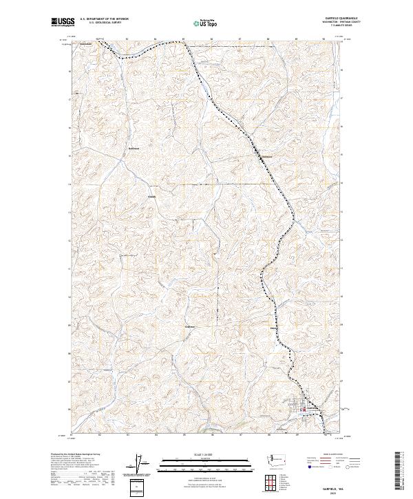 2023 Garfield2023 Print · USGSModern Whitman County reveals its deep agricultural roots through this contemporary study of the Palouse. Researchers can trace family names on rural routes like Parch RD while locating local landmarks like Garfield Cem and Belmont.
End of results
Showing maps 1-4 of 4
Top cities near Oakesdale
- Colfax historical maps
- Palouse historical maps
- Tekoa historical maps
- Rosalia historical maps
- Garfield historical maps
- Malden historical maps
See more
Frequently asked questions
- What are the different types of historical maps available for Oakesdale?
- What is the oldest map of Oakesdale?
- Where can I purchase historical maps of Oakesdale for my home or office?
- Where can I download high-res historical maps of Oakesdale?
- Are there historical topographic maps available for Oakesdale?
- Is there historical aerial imagery available for Oakesdale?
- Where are historical maps of Oakesdale sourced from?