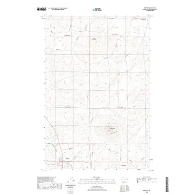
2020 Map of Steptoe
USGS Topo · Published 2020About this map
Steptoe Butte dominates the central landscape of this Whitman County quadrangle, rising sharply above the undulating Palouse hills. This geological landmark, preserved within Steptoe Butte National Park, provides a dramatic contrast to the agricultural surroundings. The settlement of Steptoe sits at the base of the butte, while Oakesdale is positioned at the northern edge, connected by a network of rural roads that follow the drainage patterns of Cottonwood Creek and Thorn Creek. The map records several named agricultural and natural features like Tennessee Flat and Steam Shovel Hill, which highlight the area's long-standing connection to dryland farming. Genealogists and local historians will find value in the placement of Bethel Cemetery and the clear delineation of township boundaries including t18n r43e and t18n r44e, tracing the property lines and rural intersections that have defined this region for generations.
Find a feature on this map
41 named features on this map. Tap any name to fly to it.
Don’t see what you’re looking for? This feature index may not catch every label — zoom into the map to look around manually.
Map Details
Editions of this 2020 Steptoe Map
This is the sole edition of this map. No revisions or reprints were ever made.
Other maps of this area

1903 · Oakesdale
USGS Topo · 1:125,000

1905 · Oakesdale
USGS Topo · 1:125,000

1910 · Pullman
USGS Topo · 1:125,000

1955 · Pullman
USGS Topo · 1:250,000

1955 · Spokane
USGS Topo · 1:250,000

1958 · Spokane
USGS Topo · 1:250,000

1958 · Pullman
USGS Topo · 1:250,000

1964 · Diamond
USGS Topo · 1:24,000

1964 · Oakesdale
USGS Topo · 1:24,000

1964 · Malden
USGS Topo · 1:24,000