
1964 Map of Malden
USGS Topo · Published 1965About this map
Malden serves as the central hub of this eastern Washington landscape, where the Chicago Milwaukee St Paul and Pacific railroad established a significant presence. The town's grid is marked by industrial markers including Water Tanks and multiple Gravel Pits, situated along the winding course of Pine Creek. This 1964 field survey captures the intersection of three major rail lines, with the Great Northern and Union Pacific also threading through the drainage basins of Thorn Creek and Cache Creek. Small rural localities like Weldon and Balder are identifiable alongside specialized infrastructure such as the Malden-Rosalia Airport and a hilltop Substation. The map provides a detailed view of the regional transport network before later decades changed the railroad operations in Whitman County.
Find a feature on this map
18 named features on this map. Tap any name to fly to it.
Don’t see what you’re looking for? This feature index may not catch every label — zoom into the map to look around manually.
Map Details
Editions of this 1964 Malden Map
2 editions found
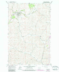
Other maps of this area

1903 · Oakesdale
USGS Topo · 1:125,000

1905 · Oakesdale
USGS Topo · 1:125,000

1954 · Cheney
USGS Topo · 1:62,500

1954 · Spangle
USGS Topo · 1:62,500

1955 · Spokane
USGS Topo · 1:250,000

1958 · Spokane
USGS Topo · 1:250,000

1964 · St. John
USGS Topo · 1:24,000
1964 · Steptoe
USGS Topo · 1:24,000
1964 · Rosalia
USGS Topo · 1:24,000
1964 · Thornton
USGS Topo · 1:24,000