1964 Map of St. John
USGS Topo · Published 1965About this map
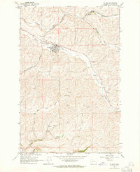
St John sits at the heart of this mid-1960s landscape, where the Union Pacific railroad follows the natural corridor of Pleasant Valley. This grain-growing region in Whitman County is defined by its drainage systems, including Cottonwood Creek and Downing Creek, which carve through the high basalt plateau. The town itself shows a clear grid transition into the surrounding agricultural land, supported by a Landing Strip and a Water Tank that speak to the infrastructure of the era.
Find a feature on this map
20 named features on this map. Tap any name to fly to it.
Don’t see what you’re looking for? This feature index may not catch every label — zoom into the map to look around manually.
Map Details
Editions of this 1964 St. John Map
This is the sole edition of this map. No revisions or reprints were ever made.
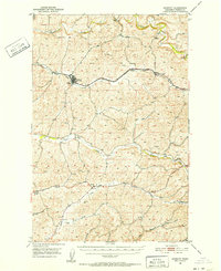
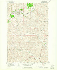
Other maps of this area

1903 · Oakesdale
USGS Topo · 1:125,000

1905 · Oakesdale
USGS Topo · 1:125,000

1910 · Pullman
USGS Topo · 1:125,000
1950 · Endicott
USGS Topo · 1:62,500

1955 · Pullman
USGS Topo · 1:250,000

1955 · Spokane
USGS Topo · 1:250,000

1958 · Spokane
USGS Topo · 1:250,000

1958 · Pullman
USGS Topo · 1:250,000

1964 · Diamond
USGS Topo · 1:24,000
1964 · Malden
USGS Topo · 1:24,000