2020s Maps of Ansted, West Virginia
Explore 4 historic maps of Ansted from the 2020s. These maps offer a rare glimpse into what life looked like during the 2020s — showing old roads, neighborhoods, homes, and landmarks that have changed or disappeared over time.
Whether you're researching your family's past, planning a metal detecting trip, or studying how Ansted's landscape evolved across the 2020s, these high-resolution maps are a powerful tool for exploring the history of this region.
- Focus on a specific era: All maps on this page are from the 2020s, giving you a focused view of this time period.
- See what’s changed: Compare century-old streets, trails, and buildings to today's modern landscape using overlays and satellite layers.
- Research with precision: Use these maps for genealogy, historical research, land use analysis, or educational projects.
- View, download, or print: Maps are fully viewable online in high resolution, and can be downloaded or printed for your own records.
Start exploring Ansted's history through authentic maps from the 2020s. This is your window into the past.
Ansted, WV maps
(4)- 2023 Map of Fayetteville, 2023 Print
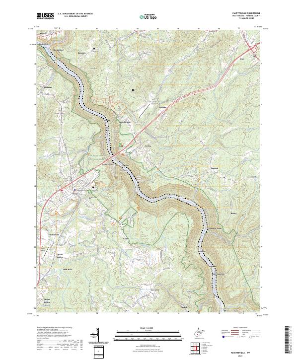 2023 Fayetteville2023 Print · USGSFayetteville and the surrounding gorge area are documented here during a period of modern preservation and recreation. Researchers can trace local lineage through Huse Memorial Cem and locate historic river communities like Caperton and Garten.
 - 2023 Map of Gauley Bridge, 2023 Print
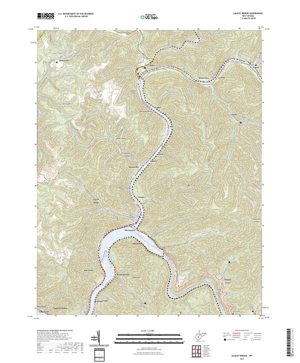 2023 Gauley Bridge2023 Print · USGSThe confluence of the New and Gauley Rivers comes alive in this contemporary look at Fayette County's river-bottom towns. Genealogists and local historians can trace legacy family sites like Abbott-Huddleston Cem or follow the rails through KM Junction and Gauley Bridge.
 - 2023 Map of Ansted, 2023 Print
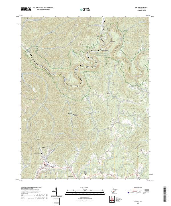 2023 Ansted2023 Print · USGSFayette and Nicholas Counties are documented here in the early twenty-first century, showing the rugged river gorge country of the New River region. Genealogists and historians can trace family locations near Ansted, Woods Ferry, and the Mount Chapel Cem.
 - 2023 Map of Beckwith, 2023 Print
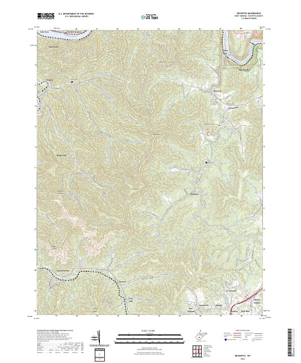 2023 Beckwith2023 Print · USGSFayette County's coal and rail corridor comes into focus here during the early twenty-first century. Genealogists and historians can trace family roots through the Robson Cem and John Nugen Cem or locate former industrial sites at Cokeoven Hollow and Beards Fork.
End of results
Showing maps 1-4 of 4
Top cities near Ansted
- Oak Hill historical maps
- Fayetteville historical maps
- Montgomery historical maps
- Mount Hope historical maps
- Gauley Bridge historical maps
- Boomer historical maps
See more
Frequently asked questions
- What are the different types of historical maps available for Ansted?
- What is the oldest map of Ansted?
- Where can I purchase historical maps of Ansted for my home or office?
- Where can I download high-res historical maps of Ansted?
- Are there historical topographic maps available for Ansted?
- Is there historical aerial imagery available for Ansted?
- Where are historical maps of Ansted sourced from?