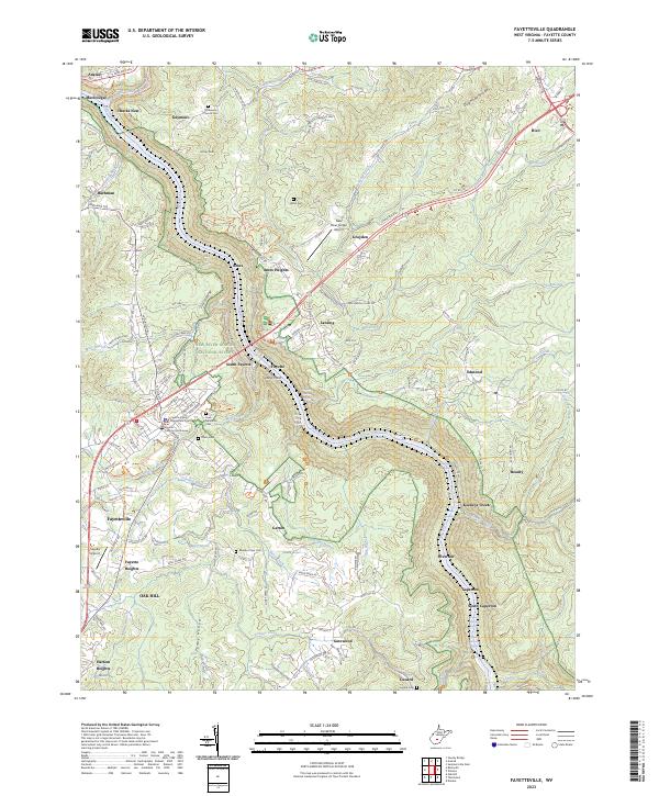
2023 Map of Fayetteville
USGS Topo · Published 2023About this map
Fayetteville serves as the focal point of this survey, anchored by the Fayette County Courthouse and Fayette County Magistrate Court. The geography is defined by the deep carving of the New River, which flows through the New River Gorge National River. This corridor is punctuated by numerous named rapids such as Greyhound Rapids, Double Z Rapids, and Keeneys Rapids, reflecting the river's dynamic character.
Find a feature on this map
160 named features on this map. Tap any name to fly to it.
Don’t see what you’re looking for? This feature index may not catch every label — zoom into the map to look around manually.
Map Details
Editions of this 2023 Fayetteville Map
This is the sole edition of this map. No revisions or reprints were ever made.
Other maps of this area

1887 · Hinton
USGS Topo · 1:125,000

1889 · Nicholas
USGS Topo · 1:125,000

1891 · Nicholas
USGS Topo · 1:125,000

1891 · Raleigh
USGS Topo · 1:125,000

1892 · Hinton
USGS Topo · 1:125,000

1897 · Kanawha Falls
USGS Topo · 1:125,000

1897 · Raleigh
USGS Topo · 1:125,000

1900 · Kanawha Falls
USGS Topo · 1:125,000

1901 · Nicholas
USGS Topo · 1:125,000

1901 · Kanawha Falls
USGS Topo · 1:125,000