Old Maps of Powellton, West Virginia for Metal Detecting
Plan your next treasure hunt with 25 historic maps of Powellton. Find old homesites, ghost towns, trails, and gathering spots that may be lost to time — perfect for identifying promising metal detecting locations.
- Locate forgotten sites: Uncover places like long-lost settlements, abandoned rail lines, or gathering spots.
- Plan better hunts: Use map overlays combined with LiDAR or satellite views to narrow in on historically rich areas.
- Made for detectorists: Thousands of hobbyists use these maps to discover relics, coins, and hidden history.
Use these historic maps to boost your research and find new opportunities beneath the surface of Powellton.
Powellton, WV maps
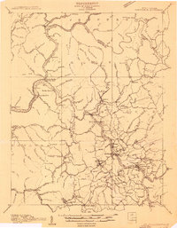
(25)- 1897 Map of Kanawha Falls
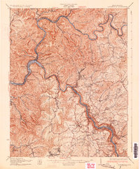
 1897 Kanawha Falls1897 Print · USGSWest Virginia's river valleys and burgeoning industrial corridors are captured here in the late nineteenth century. You can trace the early rail networks and riverside settlements such as Montgomery, Clendenin, and the river engineering at Lock 2.
 - 1900 Map of Kanawha Falls
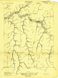
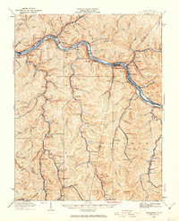
 1900 Kanawha Falls1900 Print · USGSThe Kanawha and Elk rivers converge here at the turn of the century as the coal and rail industries were rapidly transforming the West Virginia landscape. Genealogists and historians can trace riverside settlements like Montgomery and Coalburg or follow the paths of the Chesapeake and Ohio RR and early river navigation at Lock 2.
 - 1901 Map of Kanawha Falls
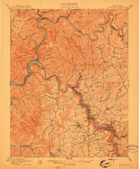
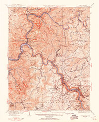
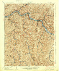
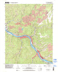
 1901 Kanawha Falls1901 Print · USGSWest Virginia's coal and rail heartland is captured here at the end of the nineteenth century, as river navigation and railroads transformed the Kanawha Valley. Genealogists and historians can trace the early footprints of Montgomery, find family sites near Kanawha Falls, and locate landmarks like Hawks Nest or Powellton.3 unique versions available
 - 1908 Map of Fayetteville
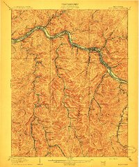
 1908 Fayetteville1908 Print · USGSFayette County was at the heart of the coal and rail boom when this survey was conducted. Researchers can trace the early industrial footprint of the Chesapeake and Ohio Railroad through settlements like Ansted, Gauley Bridge, and Kanawha Falls.
 - 1908 Map of Montgomery
 1908 Montgomery1908 Print · USGSWest Virginia's industrial heartland is revealed in the early twentieth century as a dense network of coal towns and river locks. Trace the rail-and-river economy through Cabin Creek Junction, the Wheeler Islands, and the namesake town of Montgomery.
 - 1910 Map of Fayetteville
 1910 Fayetteville1910 Print · USGSThe West Virginia coalfields were in full operation when this survey was conducted, showing the dense rail networks along the Gauley River. Local historians can trace family-named sites and industrial hamlets like Nuttallburg, Gauley Bridge, and Kaymoor.4 unique versions available
 - 1910 Map of Montgomery
 1910 Montgomery1910 Print · USGSThe industrial corridor of the Kanawha Valley is seen here in the early 1900s, defined by the river and the competing rail lines of the era. Genealogists and historians can trace the foundations of coal-field communities at Paint Creek Junction, Coalburg, and Pratt PO.3 unique versions available
 - 1928 Map of Fayetteville, 1955 Print
 1928 Fayetteville1955 Print · USGSFayette County was a hub of river-and-rail activity in the late twenties as the coal industry matured. Genealogists and historians can locate old landmarks like Kanawha Falls, the Blue Hole Tunnel, and rural centers such as Ansted and Gauley Bridge.4 unique versions available
 - 1928 Map of Montgomery, 1963 Print
 1928 Montgomery1963 Print · USGSIn the late 1920s, the Kanawha River valley was a dense network of rail and industry reaching deep into the Fayette and Kanawha hills. Genealogists and historians can trace rail stops like Hollygrove Sta and industrial sites like the Pure Oil Refinery.
 - 1931 Map of Fayetteville
 1931 Fayetteville1931 Print · USGSThe convergence of the New and Gauley rivers at the start of the 1930s reveals a bustling rail and coal corridor. Trace the path of the New York Central Railroad through mountain hamlets like Gauley Bridge, Nuttallburg, and South Caperton.3 unique versions available
 - 1931 Map of Montgomery
 1931 Montgomery1931 Print · USGSThe Kanawha River valley was a powerhouse of industry in the early thirties, defined by its complex locks and rail-heavy economy. Genealogists and historians can trace the foundations of local life through the Pure Oil Refinery, the river navigation at Lock 3, and many small schools like Marting Sch.3 unique versions available
 - 1954 Map of Charleston
 1954 Charleston1954 Print · USGSWest Virginia’s industrial heart and mountain highlands are captured here during the mid-fifties, centered on the capital city. Researchers can trace historic river-and-rail corridors along the Kanawha River and locate remote peaks within the Monongahela National Forest.
 - 1957 Map of Charleston, 1966 Print
 1957 Charleston1966 Print · USGSMid-century West Virginia unfolds along the industrial Kanawha River valley and into the high Allegheny Mountains. Genealogists and historians can trace the vital rail lines of the Chesapeake and Ohio and locate riverside settlements from Saint Albans to Buckhannon.3 unique versions available
 - 1958 Map of Charleston
 1958 Charleston1958 Print · USGSMid-century West Virginia is defined here by the industrial corridor of the Kanawha River and the high ridges of the Allegheny Mountains. Researchers can trace the rail networks of the New York Central or locate remote highland communities like Pickens and Hillsboro.
 - 1961 Map of Charleston
 1961 Charleston1961 Print · USGSWest Virginia's capital region and the highlands to the east are shown in detail during the early sixties. Genealogists and historians can trace rail networks like the Baltimore and Ohio RR and find early state parks such as Watoga State Park.
 - 1965 Map of Montgomery, 1966 Print
 1965 Montgomery1966 Print · USGSThe Kanawha River valley was a humming corridor of coal and rail in the 1960s, with towns like Montgomery and London tightly squeezed between the water and the ridges. Genealogists and historians can trace the industrial footprint of Alloy, find rural landmarks like St Anthony Ch, or locate the London Lock & Dam No 3.2 unique versions available
 - 1965 Map of Powellton, 1966 Print
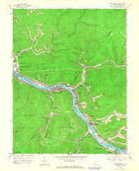
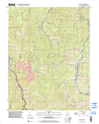
 1965 Powellton1966 Print · USGSThe Fayette and Kanawha County border comes alive in the mid-sixties, showing a landscape defined by coal mining and heavy rail. Trace family roots and industrial sites from the tipple at Mahan to the cemeteries at Johnson Cem and Meadow Haven Memorial Park.2 unique versions available
 - 1969 Map of Beckwith, 1972 Print
 1969 Beckwith1972 Print · USGSFayette County was at its industrial peak in the late sixties, where coal mining and rail transport defined every valley. Genealogists and local historians can trace family-named sites and vanished industrial works from Beards Fork to the Harlem Heights Drive-in Theater and Lochgelly.2 unique versions available
 - 1977 Map of Montgomery, 1980 Print
 1977 Montgomery1980 Print · USGSThe Kanawha Valley is seen in the late seventies as a dense network of industrial activity and riverside settlements. Researchers can trace the footprints of town sites like Montgomery, Smithers, and Boomer along the winding Kanawha River.
 - 1984 Map of Charleston
 1984 Charleston1984 Print · USGSWest Virginia's capital and the industrial Kanawha Valley are shown here in the mid-eighties as modern interstates began to reshape the region. Local researchers can locate family-named landmarks like Reamer (Sybial PO) and institutional anchors like West Virginia State College.2 unique versions available
 - 1996 Map of Montgomery, 2002 Print
 1996 Montgomery2002 Print · USGSThe Kanawha River valley serves as a bustling industrial corridor in the late nineties, anchored by the river-and-rail infrastructure of the coalfields. Researchers can trace the layout of the West Virginia Institute of Technology or locate family sites like Guthrie Cem and Mt Zion Ch.
 - 1996 Map of Powellton, 2002 Print
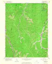
 1996 Powellton2002 Print · USGSFayette County coal country is captured here in the mid-nineties, showing a landscape defined by steep hollows and industrial rail lines. Genealogists can trace family sites from Powellton to Mahan, alongside landmarks like Meadow Haven Memorial Park (Cemetery) and the Strip Mine at Burnwell.
 - 2023 Map of Powellton, 2023 Print
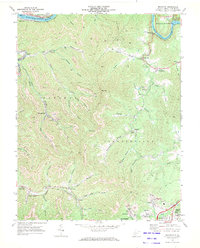
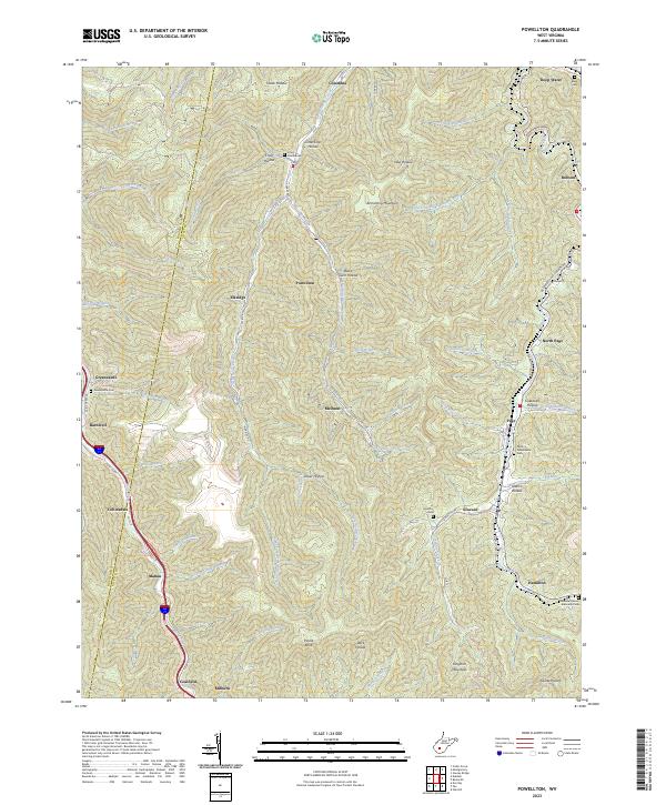 2023 Powellton2023 Print · USGSThe steep hollows of Fayette and Kanawha Counties are captured here in the early twenty-first century, showcasing a legacy of coal-country settlements. Researchers can trace local genealogy through Craig Cemeteries, Johnson Cem, and the old community sites at Elkridge and McDunn.
 - 2023 Map of Montgomery, 2023 Print
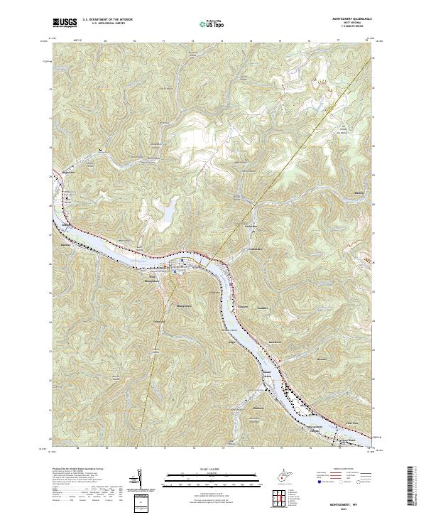 2023 Montgomery2023 Print · USGSThe industrial corridor of the Kanawha Valley is documented here in recent detail at the Fayette and Kanawha County border. Genealogists can locate several family-named landmarks and burial grounds, including Goodwin Cem, Donwood, and the heights of Armstrong Mountain.
 - 2023 Map of Beckwith, 2023 Print
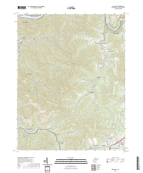 2023 Beckwith2023 Print · USGSFayette County's coal and rail corridor comes into focus here during the early twenty-first century. Genealogists and historians can trace family roots through the Robson Cem and John Nugen Cem or locate former industrial sites at Cokeoven Hollow and Beards Fork.
End of results
Showing maps 1-25 of 25
Top cities near Powellton
- Oak Hill historical maps
- Fayetteville historical maps
- Montgomery historical maps
- Ansted historical maps
- Chesapeake historical maps
- Mount Hope historical maps
See more
Top neighborhoods of Powellton
- Eagle historical maps
- Montgomery Heights historical maps
- Columbia historical maps
- Elkridge historical maps
- McDunn historical maps
- Kimberly historical maps
Frequently asked questions
- What are the different types of historical maps available for Powellton?
- What is the oldest map of Powellton?
- Where can I purchase historical maps of Powellton for my home or office?
- Where can I download high-res historical maps of Powellton?
- Are there historical topographic maps available for Powellton?
- Is there historical aerial imagery available for Powellton?
- Where are historical maps of Powellton sourced from?