1920s Maps of South Fayette, West Virginia
Explore 1 historic maps of South Fayette from the 1920s. These maps offer a rare glimpse into what life looked like during the 1920s — showing old roads, neighborhoods, homes, and landmarks that have changed or disappeared over time.
Whether you're researching your family's past, planning a metal detecting trip, or studying how South Fayette's landscape evolved across the 1920s, these high-resolution maps are a powerful tool for exploring the history of this region.
- Focus on a specific era: All maps on this page are from the 1920s, giving you a focused view of this time period.
- See what’s changed: Compare century-old streets, trails, and buildings to today's modern landscape using overlays and satellite layers.
- Research with precision: Use these maps for genealogy, historical research, land use analysis, or educational projects.
- View, download, or print: Maps are fully viewable online in high resolution, and can be downloaded or printed for your own records.
Start exploring South Fayette's history through authentic maps from the 1920s. This is your window into the past.
South Fayette, WV maps
(1)- 1928 Map of Fayetteville, 1955 Print
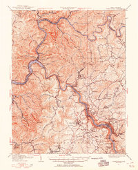 1928 Fayetteville1955 Print · USGSFayette County was a hub of river-and-rail activity in the late twenties as the coal industry matured. Genealogists and historians can locate old landmarks like Kanawha Falls, the Blue Hole Tunnel, and rural centers such as Ansted and Gauley Bridge.4 unique versions available
End of results
Showing maps 1-1 of 1
Top cities near South Fayette
- Oak Hill historical maps
- Summersville historical maps
- Fayetteville historical maps
- Ansted historical maps
- Mount Hope historical maps
- Gauley Bridge historical maps
See more
Frequently asked questions
- What are the different types of historical maps available for South Fayette?
- What is the oldest map of South Fayette?
- Where can I purchase historical maps of South Fayette for my home or office?
- Where can I download high-res historical maps of South Fayette?
- Are there historical topographic maps available for South Fayette?
- Is there historical aerial imagery available for South Fayette?
- Where are historical maps of South Fayette sourced from?