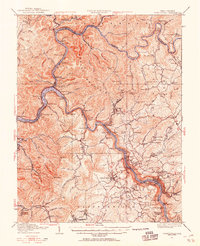
1928 Map of Fayetteville
USGS Topo · Published 1955About this map
The Gauley River and New River converge in this 1928 revision to form the Kanawha River, a critical geographic junction that shaped the region's industrial development. The Chesapeake and Ohio railroad follows the winding riverbanks, passing through engineering landmarks like the Blue Hole Tunnel near Cotton Hill. This era shows the landscape at a point of transition, where small mountain settlements like Ansted and Gauley Bridge are well-established alongside dozens of rural schoolhouses and churches.
Find a feature on this map
163 named features on this map. Tap any name to fly to it.
Don’t see what you’re looking for? This feature index may not catch every label — zoom into the map to look around manually.
Map Details
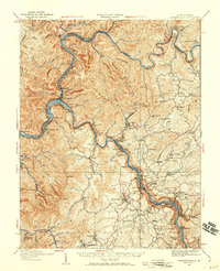
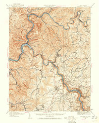
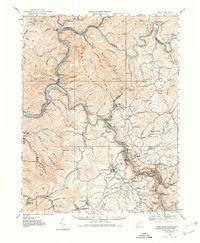
Editions of this 1928 Fayetteville Map
4 editions found
Other maps of this area

1887 · Hinton
USGS Topo · 1:125,000

1889 · Nicholas
USGS Topo · 1:125,000

1891 · Nicholas
USGS Topo · 1:125,000

1891 · Raleigh
USGS Topo · 1:125,000

1892 · Hinton
USGS Topo · 1:125,000

1897 · Kanawha Falls
USGS Topo · 1:125,000

1897 · Raleigh
USGS Topo · 1:125,000

1900 · Kanawha Falls
USGS Topo · 1:125,000

1901 · Nicholas
USGS Topo · 1:125,000

1901 · Kanawha Falls
USGS Topo · 1:125,000