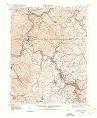
1928 Map of Fayetteville
USGS Topo · Published 1980About this map
The Gauley River and New River converge at Gauley Bridge to form the Kanawha River, creating a landscape defined by dramatic elevation changes and industrial transit. This 1928 revision documents the coal-driven economy of the New River Gorge, where settlements like Nuttallburg and Kaymoor cling to the steep riverbanks. The Chesapeake and Ohio railroad follows the winding water gaps, passing through the Blue Hole Tunnel near Cotton Hill.
Find a feature on this map
157 named features on this map. Tap any name to fly to it.
Don’t see what you’re looking for? This feature index may not catch every label — zoom into the map to look around manually.
Map Details
Editions of this 1928 Fayetteville Map
4 editions found
Other maps of this area

1887 · Hinton
USGS Topo · 1:125,000

1889 · Nicholas
USGS Topo · 1:125,000

1891 · Nicholas
USGS Topo · 1:125,000

1891 · Raleigh
USGS Topo · 1:125,000

1892 · Hinton
USGS Topo · 1:125,000

1897 · Kanawha Falls
USGS Topo · 1:125,000

1897 · Raleigh
USGS Topo · 1:125,000

1900 · Kanawha Falls
USGS Topo · 1:125,000

1901 · Nicholas
USGS Topo · 1:125,000

1901 · Kanawha Falls
USGS Topo · 1:125,000