1930s Maps of Grant District, West Virginia
Explore 2 historic maps of Grant District from the 1930s. These maps offer a rare glimpse into what life looked like during the 1930s — showing old roads, neighborhoods, homes, and landmarks that have changed or disappeared over time.
Whether you're researching your family's past, planning a metal detecting trip, or studying how Grant District's landscape evolved across the 1930s, these high-resolution maps are a powerful tool for exploring the history of this region.
- Focus on a specific era: All maps on this page are from the 1930s, giving you a focused view of this time period.
- See what’s changed: Compare century-old streets, trails, and buildings to today's modern landscape using overlays and satellite layers.
- Research with precision: Use these maps for genealogy, historical research, land use analysis, or educational projects.
- View, download, or print: Maps are fully viewable online in high resolution, and can be downloaded or printed for your own records.
Start exploring Grant District's history through authentic maps from the 1930s. This is your window into the past.
Grant District, WV maps
(2)- 1935 Map of Steubenville, 1958 Print
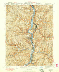 1935 Steubenville1958 Print · USGSThe industrial heart of the Ohio River valley comes to life in this mid-century survey of the Ohio, West Virginia, and Pennsylvania borders. Genealogists and historians can trace the early footprints of Weirton, Steubenville, and smaller stops like Zalia and Reeds Mills.
 - 1937 Map of Wellsville, 1960 Print
 1937 Wellsville1960 Print · USGSThe Ohio River valley thrives as a Tri-State industrial hub in the years before the Second World War. Researchers can trace the riverfront rail lines of the Pennsylvania RR and locate vanished local landmarks like Pughtown PO and Nessly Chapel.
End of results
Showing maps 1-2 of 2
Top cities near Grant District
- Weirton historical maps
- Steubenville historical maps
- East Liverpool historical maps
- Toronto historical maps
- Wellsville historical maps
- Wintersville historical maps
See more
Top neighborhoods of Grant District
- Congo historical maps
- Lennyville historical maps
- Moscow historical maps
- Fairhaven historical maps
- Brownsdale Mobile Home Park historical maps
- New Manchester historical maps
See more
Frequently asked questions
- What are the different types of historical maps available for Grant District?
- What is the oldest map of Grant District?
- Where can I purchase historical maps of Grant District for my home or office?
- Where can I download high-res historical maps of Grant District?
- Are there historical topographic maps available for Grant District?
- Is there historical aerial imagery available for Grant District?
- Where are historical maps of Grant District sourced from?