Old Maps of Grant District, West Virginia for Academic Research
Study the evolution of Grant District with 41 high-resolution historic maps. Whether you're teaching, researching, or modeling changes in land use, these maps provide essential visual documentation of urban, environmental, and geographic change.
- Analyze long-term change: Track patterns in development, transportation, and natural features.
- Ideal for environmental or urban studies: Support academic projects with primary historical map data.
- Use in the classroom or lab: Educators and researchers rely on these maps to bring historical context to life.
These maps are a powerful tool for teaching, research, and visualizing how Grant District has changed over the decades.
Grant District, WV maps
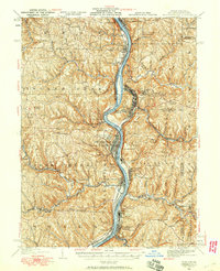
(41)- 1904 Map of Wellsville
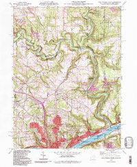
 1904 Wellsville1904 Print · USGSThe tri-state border region along the OHIO RIVER is captured here during the peak of its rail-and-river expansion. Genealogists can trace family footprints in Wellsville or find early rural landmarks like Grimm's Bridge and Cannon's Mill.3 unique versions available
 - 1904 Map of Steubenville
 1904 Steubenville1904 Print · USGSThe industrial heart of the Ohio River Valley comes to life in this early 1900s survey of the tri-state border region. Genealogists and historians can trace the early footprints of Steubenville, the rail junctions at Mingo Junction, and river crossings like Middle Ferry.5 unique versions available
 - 1935 Map of Steubenville, 1958 Print
 1935 Steubenville1958 Print · USGSThe industrial heart of the Ohio River valley comes to life in this mid-century survey of the Ohio, West Virginia, and Pennsylvania borders. Genealogists and historians can trace the early footprints of Weirton, Steubenville, and smaller stops like Zalia and Reeds Mills.
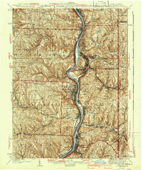
 - 1937 Map of Wellsville, 1960 Print
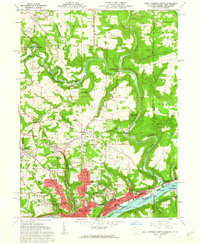
 1937 Wellsville1960 Print · USGSThe Ohio River valley thrives as a Tri-State industrial hub in the years before the Second World War. Researchers can trace the riverfront rail lines of the Pennsylvania RR and locate vanished local landmarks like Pughtown PO and Nessly Chapel.
 - 1942 Map of Steubenville
 1942 Steubenville1942 Print · USGSThe industrial corridor of the upper Ohio River comes to life here during the early 1940s. Genealogists can trace family roots through the streets of Steubenville and Weirton, or locate rural landmarks like Jefferson Sch and New Alexandria Sta.2 unique versions available
 - 1944 Map of Wellsville
 1944 Wellsville1944 Print · USGSThe industrial heart of the Ohio River valley comes to life in the 1940s, showing the bustling riverfronts of Wellsville and East Liverpool. Researchers can trace the Pennsylvania RR lines and find local landmarks like Grimms Bridge and Pughtown PO.2 unique versions available
 - 1951 Map of Canton
 1951 Canton1951 Print · USGSThe industrial heartland of Ohio and Pennsylvania reached its mid-century peak during this era of heavy rail and river transit. Genealogists and historians can trace the development of steel towns like Aliquippa and Weirton alongside the Ohio River and major lines of the Pennsylvania RR.
 - 1953 Map of Canton
 1953 Canton1953 Print · USGSThe industrial heartland of Ohio and Pennsylvania is captured at its mid-century peak in this detailed regional survey. Genealogists and historians can trace the vast rail networks of the Pennsylvania RR and find local landmarks like Nimisila Reservoir and Tappan Reservoir.
 - 1957 Map of Canton, 1971 Print
 1957 Canton1971 Print · USGSThe industrial heartland of eastern Ohio and western Pennsylvania comes alive in this mid-century survey of the Ohio River Valley. Trace the heritage of rail and river commerce through Pittsburgh, the massive steel towns along the Ohio River, and major junctions on the Pennsylvania RR.3 unique versions available
 - 1958 Map of Weirton, 1960 Print
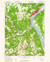
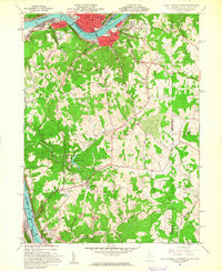
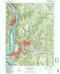
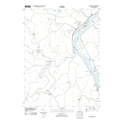
 1958 Weirton1960 Print · USGSWeirton and the surrounding Ohio River valley are shown here during a decade of significant post-war growth. Researchers can trace family history through numerous labeled schools and landmarks like Holidays Cove and Three Springs Cem.2 unique versions available
 - 1960 Map of Wellsville, 1962 Print
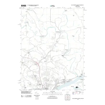
 1960 Wellsville1962 Print · USGSThe Ohio River valley in the early sixties is a landscape of heavy industry and riverfront commerce. Genealogists can trace family plots at Spring Hill Cem or explore rail-side communities like Wellsville, Irondale, and Hammondsville.6 unique versions available
 - 1960 Map of East Liverpool North, 1962 Print
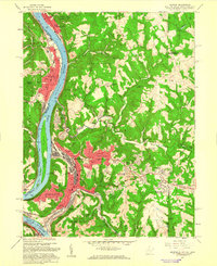
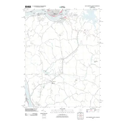
 1960 East Liverpool North1962 Print · USGSThe industrial riverfront of the Ohio Valley meets the historic tri-state border lands in the early 1960s. Genealogists and historians can trace the geodetic history of the Geographers Line or locate family sites at Riverview Cemetery and Spring Grove.6 unique versions available
 - 1960 Map of East Liverpool South, 1962 Print
 1960 East Liverpool South1962 Print · USGSThe Ohio River borderlands in the early sixties reveal a landscape of heavy industry and quiet ridge-top communities. Genealogists can trace family sites at Glendale Ch, the Locust Hill Cem, and the historic County Childrens Home.6 unique versions available
 - 1962 Map of Canton
 1962 Canton1962 Print · USGSThe industrial heartland of Eastern Ohio and Western Pennsylvania thrives in the early sixties as steel mills and rail lines dominate the river valleys. Genealogists and historians can trace local landmarks like McKinley National Memorial, Malone College, and industrial sites such as Republic Steel Corp.2 unique versions available
 - 1968 Map of Weirton, 1970 Print
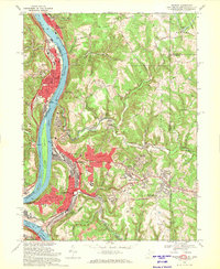 1968 Weirton1970 Print · USGSThe industrial corridor along the Ohio River is shown here at its mid-century peak during the late sixties. Genealogists and local historians can trace family locations through Union Cem, Sacred Heart of Mary Ch, and numerous neighborhood schools like Roosevelt Sch.3 unique versions available
 - 1986 Map of Pittsburgh West
 1986 Pittsburgh West1986 Print · USGSThe Tri-State region's coal and rail corridors are captured in the mid-eighties as industry and aviation expanded. Trace the legacy of extraction at Nelms Mine No 1, locate Short Creek PO, or follow the Chessie System tracks along the Ohio River.3 unique versions available
 - 1986 Map of East Liverpool
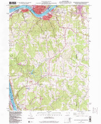
 1986 East Liverpool1986 Print · USGSThe tri-state border region in the 1980s reveals a landscape shaped by the Ohio River and a massive rail network. Researchers can trace the industrial footprint of East Liverpool and Midland or locate inland landmarks like Pine Lake and Strip Mines.2 unique versions available
 - 1994 Map of Wellsville, 1998 Print
 1994 Wellsville1998 Print · USGSThe Ohio River valley at the turn of the millennium shows a landscape shaped by coal mining and river industry. Genealogists can locate family sites at Spring Hill Cem and Cuppy Cem, or trace the rail routes of Conrail through Hammondsville.
 - 1994 Map of East Liverpool North, 1998 Print
 1994 East Liverpool North1998 Print · USGSThe tri-state border region of Ohio, Pennsylvania, and West Virginia is captured here in the late twentieth century as the industrial legacy of the Ohio River meets the protected valley of Little Beaver Creek. Researchers can locate family sites at Riverview Cemetery or trace old routes through Calcutta and Sprucevale.
 - 1994 Map of Weirton, 1998 Print
 1994 Weirton1998 Print · USGSThe Ohio River valley at the close of the 20th century shows a landscape defined by heavy industry and established riverfront towns. Genealogists and researchers can trace local roots through landmarks like Hollidays Cove, Union Cem, and Roosevelt Sch.
 - 1996 Map of East Liverpool South, 1999 Print
 1996 East Liverpool South1999 Print · USGSThe industrial Ohio River valley and West Virginia panhandle are captured in the late 1990s as legacy towns like Newell and Chester face the river. Researchers can trace the region's civic roots through landmarks like the County Childrens Home, Locust Hill Cem, and Tomlinson Run State Park.
 - 2010 Map of Weirton, 2010 Print
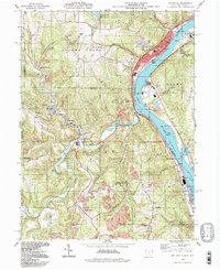
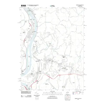 2010 Weirton2010 Print · USGSCovers Grant District, including Weirton, Steubenville, and other nearby areas
 - 2011 Map of East Liverpool North, 2011 Print
 2011 East Liverpool North2011 Print · USGSCovers Grant District, including East Liverpool, Glasgow, and other nearby areas
 - 2011 Map of East Liverpool South, 2011 Print
 2011 East Liverpool South2011 Print · USGSCovers Grant District, including East Liverpool, Chester, and other nearby areas
 - 2011 Map of Wellsville, 2011 Print
 2011 Wellsville2011 Print · USGSCovers Grant District, including Wellsville, New Cumberland, and other nearby areas
Showing maps 1-25 of 41
Top cities near Grant District
- Weirton historical maps
- Steubenville historical maps
- East Liverpool historical maps
- Toronto historical maps
- Wellsville historical maps
- Wintersville historical maps
See more
Top neighborhoods of Grant District
- Congo historical maps
- Lennyville historical maps
- Moscow historical maps
- Fairhaven historical maps
- Brownsdale Mobile Home Park historical maps
- New Manchester historical maps
See more
Frequently asked questions
- What are the different types of historical maps available for Grant District?
- What is the oldest map of Grant District?
- Where can I purchase historical maps of Grant District for my home or office?
- Where can I download high-res historical maps of Grant District?
- Are there historical topographic maps available for Grant District?
- Is there historical aerial imagery available for Grant District?
- Where are historical maps of Grant District sourced from?