Old Maps of Hardy County, West Virginia for Genealogy
Trace your family roots with 157 historic maps of Hardy County. These high-res maps reveal old neighborhoods, homesites, landmarks, and streets — helping you uncover where your ancestors lived and how the area evolved over time.
- Explore historic neighborhoods: Identify where your relatives may have lived in the 1800s or 1900s.
- Compare maps over time: Trace the changes in streets, buildings, and landmarks for multi-generational research.
- Perfect for genealogy & ancestry research: Used by family historians and researchers to map out lineage and migration.
These maps are an incredible resource for exploring your personal connection to Hardy County's past.
Hardy County, WV maps
(157)- 1891 Map of Romney, 1897 Print
 1891 Romney1897 Print · USGSHampshire, Hardy, and Mineral counties are captured here in the 1880s as the river valleys were transitioning from frontier outposts to connected industrial hubs. Genealogists and historians can trace family locations near Capon Iron Works, Adams Mill, and the many hamlets along Patterson Creek.5 unique versions available
 - 1892 Map of Franklin
 1892 Franklin1892 Print · USGSPendleton County and the Potomac Highlands are shown here in the 1890s, organized by the dramatic ridges and river valleys of the Alleghanies. Researchers can trace historic homesteads and early post offices at Fort Seybert, Upper Tract, and the riverside crossroads of Kline Cross Roads.
 - 1892 Map of Woodstock, 1898 Print
 1892 Woodstock1898 Print · USGSThe Shenandoah Valley in the 1890s is captured here as a landscape of river-driven towns and mountain iron furnaces. Researchers can trace family roots in Woodstock or Edinburg and locate historic industrial sites like Liberty Furnace and Columbia Furnace.5 unique versions available
 - 1895 Map of Piedmont
 1895 Piedmont1895 Print · USGSThe West Virginia and Maryland borderlands come to life in the 1890s, when coal and timber drove the expansion of the Potomac River valleys. Genealogists can trace the early industrial roots of Piedmont, locate the historic Fairfax Stone, or find the long-lost operations at Rees Tannery.4 unique versions available
 - 1896 Map of Franklin, 1907 Print
 1896 Franklin1907 Print · USGSThe Potomac River's headwaters and the high ridges of the Alleghenies are documented here in the final years of the nineteenth century. Genealogists and local historians can trace early valley communities like Fort Seybert, Sugar Grove, and the mills at Harper Mill.4 unique versions available
 - 1920 Map of Petersburg
 1920 Petersburg1920 Print · USGSThe West Virginia and Virginia borderlands were a network of tight-knit mountain communities just after the Great War. Genealogists can locate family-named sites like Schmuckers School and Sites Chapel or trace the early Smoke Hole Settlement.3 unique versions available
 - 1920 Map of Moorefield, 1958 Print
 1920 Moorefield1958 Print · USGSHardy and Hampshire Counties come alive in the 1920s as the Baltimore and Ohio RR winds through the Trough. Genealogists can locate family homesteads near dozens of rural landmarks like Old Pine Church, Sector PO, and the Hines School.2 unique versions available
 - 1921 Map of Orkney Springs
 1921 Orkney Springs1921 Print · USGSHardy County life in the early 1920s was centered in the valley between the high ridges of Shenandoah and South Fork mountains. Genealogists can trace family footprints through a dense network of rural schools and churches, including Jenkins Chapel, Mathias, and the Lumber RR.2 unique versions available
 - 1921 Map of Petersburg
 1921 Petersburg1921 Print · USGSEastern West Virginia at the start of the twenties shows a landscape of mountain hollows tied together by the Baltimore and Ohio at Petersburg. Genealogists can trace family names through landmarks like Hedrick Church, Crites School, and Ketterman.
 - 1921 Map of Greenland Gap
 1921 Greenland Gap1921 Print · USGSWest Virginia's Grant County highlands are documented here during the early twenties, showing a landscape of isolated mountain hollows and ridge-top schools. Genealogists can locate family landmarks like Locust Grove Church, Maysville, and over a dozen rural schoolhouses including Mountain Top School.3 unique versions available
 - 1921 Map of Moorefield
 1921 Moorefield1921 Print · USGSHardy and Hampshire counties come to life in the early 1920s as mountain settlements like Needmore and Oldfields cluster along the river gaps. Researchers can locate dozens of vanished rural schoolhouses and churches, from Thrasher Spring School to Old Pine Church.2 unique versions available
 - 1922 Map of Moorefield
 1922 Moorefield1922 Print · USGSHardy and Hampshire counties come into focus in the early 1920s as the river-and-rail economy defined the Potomac Highlands. Genealogists can trace family names through landmarks like Potter Spring Knob and rural centers such as Old Pine Church and Globe PO.2 unique versions available
 - 1922 Map of Wardensville
 1922 Wardensville1922 Print · USGSThe Hardy County highlands in the early twenties show a landscape of isolated hollows and mountain railroads. Genealogists can locate family homesteads near numerous country schools like Sugar Grove School and tracks of the Winchester and Western.
 - 1922 Map of Petersburg
 1922 Petersburg1922 Print · USGSThe West Virginia highlands in the early 1920s are centered here on the river valley at Petersburg. Researchers can locate dozens of rural schools and mountain churches, including Royal Glen Mill, Hedrick Church, and Mountaindale School.2 unique versions available
 - 1923 Map of Orkney Springs
 1923 Orkney Springs1923 Print · USGSHardy County, West Virginia, is shown in the early twenties as a landscape of rural schoolhouses and mountain churches tucked between high ridges. Genealogists can locate specific family-named landmarks like Halterman School, Jenkins Chapel, and the Lumber RR line.2 unique versions available
 - 1923 Map of Edinburg
 1923 Edinburg1923 Print · USGSThe Virginia and West Virginia borderlands appear in the early twenties as a landscape of isolated mountain schools and forest lookouts. Genealogists can trace family footprints around the Heishman School and Mt Vernon Church or locate early settlements at Rockland and Perry.5 unique versions available
 - 1924 Map of Wardensville
 1924 Wardensville1924 Print · USGSWardensville and the surrounding mountains of Hardy County are shown here during the early twenties. Genealogists can trace family names through landmarks like Heishman School, Rio, and Crest Hill Church along the river valleys.2 unique versions available
 - 1940 Map of Orkney Springs
 1940 Orkney Springs1940 Print · USGSThe West Virginia and Virginia borderlands appear in the early 1940s, showing a landscape of mountain resorts and valley farms. Genealogists can trace family landmarks like Halterman Cem and schools such as Mt Hermon Sch.2 unique versions available
 - 1943 Map of Orkney Springs
 1943 Orkney Springs1943 Print · USGSThe mountain valleys of the West Virginia-Virginia border come alive in the 1940s, showing a landscape defined by ridges and rural hamlets. Family researchers can trace ancestry through numerous schools and churches like Jenkins Chapel, Halterman School, and Tusing Cem.2 unique versions available
 - 1944 Map of Orkney Springs
 1944 Orkney Springs1944 Print · USGSDeep in the mountains of Hardy County during the 1940s, this area was defined by its tight-knit valley settlements and small mountain schools. Genealogists can locate family landmarks like Fravel Run Sch, Jenkins Chapel, and the community of Lost City.
 - 1945 Map of Moorefield
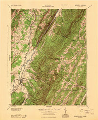 1945 Moorefield1945 Print · USGSHardy and Hampshire counties at the close of World War II reveal a landscape defined by the Potomac river-and-rail economy. Genealogists can locate family landmarks like Reynolds Gap and rural centers such as Old Pine Ch and Bethel Sch.
 - 1947 Map of Edinburg, 1958 Print
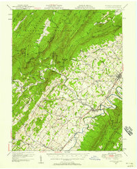 1947 Edinburg1958 Print · USGSThe Shenandoah Valley is mapped here just after the war, showing the historic transportation spine between Woodstock and Mt Jackson. Researchers can trace rural life through landmarks like Columbia Furnace, Lantz Mills, and Union Forge Ch.2 unique versions available
 - 1948 Map of Cumberland
 1948 Cumberland1948 Print · USGSMid-century Appalachia and the Shenandoah Valley are shown in detail, documenting the industrial and transportation hubs of the tri-state area. Genealogists can trace family roots through settlements like Double Tollgate and Bunker Hill or along the Baltimore & Ohio RR.3 unique versions available
 - 1949 Map of Charlottesville
 1949 Charlottesville1949 Print · USGSThe Shenandoah Valley and Blue Ridge appear in the late 1940s as a thriving corridor of rail and river commerce. Researchers can trace the mid-century footprints of Harrisonburg, Staunton, and Culpeper alongside the historic routes of the Southern Railway.2 unique versions available
 - 1951 Map of Edinburg
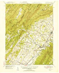 1951 Edinburg1951 Print · USGSShenandoah County is shown here at the start of the 1950s, where the river valley and rail lines shaped a landscape of small towns and industrial history. Genealogists and historians can trace family locations through numerous rural sites like Lantz Mills, Sugar Hill Cem, and Pleasant Grove Sch.
Showing maps 1-25 of 157
Top cities of Hardy County
Frequently asked questions
- What are the different types of historical maps available for Hardy County?
- What is the oldest map of Hardy County?
- Where can I purchase historical maps of Hardy County for my home or office?
- Where can I download high-res historical maps of Hardy County?
- Are there historical topographic maps available for Hardy County?
- Is there historical aerial imagery available for Hardy County?
- Where are historical maps of Hardy County sourced from?