Old Maps of Jackson County, West Virginia for Metal Detecting
Plan your next treasure hunt with 127 historic maps of Jackson County. Find old homesites, ghost towns, trails, and gathering spots that may be lost to time — perfect for identifying promising metal detecting locations.
- Locate forgotten sites: Uncover places like long-lost settlements, abandoned rail lines, or gathering spots.
- Plan better hunts: Use map overlays combined with LiDAR or satellite views to narrow in on historically rich areas.
- Made for detectorists: Thousands of hobbyists use these maps to discover relics, coins, and hidden history.
Use these historic maps to boost your research and find new opportunities beneath the surface of Jackson County.
Jackson County, WV maps
(127)- 1906 Map of Belleville
 1906 Belleville1906 Print · USGSWood County at the turn of the century is defined by its deep river valleys and the expansion of the Baltimore and Ohio RR. Genealogists and historians can trace late-Victorian settlements like Mineral Wells, Belleville, and the riverfront at Walkers Crossing.2 unique versions available
 - 1906 Map of Kenna, 1959 Print
 1906 Kenna1959 Print · USGSThe West Virginia hills north of Charleston appear in this early century survey of the Jackson and Kanawha county border. Researchers can locate early homesteads and community hubs like Sissonville, the Emma Belle School, and Staats Mills.
 - 1906 Map of Winfield, 1961 Print
 1906 Winfield1961 Print · USGSThe Kanawha River valley at the turn of the century shows a landscape defined by river locks and the growing influence of the railroad. Genealogists and historians can trace old homesteads and landings from Redhouse Shoals to the small village of Confidence.
 - 1907 Map of Kenna
 1907 Kenna1907 Print · USGSThe hill country of Jackson and Kanawha counties is captured here in the early twentieth century as a landscape of isolated valley farms and ridge-top communities. Genealogists can trace family footprints through rural centers like Sissonville, Staats Mills, and White Chapel.3 unique versions available
 - 1907 Map of Keno, 1919 Print
 1907 Keno1919 Print · USGSMeigs County and the Ohio River valley appear in high detail just after the turn of the century, showing a landscape defined by river trade and rail. Researchers can trace family sites at Nease Settlement, find the Minersville PO, or locate old schools like Morningstar School and Redbrush School.3 unique versions available
 - 1907 Map of Ripley, 1922 Print
 1907 Ripley1922 Print · USGSJackson County at the start of the twentieth century shows a landscape of ridge-top schools and creek-bottom settlements. Trace early routes like the Buffalo Turnpike or locate family sites at Lockhart PO and Klondike Schoolhouse.
 - 1908 Map of Winfield
 1908 Winfield1908 Print · USGSThe Kanawha River valley at the turn of the century shows a landscape defined by river traffic and rail expansion. Genealogists and historians can trace riverside settlements like Winfield and Buffalo, or find lost rail stops and river locks including Lock No 10 and Black Betsey.3 unique versions available
 - 1908 Map of Ravenswood
 1908 Ravenswood1908 Print · USGSEarly 1900s life along the Ohio River comes alive in this survey of the West Virginia and Ohio borderlands. Genealogists and historians can trace family locations near landmarks like Antioch Church, Letart Falls, and the old K and M RR line.2 unique versions available
 - 1924 Map of Belleville, 1954 Print
 1924 Belleville1954 Print · USGSWood County’s riverfront settlements and rural school districts are captured here in the mid-twenties during the height of the rail era. Genealogists can locate long-lost family landmarks like Harris Ferry, Meldahl, and dozens of rural schoolhouses including Leafy Glen School.
 - 1926 Map of Ravenswood
 1926 Ravenswood1926 Print · USGSThe Ohio River valley in the mid-1920s reveals a landscape of tight river bends and bustling waterfront towns like Ravenswood and Hartford. Researchers can trace the early rail network of the Baltimore and Ohio and locate numerous rural landmarks such as Jackson Chapel and the Mountain Flower School.
 - 1926 Map of Belleville
 1926 Belleville1926 Print · USGSThe Ohio River valley and its rugged Wood County hinterlands come into focus in the mid-twenties. Genealogists and historians can locate dozens of rural schools and churches like Leafy Glen School, Torch PO, and Serepta Church along the winding runs.2 unique versions available
 - 1926 Map of Ripley, 1958 Print
 1926 Ripley1958 Print · USGSJackson County is shown during its mid-1920s development, centered on the rail-and-river hub of Ripley. Genealogists and historians can trace dozens of early rural schoolhouses and churches, including Klondike Sch, Batchel Chapel, and Parchment Valley Sch.
 - 1928 Map of Ravenswood
 1928 Ravenswood1928 Print · USGSThe Ohio River's great winding oxbows dominate the landscape in the late twenties, anchoring a world of river-town commerce and hilltop farming. Genealogists can trace hundreds of family-named landmarks, from the Mountain Flower School to the Antioch Church and the rails of the Baltimore & Ohio RR.3 unique versions available
 - 1928 Map of Ripley
 1928 Ripley1928 Print · USGSJackson County hill country in the late twenties is mapped here in detail, showing the rural communities surrounding Ripley and the Baltimore and Ohio Railroad. Genealogists can trace family footprints through numerous landmarks like Morning Star Sch, Kings Chapel, and Hargreave Knob.2 unique versions available
 - 1949 Map of Clarksburg
 1949 Clarksburg1949 Print · USGSThe upper Ohio River valley and the industrial heart of West Virginia come into focus during this post-war period. Genealogists and researchers can trace the rail corridors of the Baltimore and Ohio and locate centers like Fairmont, Grafton, and Waynesburg.
 - 1954 Map of Charleston
 1954 Charleston1954 Print · USGSWest Virginia’s industrial heart and mountain highlands are captured here during the mid-fifties, centered on the capital city. Researchers can trace historic river-and-rail corridors along the Kanawha River and locate remote peaks within the Monongahela National Forest.
 - 1956 Map of Clarksburg, 1966 Print
 1956 Clarksburg1966 Print · USGSThe Ohio River valley and the industrial heart of West Virginia are seen here in the mid-1950s as rail and river commerce thrived. Researchers can trace historic transport lines like the Baltimore and Ohio RR and locate ancestral homes in Clarksburg, Moundsville, or Parkersburg.2 unique versions available
 - 1957 Map of Romance, 1959 Print
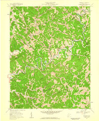 1957 Romance1959 Print · USGSThe Pocatalico River valley in the late fifties was a landscape of remote hollows and hilltop cemeteries at the borders of Jackson, Roane, and Kanawha counties. Researchers can trace rural lineages through family landmarks like Clendenin Cem and the Goff Sch near Romance.3 unique versions available
 - 1957 Map of Kenna, 1959 Print
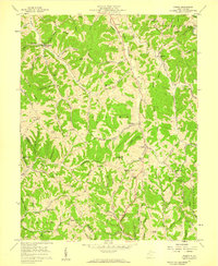 1957 Kenna1959 Print · USGSJackson County in the late fifties was a region of high ridges and deep hollows where community life centered on remote schools and chapels. Genealogists can trace family roots through landmarks like Seldom Seen Sch, Parchment Chapel, and Southall Cem.2 unique versions available
 - 1957 Map of Kentuck, 1959 Print
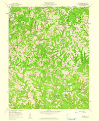 1957 Kentuck1959 Print · USGSThe hills of Jackson and Roane Counties appear in the mid-fifties as a network of ridge-top schools and narrow valley farms. Genealogists can trace family names across dozens of sites like Skeen Cem, Sinaville Ch, and the community of Belgrove.3 unique versions available
 - 1957 Map of Charleston, 1966 Print
 1957 Charleston1966 Print · USGSMid-century West Virginia unfolds along the industrial Kanawha River valley and into the high Allegheny Mountains. Genealogists and historians can trace the vital rail lines of the Chesapeake and Ohio and locate riverside settlements from Saint Albans to Buckhannon.3 unique versions available
 - 1958 Map of Charleston
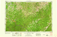 1958 Charleston1958 Print · USGSMid-century West Virginia is defined here by the industrial corridor of the Kanawha River and the high ridges of the Allegheny Mountains. Researchers can trace the rail networks of the New York Central or locate remote highland communities like Pickens and Hillsboro.
 - 1958 Map of Sissonville, 1959 Print
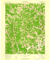 1958 Sissonville1959 Print · USGSMid-century Kanawha County comes to life in this survey of the hollows and ridges surrounding the Pocatalico River. Local researchers can trace family roots through numerous named landmarks like Bonham Chapel, Point Harmony Sch, and Rock Spring Cem.4 unique versions available
 - 1958 Map of Mount Alto, 1960 Print
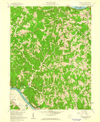 1958 Mount Alto1960 Print · USGSNear the confluence of the Ohio and Kanawha Rivers in the late fifties, this Mason County landscape preserves a network of ridgeline farms and rural crossroads. Genealogists can trace family landmarks like Mt Zion Cem, Shiloh Church Hill Sch, and the riverside settlement at Mount Alto.4 unique versions available
 - 1958 Map of Elmwood, 1960 Print
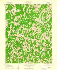 1958 Elmwood1960 Print · USGSThe hill country at the intersection of Mason, Jackson, and Putnam counties is captured here in the late fifties, showing a landscape defined by high ridges and deep hollows. Genealogists can trace family footprints through numerous rural landmarks like Mt Prospect Ch, New Jersey Sch, and the Barnette Cem.2 unique versions available
Showing maps 1-25 of 127
Top cities of Jackson County
Frequently asked questions
- What are the different types of historical maps available for Jackson County?
- What is the oldest map of Jackson County?
- Where can I purchase historical maps of Jackson County for my home or office?
- Where can I download high-res historical maps of Jackson County?
- Are there historical topographic maps available for Jackson County?
- Is there historical aerial imagery available for Jackson County?
- Where are historical maps of Jackson County sourced from?