2000s (21st Century) Maps of Jackson County, West Virginia
Explore 21 historic maps of Jackson County from the 2000s (21st Century). These maps offer a rare glimpse into what life looked like during the 2000s — showing old roads, neighborhoods, homes, and landmarks that have changed or disappeared over time.
Whether you're researching your family's past, planning a metal detecting trip, or studying how Jackson County's landscape evolved across the 2000s, these high-resolution maps are a powerful tool for exploring the history of this region.
- Focus on a specific era: All maps on this page are from the 2000s, giving you a focused view of this time period.
- See what’s changed: Compare century-old streets, trails, and buildings to today's modern landscape using overlays and satellite layers.
- Research with precision: Use these maps for genealogy, historical research, land use analysis, or educational projects.
- View, download, or print: Maps are fully viewable online in high resolution, and can be downloaded or printed for your own records.
Start exploring Jackson County's history through authentic maps from the 2000s. This is your window into the past.
Jackson County, WV maps
(21)- 2000 Map of Sissonville, 2001 Print
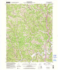 2000 Sissonville2001 Print · USGSThe Pocatalico River valley at the turn of the millennium remains a landscape of deep hollows and family-named ridges. Genealogists and historians can trace community roots through numerous country schools like Unexpected Sch and local landmarks such as Bonham Chapel and Goldtown.
 - 2010 Map of Portland, 2010 Print
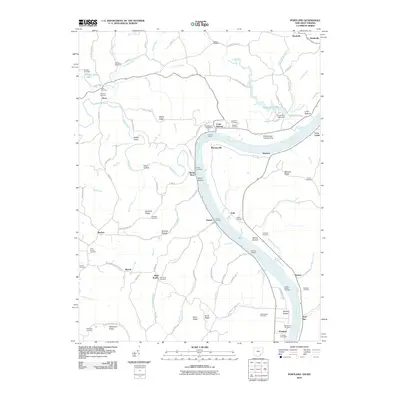 2010 Portland2010 Print · USGSCovers Jackson County, including Rushville, Hazael, and other nearby areas
 - 2013 Map of Portland, 2013 Print
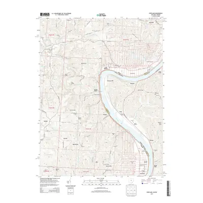 2013 Portland2013 Print · USGSCovers Jackson County, including Rushville, Hazael, and other nearby areas
 - 2016 Map of Portland, 2016 Print
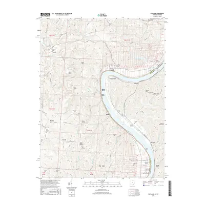 2016 Portland2016 Print · USGSCovers Jackson County, including Rushville, Hazael, and other nearby areas
 - 2019 Map of Portland, 2019 Print
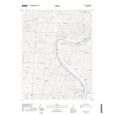 2019 Portland2019 Print · USGSCovers Jackson County, including Rushville, Hazael, and other nearby areas
 - 2023 Map of Cottageville, 2023 Print
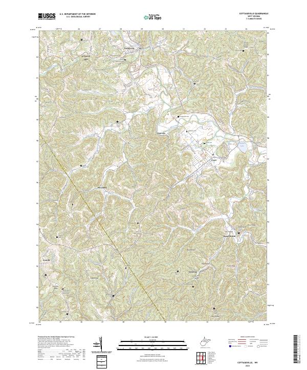 2023 Cottageville2023 Print · USGSWest Virginia's Jackson County uplands come into focus here, showing the rural communities along Mill Creek in the 2020s. Researchers can locate dozens of family burial grounds and historical landmarks like Antioch Church, Blaine Memorial Cem, and Hutchison Lake.
 - 2023 Map of Liverpool, 2023 Print
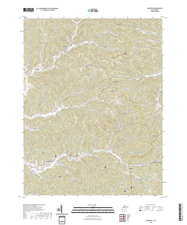 2023 Liverpool2023 Print · USGSThe West Virginia hill country at the intersection of Jackson, Wirt, and Roane counties is shown in detail during the early 2020s. Researchers can trace numerous ancestral burial sites including Sheppard Chapel Church Cem and Wright Cem near the settlements of Liverpool and Duncan.
 - 2023 Map of Kenna, 2023 Print
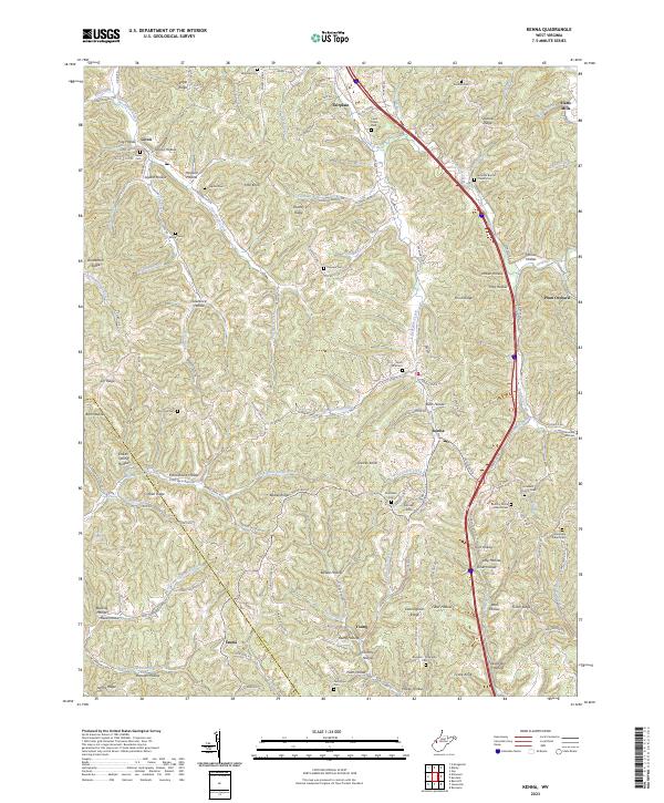 2023 Kenna2023 Print · USGSJackson and Putnam counties come alive in this contemporary survey of West Virginia's ridge-and-hollow country. Researchers can trace deep family roots at Given Cem, Harpold Cem, or the Stonelick Church Cem near Kenna.
 - 2023 Map of Kentuck, 2023 Print
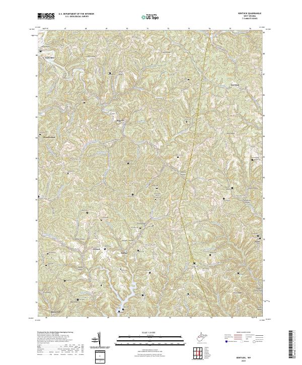 2023 Kentuck2023 Print · USGSWest Virginia's ridgelands come into focus during the early twenty-first century, showing the small communities and family cemeteries that define this corner of the state. Genealogists can locate family burial grounds like Woodfell Cem and Counts Cem near Belgrove and Kentuck.
 - 2023 Map of Elmwood, 2023 Print
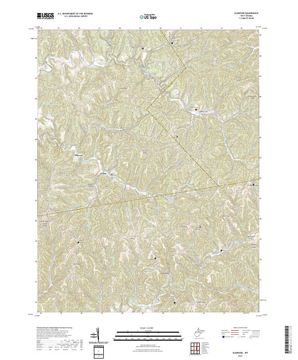 2023 Elmwood2023 Print · USGSThe hills of Putnam and Jackson counties are captured here in the early twenty-first century, showing the enduring rural character of the region. Researchers can trace family history through numerous burial sites like Sayre Cem, Walker Chapel Cem, and the aptly named Tightsqueeze Hollow.
 - 2023 Map of Gay, 2023 Print
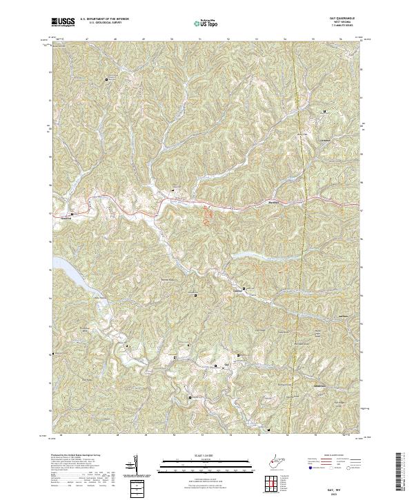 2023 Gay2023 Print · USGSThe West Virginia borderlands of Jackson and Roane counties are captured here in detail, showing a landscape defined by ridges and deep hollows. Researchers can locate numerous family burial sites and rural centers like Gay, Litton Cem, and the Mount Hope Church of God.
 - 2023 Map of Sissonville, 2023 Print
 2023 Sissonville2023 Print · USGSThe Pocatalico River valley in the early 2020s reveals a landscape deeply etched by family history and rural community life across Kanawha County. Genealogists and local historians can locate numerous family burial sites, including Boggess Family Cem, while tracing the early footprints of Sissonville and Liberty.
 - 2023 Map of New Haven, 2023 Print
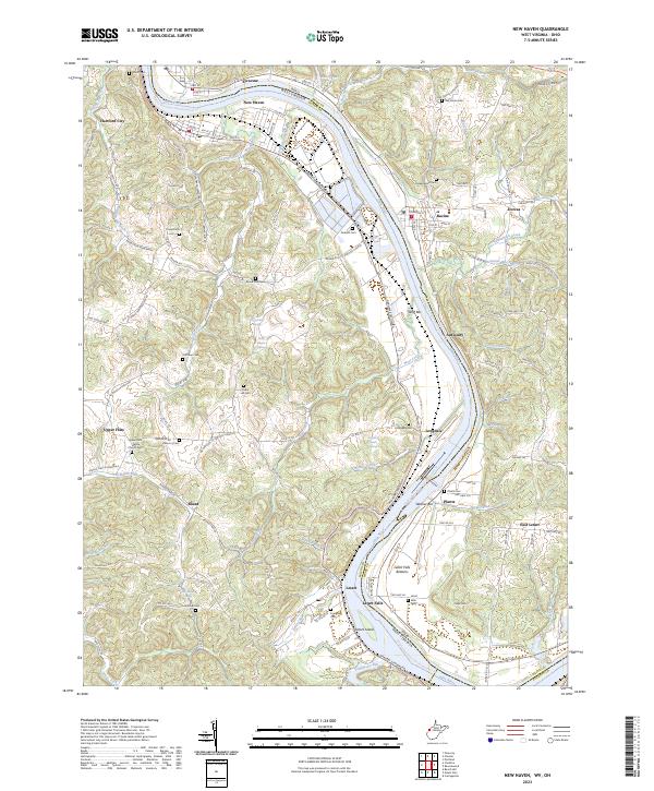 2023 New Haven2023 Print · USGSThe riverfront communities of Mason County and Meigs County are shown here in modern detail as they line the banks of the Ohio. Researchers can locate numerous local burial sites and landmarks like Upper Flats White Church Cem, Letart Falls, and the prominent Letart Island.
 - 2023 Map of Rockport, 2023 Print
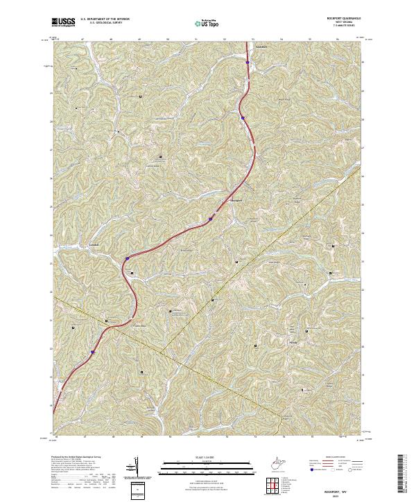 2023 Rockport2023 Print · USGSThe Wood and Jackson County borderlands are shown here in the 2020s, a landscape defined by high ridges and tight valley communities. Researchers can locate numerous family burial sites and rural congregations, including Lowdell Cem, Mount Moriah Cem, and the Central Church of Christ Cem.
 - 2023 Map of Romance, 2023 Print
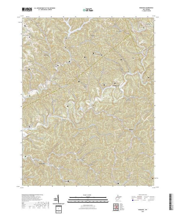 2023 Romance2023 Print · USGSThe Pocatalico River valley comes alive in this contemporary record of rural Kanawha and Jackson Counties. Genealogists and local historians can trace family lineages across dozens of named cemeteries like Newhouser Cem and Fields Cem or locate community landmarks such as Pleasant Grove Church.
 - 2023 Map of Ravenswood, 2023 Print
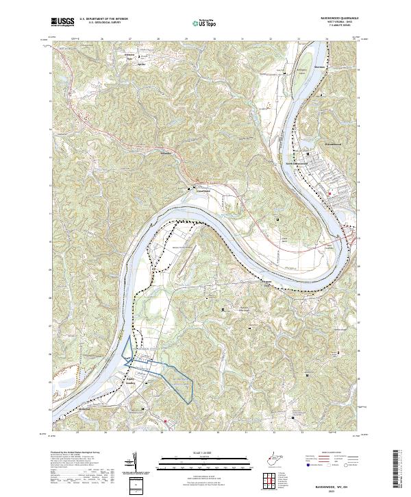 2023 Ravenswood2023 Print · USGSThe Ohio River valley near Ravenswood is shown here in the 2020s, revealing a landscape shaped by river commerce and ridge-top settlements. Genealogists can trace family landmarks and local burial grounds like Ottobine Cem, DeBussey Cem, and the Flatwoods United Methodist Church.
 - 2023 Map of Ripley, 2023 Print
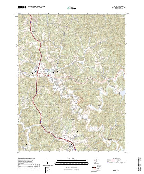 2023 Ripley2023 Print · USGSRipley and its surrounding hollows are documented here in the early twenty-first century, showing the enduring layout of this Jackson County hub. Family historians can locate dozens of burial sites like Old Ripley Cem and landmarks such as the Jackson County Courthouse.
 - 2023 Map of Sandyville, 2023 Print
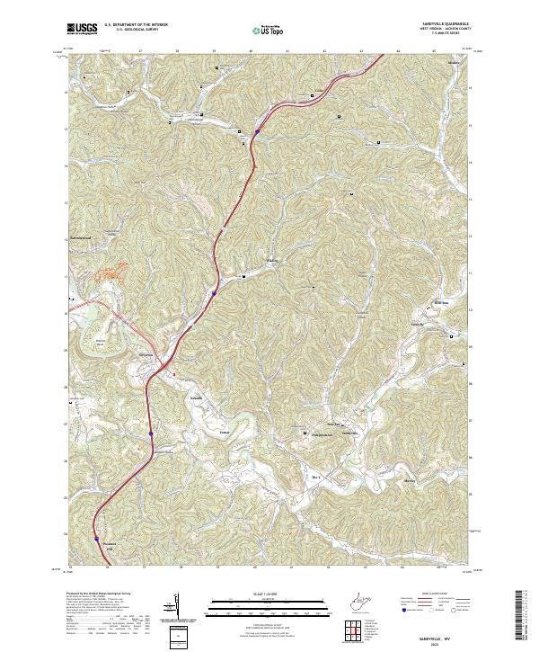 2023 Sandyville2023 Print · USGSJackson County's deeply-furrowed landscape is captured here in the early twenty-first century, showing the enduring rural network of Sandy Creek. Genealogists can locate family-named sites such as Nesselroad Cem, Staats Cem, and the Silverton-Red Bush School.
 - 2023 Map of Portland, 2023 Print
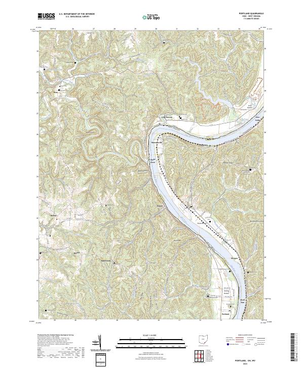 2023 Portland2023 Print · USGSMeigs County, Ohio, and across the river into West Virginia, the landscape is captured here along a dramatic bend in the Ohio River. Local historians can trace family roots through numerous hilltop burial sites like Rainbow Cem and Laucks Chapel Cem or locate old settlements at Long Bottom and Hazael.
 - 2023 Map of Pond Creek, 2023 Print
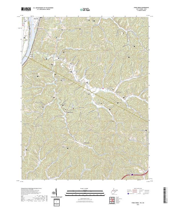 2023 Pond Creek2023 Print · USGSThe Ohio River valley and the interior ridges of West Virginia come alive in this recent survey. Researchers can locate family landmarks such as Shafer Cem and Isabelle Flinn Cem or trace the routes through Flinn and Willowdale.
 - 2023 Map of Mount Alto, 2023 Print
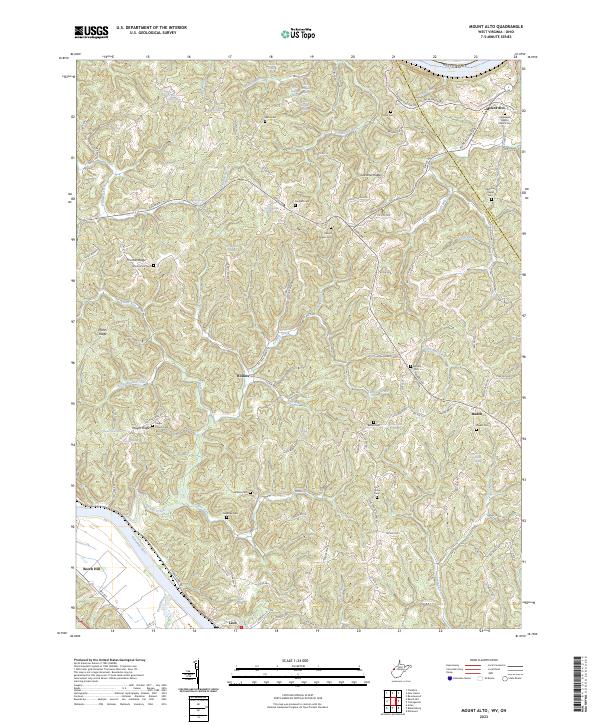 2023 Mount Alto2023 Print · USGSThe hill country of Jackson and Mason counties appears in extensive detail in this contemporary study of the Ohio River hinterlands. Researchers can trace family history through a high density of rural landmarks, including Mount Zion Cem, Jenkins Cem, and the settlement of Baden.
End of results
Showing maps 1-21 of 21
Top cities of Jackson County
Frequently asked questions
- What are the different types of historical maps available for Jackson County?
- What is the oldest map of Jackson County?
- Where can I purchase historical maps of Jackson County for my home or office?
- Where can I download high-res historical maps of Jackson County?
- Are there historical topographic maps available for Jackson County?
- Is there historical aerial imagery available for Jackson County?
- Where are historical maps of Jackson County sourced from?