Old Maps of Ashton, West Virginia for Hiking & Exploration
Hike through history with 13 historic maps of Ashton. Explore old trails, ghost towns, and forgotten backroads — perfect for outdoor adventurers and local explorers.
- Rediscover forgotten places: Map out old mining camps, roads, and footpaths that no longer exist on modern maps.
- Layer with modern tools: Combine with LiDAR or satellite views to plan hikes through historical terrain.
- Made for exploration: Popular among hikers, overlanders, and local history lovers.
Use these maps to find adventure and explore the hidden past of Ashton.
Ashton, WV maps
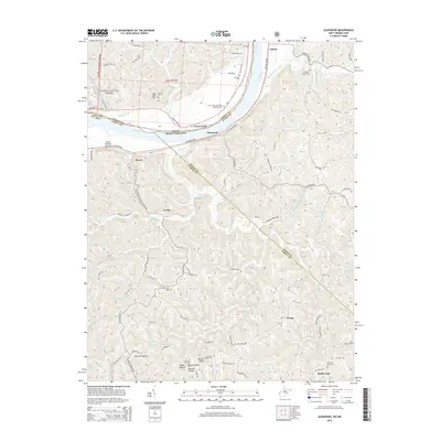
(13)- 1906 Map of Glenwood, 1958 Print
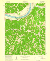
 1906 Glenwood1958 Print · USGSThe Ohio River valley was a bustling corridor of steam and rail at the start of the 1900s, anchoring the border between Mason County and Ohio. Researchers can trace riverside settlements like Mercers Bottom, find vanished post offices such as Thivener PO, and follow the Baltimore and Ohio RR through Apple Grove.
 - 1908 Map of Glenwood
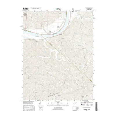
 1908 Glenwood1908 Print · USGSThe Ohio River valley at the turn of the century shows a landscape of riverfront rail towns and high ridges before modern development. Genealogists can trace early post offices like Yellowtown Thivener PO and settlements at Mercers Bottom or Ben Lomond.3 unique versions available
 - 1957 Map of Huntington, 1966 Print
 1957 Huntington1966 Print · USGSThe industrial heart of the Ohio River valley is captured here in the mid-sixties, showing the growth of Huntington and Ashland. Researchers can trace the extensive rail networks of the Chesapeake and Ohio RR and locate sites like the Chief Cornstalk Hunting Ground.3 unique versions available
 - 1958 Map of Glenwood, 1959 Print
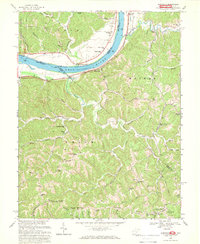
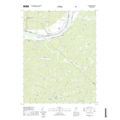
 1958 Glenwood1959 Print · USGSThe Ohio River valley in the late fifties was a landscape of ridge-top schools and river-rail commerce. Genealogists can trace family names at Swan Creek Ch, Barker Sch, and Bias Chapel.2 unique versions available
 - 1960 Map of Huntington
 1960 Huntington1960 Print · USGSThe tri-state river valley thrived in the late fifties as a hub of heavy industry and Appalachian rail transit. Genealogists and historians can trace the connection between river towns like Ashland and Portsmouth or locate family homesteads near Coleman Ridge.
 - 1968 Map of Glenwood, 1969 Print
 1968 Glenwood1969 Print · USGSCabell County at the end of the sixties reveals a landscape of riverfront rail traffic and high-ridge community life. Genealogists can trace family names through landmarks like Union Ridge Cem, Bias Chapel, and schoolhouses like Central Sch.2 unique versions available
 - 1981 Map of Ironton, 1982 Print
 1981 Ironton1982 Print · USGSThe tri-state river valley at the start of the eighties shows a landscape shaped by heavy industry, atomic energy, and sprawling national forests. Researchers can trace the legacy of iron production at Harrison Furnace or follow the historic rail lines of the C & O RR and N & W RR.
 - 2002 Map of Glenwood, 2006 Print
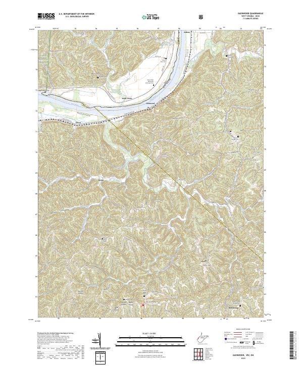
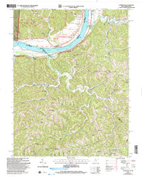 2002 Glenwood2006 Print · USGSThe Ohio River valley and the ridges of Cabell and Mason counties are shown here as they appeared at the start of the century. Genealogists and local historians can trace rural family life through landmarks like Moores Chapel, Swan Creek Sch, and Dudley Gap.
 - 2011 Map of Glenwood, 2011 Print
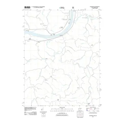 2011 Glenwood2011 Print · USGSCovers Ashton, including Ohio Township, Gwinn, and other nearby areas
 - 2014 Map of Glenwood, 2014 Print
 2014 Glenwood2014 Print · USGSCovers Ashton, including Ohio Township, Gwinn, and other nearby areas
 - 2016 Map of Glenwood, 2016 Print
 2016 Glenwood2016 Print · USGSCovers Ashton, including Ohio Township, Gwinn, and other nearby areas
 - 2019 Map of Glenwood, 2019 Print
 2019 Glenwood2019 Print · USGSCovers Ashton, including Ohio Township, Gwinn, and other nearby areas
 - 2023 Map of Glenwood, 2023 Print
 2023 Glenwood2023 Print · USGSModern West Virginia river life and hill country traditions meet along the banks of the Ohio River in the early 2020s. Genealogists and local historians can trace family ties through numerous upland sites like Moores Chapel Cemetery and the historic Swan Creek settlement.
End of results
Showing maps 1-13 of 13
Top cities near Ashton
- Huntington historical maps
- Teays Valley historical maps
- Rome historical maps
- Hurricane historical maps
- Point Pleasant historical maps
- Gallipolis historical maps
See more
Frequently asked questions
- What are the different types of historical maps available for Ashton?
- What is the oldest map of Ashton?
- Where can I purchase historical maps of Ashton for my home or office?
- Where can I download high-res historical maps of Ashton?
- Are there historical topographic maps available for Ashton?
- Is there historical aerial imagery available for Ashton?
- Where are historical maps of Ashton sourced from?