1990s Maps of Mingo County, West Virginia
Explore 12 historic maps of Mingo County from the 1990s. These maps offer a rare glimpse into what life looked like during the 1990s — showing old roads, neighborhoods, homes, and landmarks that have changed or disappeared over time.
Whether you're researching your family's past, planning a metal detecting trip, or studying how Mingo County's landscape evolved across the 1990s, these high-resolution maps are a powerful tool for exploring the history of this region.
- Focus on a specific era: All maps on this page are from the 1990s, giving you a focused view of this time period.
- See what’s changed: Compare century-old streets, trails, and buildings to today's modern landscape using overlays and satellite layers.
- Research with precision: Use these maps for genealogy, historical research, land use analysis, or educational projects.
- View, download, or print: Maps are fully viewable online in high resolution, and can be downloaded or printed for your own records.
Start exploring Mingo County's history through authentic maps from the 1990s. This is your window into the past.
Mingo County, WV maps
(12)- 1992 Map of Kermit
 1992 Kermit1992 Print · USGSCoal and rail define this border region along the Tug Fork in the nineties. Researchers can trace the industrial footprint of the Strip Mine and Norfolk and Western railway alongside local landmarks like Warfield Sch and Gospel Light Ch.
 - 1992 Map of Matewan
 1992 Matewan1992 Print · USGSThe Tug Fork border between West Virginia and Kentucky is shown here in the early nineties, revealing a dense landscape of coal hollows and river towns. Researchers can trace the heritage of Matewan and Blackberry City alongside landmarks like Blackberry Sch and the Delorme Post Office.
 - 1992 Map of Williamson
 1992 Williamson1992 Print · USGSThe industrial heart of Mingo County is captured here in the early nineties, centered on the river-and-rail hub of Williamson. Genealogists and historians can trace the development of border towns like Nolan, Goodman, and Belfry along the Tug Fork.
 - 1996 Map of Holden, 2002 Print
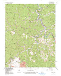
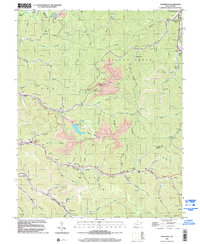
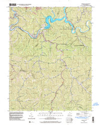
 1996 Holden2002 Print · USGSLogan County coal country is detailed here in the late nineties, showing the dense network of mining towns and valley settlements. Genealogists can locate family landmarks like Farrar Cem and Whitman Cem, or local institutions like the Coal Miners Chapel.
 - 1996 Map of Barnabus, 2002 Print
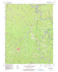
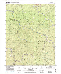
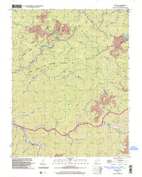
 1996 Barnabus2002 Print · USGSThe West Virginia coal country of the 1990s is captured here, showing the intricate industrial landscape of the LOGAN CO and MINGO CO border. Researchers can trace family history through numerous hillside burial sites like Hatfield Cem and Ferrell Cem or locate the Stirrat Sch.
 - 1996 Map of Wilsondale, 2003 Print
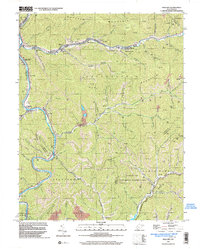
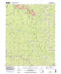
 1996 Wilsondale2003 Print · USGSThe West Virginia hill country at the borders of Wayne and Mingo counties is captured here in the late twentieth century. Researchers can locate numerous family-named landmarks and burial sites like Perry Ridge Cem and the Lower Turkey Ch Sch along Twelvepole Creek.
 - 1996 Map of Mallory, 2003 Print
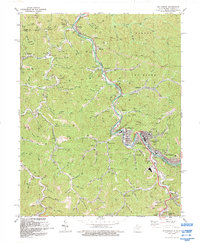
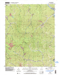
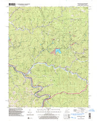
 1996 Mallory2003 Print · USGSLogan County coal and gas country is captured here in the mid-1990s as the river valleys hummed with industrial activity. Genealogists and local historians can trace family sites like McDonald Cem, Emmanuel Ch, and the old post office at Greenville.
 - 1996 Map of Man, 2003 Print
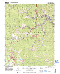
 1996 Man2003 Print · USGSMid-century Logan and Mingo counties are defined here by a dense network of mining operations and river-valley settlements during the 1990s. Genealogists and historians can trace family locations through Greenville (Hunt PO), Stirrat, and Sarah Ann while locating historic coal infrastructure like Tipples and the Island Creek RR.
 - 1996 Map of Gilbert, 2003 Print
 1996 Gilbert2003 Print · USGSMingo and Wyoming counties appear in the mid-1990s as a landscape of deep river valleys and active resource extraction. Genealogists and historians can trace family settlements from Gilbert to Ikes Fork, alongside numerous mines and cemeteries near the Guyandotte River.
 - 1996 Map of Myrtle, 2003 Print
 1996 Myrtle2003 Print · USGSMingo County in the mid-1990s shows a landscape of deep hollows and active coal works. Genealogists and historians can trace family cemeteries like Ooten Cem and Mounts Cem or locate the Lily of the Valley Ch near the banks of Pigeon Creek.
 - 1997 Map of Trace, 2003 Print
 1997 Trace2003 Print · USGSThe Mingo and Logan county borders are documented here in the late nineties, showing a landscape defined by gas extraction and deep mountain hollows. Researchers can trace historic family landmarks and community sites like Hugh Dingess Sch, Elizabeth Ch, and Mt Mariah Ch Cem.
 - 1997 Map of Naugatuck, 2003 Print
 1997 Naugatuck2003 Print · USGSThe Tug River borderlands of Mingo County appear in detail here during the late nineties, showing the winding valleys of the West Virginia-Kentucky line. Researchers can trace family history through local sites like Parsley Bottom, Waldron Cem, and Mouth of Long Branch Sch.
End of results
Showing maps 1-12 of 12
Top cities of Mingo County
- Williamson historical maps
- Chattaroy historical maps
- Red Jacket historical maps
- Matewan historical maps
- Delbarton historical maps
- Gilbert historical maps
See more
Frequently asked questions
- What are the different types of historical maps available for Mingo County?
- What is the oldest map of Mingo County?
- Where can I purchase historical maps of Mingo County for my home or office?
- Where can I download high-res historical maps of Mingo County?
- Are there historical topographic maps available for Mingo County?
- Is there historical aerial imagery available for Mingo County?
- Where are historical maps of Mingo County sourced from?