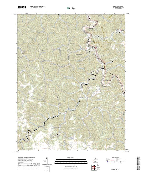
1992 Map of Kermit
USGS Topo · Published 1992About this map
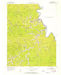
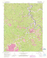
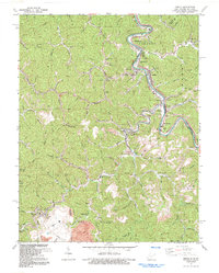
The Tug Fork river serves as the central artery for this borderland where West Virginia meets Kentucky. In the early 1990s, the landscape here was defined by a complex industrial infrastructure of coal extraction and transportation. Extensive Strip Mine operations dominate the southern terrain, supported by a network of specialized features including a Conveyor, Tipple, Tailings Pond, and multiple Air Shaft locations. The Norfolk and Western railroad tracks follow the river's winding path, connecting the settlements of Kermit, Warfield, and East Kermit. Community life is anchored by landmarks like the Warfield Sch, Gospel Light Ch, and the Jefferson Mem Gardens Cem, while family-named branches like Maynard Br and Hale Branch flow through the surrounding hills.
Find a feature on this map
70 named features on this map. Tap any name to fly to it.
Don’t see what you’re looking for? This feature index may not catch every label — zoom into the map to look around manually.
Map Details
Editions of this 1992 Kermit Map
This is the sole edition of this map. No revisions or reprints were ever made.
Historical Maps of Warfield Through Time
4 maps found