2020s Maps of Mingo County, West Virginia
Explore 17 historic maps of Mingo County from the 2020s. These maps offer a rare glimpse into what life looked like during the 2020s — showing old roads, neighborhoods, homes, and landmarks that have changed or disappeared over time.
Whether you're researching your family's past, planning a metal detecting trip, or studying how Mingo County's landscape evolved across the 2020s, these high-resolution maps are a powerful tool for exploring the history of this region.
- Focus on a specific era: All maps on this page are from the 2020s, giving you a focused view of this time period.
- See what’s changed: Compare century-old streets, trails, and buildings to today's modern landscape using overlays and satellite layers.
- Research with precision: Use these maps for genealogy, historical research, land use analysis, or educational projects.
- View, download, or print: Maps are fully viewable online in high resolution, and can be downloaded or printed for your own records.
Start exploring Mingo County's history through authentic maps from the 2020s. This is your window into the past.
Mingo County, WV maps
(17)- 2022 Map of Majestic, 2022 Print
 2022 Majestic2022 Print · USGSThe borderlands of Kentucky and West Virginia come into sharp focus in this detailed survey of the Pike and Mingo County line. Researchers can trace ancestral locations from Thacker Mines to Majestic, finding local landmarks like Steele Cem and Stopover.
 - 2023 Map of Holden, 2023 Print
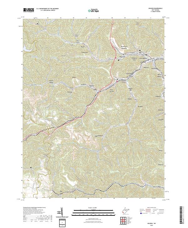 2023 Holden2023 Print · USGSLogan County’s deep-valley settlements and coal-country geography are meticulously documented in this recent survey. Researchers can trace the layout of residential areas like Whitman Junction and Hedgeview or locate local landmarks like Pickering Knob and Ferrell Cem.
 - 2023 Map of Chapmanville, 2023 Print
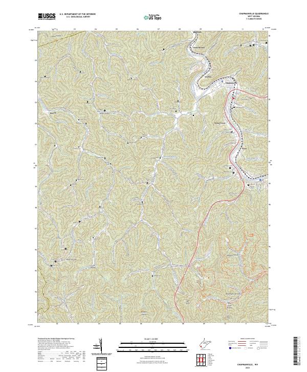 2023 Chapmanville2023 Print · USGSLogan and Lincoln County borders meet in this river-valley landscape during the early 2020s. Genealogists can trace family burial sites across dozens of locations like Lily Cem, Dingess Cem, and the expansive Highland Memory Gardens.
 - 2023 Map of Kermit, 2023 Print
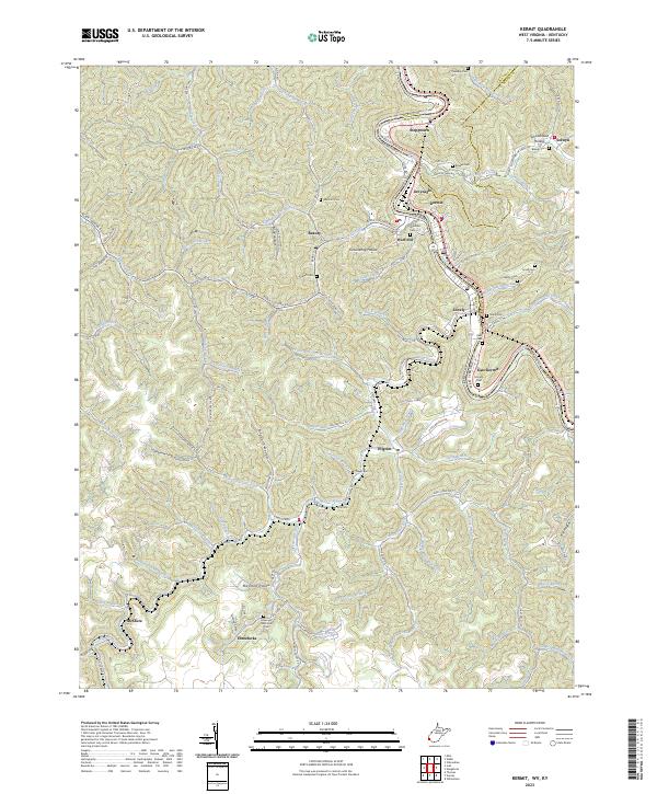 2023 Kermit2023 Print · USGSMingo County, West Virginia and Martin County, Kentucky are documented here in the early twenty-first century as the Tug Fork divides their mirrored river towns. Genealogists can locate family burial sites like Brewer Cem and Petercave Memorial Cem near the communities of Kermit and Beauty.
 - 2023 Map of Williamson, 2023 Print
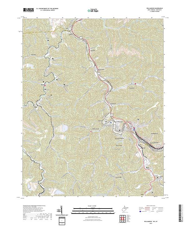 2023 Williamson2023 Print · USGSThe Tug Fork borderlands near the West Virginia and Kentucky line are shown here in recent detail. Genealogists can trace family landmarks across the hollows, including the Stepp Vance Cem, Tandy Sester Alley Cem, and the old settlement at Borderland.
 - 2023 Map of Delbarton, 2023 Print
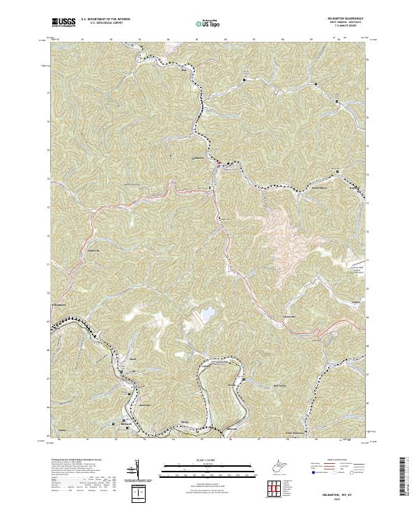 2023 Delbarton2023 Print · USGSThe rugged coal country of Mingo County is mapped in detail during the early 2020s, tracing the winding Tug Fork and Pigeon Creek. Genealogists and local historians can locate family cemeteries like McCoy Cem and industrial landmarks like Lando Mines.
 - 2023 Map of Barnabus, 2023 Print
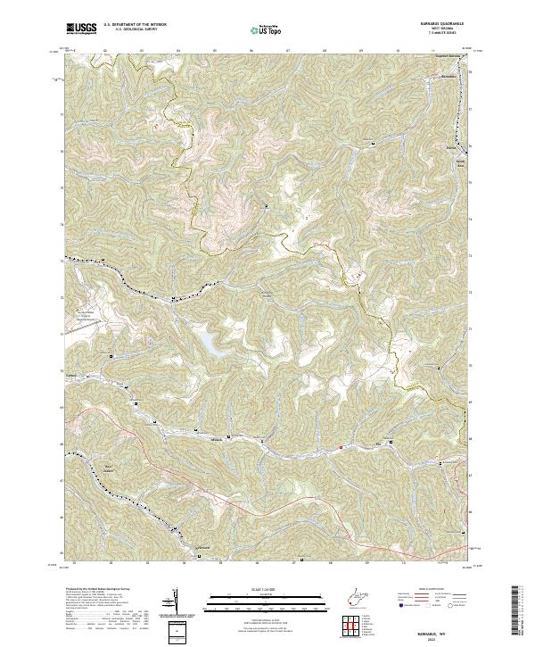 2023 Barnabus2023 Print · USGSMingo and Logan counties are shown in high detail in the early 2020s, highlighting the deeply etched valleys and small hollow settlements of the coalfields. Researchers can trace dozens of family burial sites like Hatfield Cem and Sizemore Cem or locate the historic communities of Red Jacket and Barnabus.
 - 2023 Map of Myrtle, 2023 Print
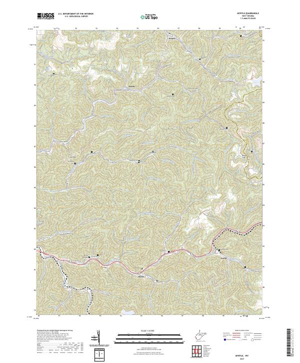 2023 Myrtle2023 Print · USGSMingo County and the Logan County border are shown in this contemporary study of the southern West Virginia coalfields. Genealogists can locate family burial grounds like Mounts Cemeteries and Newsome Cem, or trace the path of the Old N W Railroad Bed Rd.
 - 2023 Map of Webb, 2023 Print
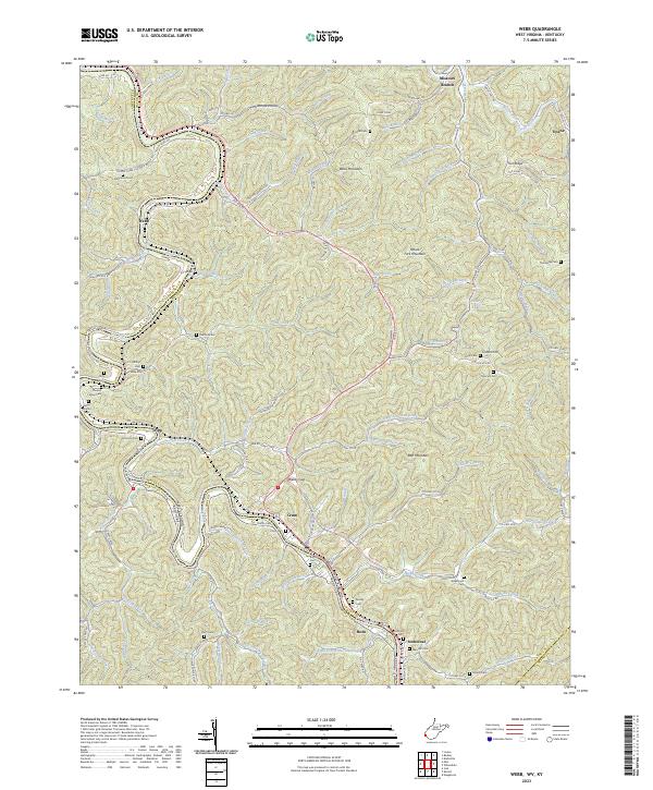 2023 Webb2023 Print · USGSThe Tug Fork valley and the rugged ridges of Wayne County are captured in this recent survey. Local historians can trace family lineage through numerous upland burial sites like Sammons Cem and explore communities at Webb, Crum, and Stonecoal.
 - 2023 Map of Wilsondale, 2023 Print
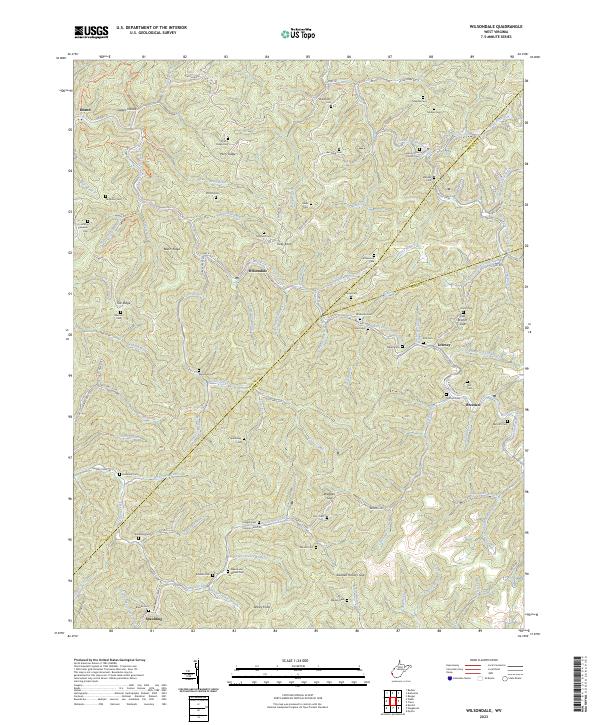 2023 Wilsondale2023 Print · USGSSouthern West Virginia's rugged valleys and family settlements are captured here in the early twenty-first century. Genealogists and local historians can trace lineage across dozens of burial sites like Mount Sinai Church Cem and Maynard Cem, while following the Trace Br railroad and West Fork Twelvepole Creek.
 - 2023 Map of Trace, 2023 Print
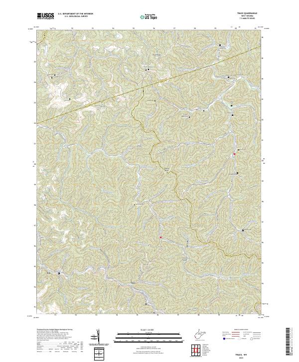 2023 Trace2023 Print · USGSThis part of the West Virginia coalfields near the junction of four counties shows a landscape of deep hollows and family-held ridges. Genealogists can locate numerous family burial sites like Thompson Branch Cem and trace the Old N W Railroad Bed Rd along the water.
 - 2023 Map of Matewan, 2023 Print
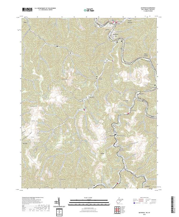 2023 Matewan2023 Print · USGSThe Tug Valley at the Kentucky and West Virginia border is a landscape shaped by the coal industry and family history. Genealogists can locate several family sites including Jerry Hatfield Cem, Julius Scott Cem, and the riverfront at Hatfield Bottom.
 - 2023 Map of Naugatuck, 2023 Print
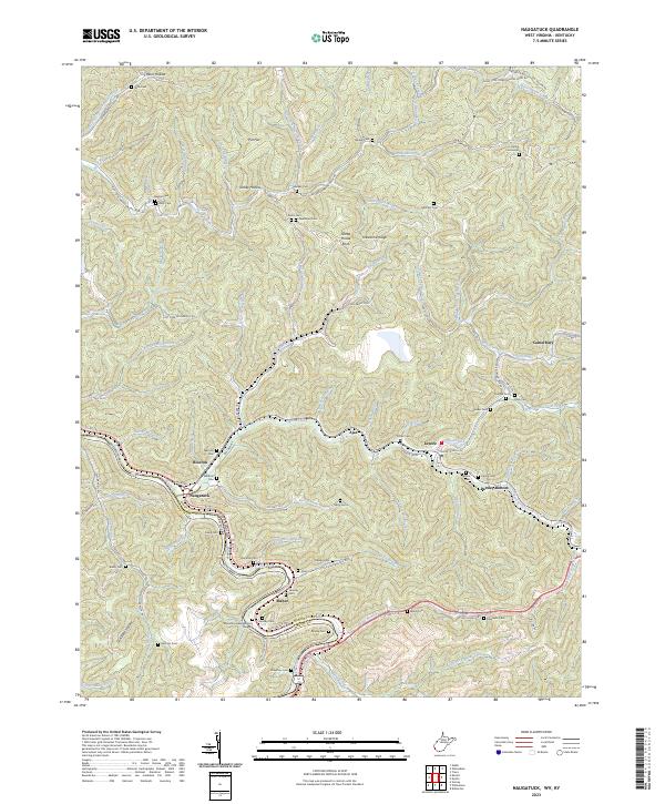 2023 Naugatuck2023 Print · USGSThe borderlands of Mingo County and Kentucky come alive in this recent survey of the Tug Fork valley. Genealogists can trace family heritage through dozens of documented burial sites including Waldron Cem, Stepp Cem, and Hensley Cem.
 - 2023 Map of Wharncliffe, 2023 Print
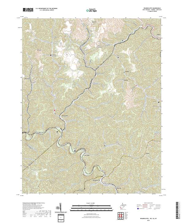 2023 Wharncliffe2023 Print · USGSMingo County, West Virginia, and the surrounding borders of Virginia and Kentucky are captured in this modern survey of the Tug Fork valley. Researchers can trace family history through numerous remote burial sites like Toler Cem, Snow Cem, and Mounts Cem.
 - 2023 Map of Man, 2023 Print
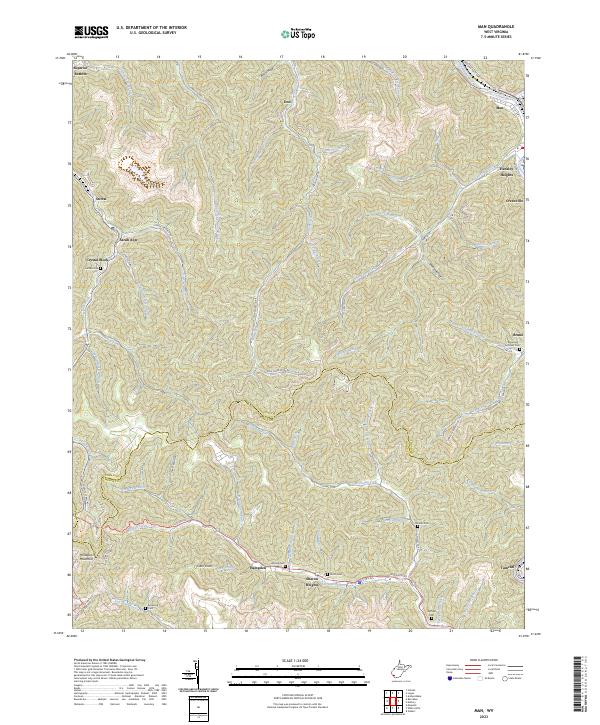 2023 Man2023 Print · USGSThe Guyandotte River valley and the Logan-Mingo county line define this mountain landscape in the 2020s. Genealogists can trace family landmarks like Hatfield Cem, Old Ellis Cem, and settlements such as Crystal Block and Tamcliff.
 - 2023 Map of Gilbert, 2023 Print
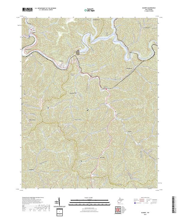 2023 Gilbert2023 Print · USGSIn the steep river valleys of Southern West Virginia, this recent survey documents the landscape along the Guyandotte River and R D Bailey Lake. Genealogists can trace family landmarks like Lester Cemeteries, Davis Cem, and the communities of North Spring and Ikes Fork.
 - 2023 Map of Mallory, 2023 Print
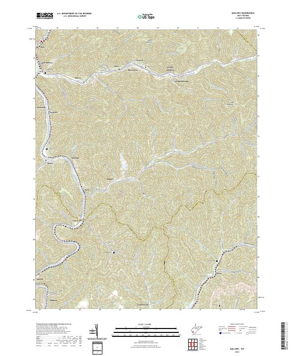 2023 Mallory2023 Print · USGSThe Guyandotte River valley serves as the backbone for this modern look at Logan County coal country. Genealogists can trace family burial sites like McDonald Cem and Browning Cem or explore the narrow hollows of Mineral City and Slabtown.
End of results
Showing maps 1-17 of 17
Top cities of Mingo County
- Williamson historical maps
- Chattaroy historical maps
- Red Jacket historical maps
- Matewan historical maps
- Delbarton historical maps
- Gilbert historical maps
See more
Frequently asked questions
- What are the different types of historical maps available for Mingo County?
- What is the oldest map of Mingo County?
- Where can I purchase historical maps of Mingo County for my home or office?
- Where can I download high-res historical maps of Mingo County?
- Are there historical topographic maps available for Mingo County?
- Is there historical aerial imagery available for Mingo County?
- Where are historical maps of Mingo County sourced from?