Old Maps of Bath (Berkeley Springs), West Virginia for Academic Research
Study the evolution of Bath (Berkeley Springs) with 19 high-resolution historic maps. Whether you're teaching, researching, or modeling changes in land use, these maps provide essential visual documentation of urban, environmental, and geographic change.
- Analyze long-term change: Track patterns in development, transportation, and natural features.
- Ideal for environmental or urban studies: Support academic projects with primary historical map data.
- Use in the classroom or lab: Educators and researchers rely on these maps to bring historical context to life.
These maps are a powerful tool for teaching, research, and visualizing how Bath (Berkeley Springs) has changed over the decades.
Bath (Berkeley Springs), WV maps
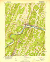
(19)- 1899 Map of Hancock, 1960 Print
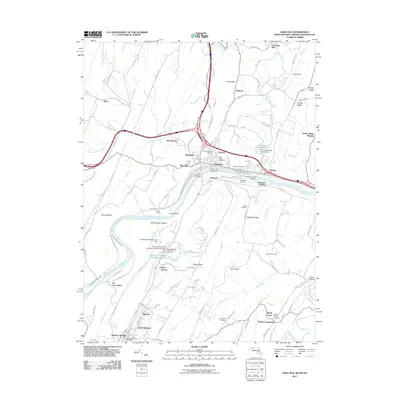
 1899 Hancock1960 Print · USGSThe Potomac River valley at the turn of the century shows a bustling corridor of trade where Maryland, West Virginia, and Pennsylvania meet. Genealogy researchers can trace family landmarks like Stotlers Crossroads, Yeakle Mill, and the historic Fort Frederick.
 - 1901 Map of Hancock
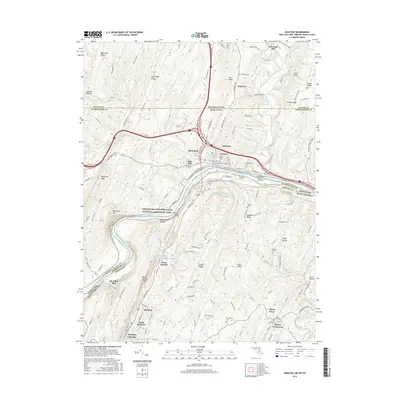
 1901 Hancock1901 Print · USGSMaryland and West Virginia met at the turn of the century along a busy corridor of river transport and rail expansion. Genealogists can trace family roots through old landmarks like Yeakle Mill, Fairview Church, and early hamlets such as Stotlers Crossroads.8 unique versions available
 - 1948 Map of Cumberland
 1948 Cumberland1948 Print · USGSMid-century Appalachia and the Shenandoah Valley are shown in detail, documenting the industrial and transportation hubs of the tri-state area. Genealogists can trace family roots through settlements like Double Tollgate and Bunker Hill or along the Baltimore & Ohio RR.3 unique versions available
 - 1951 Map of Hancock, 1953 Print
 1951 Hancock1953 Print · USGSThe tri-state Potomac borderlands are captured here in the early fifties, showing the convergence of rail and river industry. Genealogists can trace family roots through Dogtown, Ridersville, and Johnsons Mill, or locate rural landmarks like the Westview Sch.4 unique versions available
 - 1952 Map of Cumberland
 1952 Cumberland1952 Print · USGSThe Potomac Highlands and the Shenandoah Valley are revealed in this early 1950s survey of the Appalachian interior. Researchers can trace the river-and-rail corridors connecting Cumberland, Winchester, and the recreational waters of Deep Creek Lake.
 - 1956 Map of Cumberland, 1966 Print
 1956 Cumberland1966 Print · USGSThe tri-state Highlands in the mid-1950s show a landscape shaped by coal, timber, and the massive presence of the Baltimore & Ohio RR. Researchers can trace the industrial corridor from Cumberland through the Allegheny Mountains to mountain retreats like Deep Creek Lake.6 unique versions available
 - 1957 Map of Cumberland
 1957 Cumberland1957 Print · USGSThe Potomac River valley and the ridges of the Allegheny Front define this mid-century landscape at the intersection of Maryland, West Virginia, and Pennsylvania. Trace the steam-era rail lines of the Baltimore and Ohio RR or locate rural landmarks like St Stephens Church and Stony River Dam.
 - 1958 Map of Stotlers Crossroads, 1959 Print
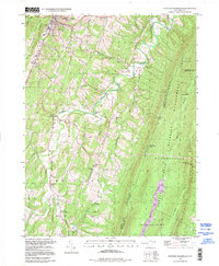
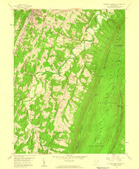 1958 Stotlers Crossroads1959 Print · USGSMorgan County is shown in the late fifties as a landscape of ridge-top farms and deep forest preserves between the Potomac and the mountains. Genealogists can trace family names and rural hubs like Johnsons Mill, Stotlers Crossroads, and Ambrose Chapel.4 unique versions available
 - 1961 Map of Cumberland
 1961 Cumberland1961 Print · USGSThe tri-state highlands of Maryland, West Virginia, and Pennsylvania are shown in the mid-twentieth century as a complex landscape of ridges and river valleys. Researchers can trace the winding Potomac River and find old rail-and-river towns like Cumberland, Keyser, and Morgantown.
 - 1962 Map of Cumberland
 1962 Cumberland1962 Print · USGSThe central Appalachians meet at the height of the mid-century industrial era, showing the rugged topography between Morgantown and Winchester. Genealogists can trace family lands near Fort Necessity or along the vital Baltimore & Ohio RR corridors.
 - 1981 Map of Cumberland, 1982 Print
 1981 Cumberland1982 Print · USGSThe tri-state region of Maryland, Pennsylvania, and West Virginia is captured here in the early eighties as a landscape of industrial history and ridgeline geography. Researchers can trace the heritage of the C & O Canal and the B & O RR through mountain gaps and coal towns like Eckhart Mines and Frostburg.2 unique versions available
 - 1996 Map of Hancock, 2000 Print
 1996 Hancock2000 Print · USGSThe tri-state border region comes alive in the late nineties as transportation corridors follow the winding river gaps through the Appalachian ridges. Trace local landmarks from the Mason and Dixon Line down to Berkeley Springs, including Stotlers Crossroads and the Potomac Airport.
 - 1998 Map of Stotlers Crossroads, 1999 Print
 1998 Stotlers Crossroads1999 Print · USGSMorgan County is captured in the late nineties as a landscape of ridge-top forests and creek-side hamlets. Genealogists and historians can locate family landmarks like Mt Olivet Church, Duckwalls, and the Michael Cemetery along the hollows.
 - 2011 Map of Hancock, 2011 Print
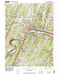
 2011 Hancock2011 Print · USGSCovers Bath (Berkeley Springs), including Hancock, Berkeley Springs, and other nearby areas
 - 2014 Map of Hancock, 2014 Print
 2014 Hancock2014 Print · USGSCovers Bath (Berkeley Springs), including Hancock, Berkeley Springs, and other nearby areas
 - 2016 Map of Hancock, 2016 Print
 2016 Hancock2016 Print · USGSCovers Bath (Berkeley Springs), including Hancock, Berkeley Springs, and other nearby areas
 - 2019 Map of Hancock, 2019 Print
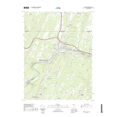 2019 Hancock2019 Print · USGSCovers Bath (Berkeley Springs), including Hancock, Berkeley Springs, and other nearby areas
 - 2023 Map of Hancock, 2023 Print
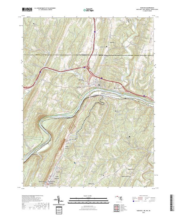 2023 Hancock2023 Print · USGSThe tri-state border where Maryland, West Virginia, and Pennsylvania converge comes alive in this survey of the Potomac valley. Trace the legacy of the Chesapeake and Ohio Canal and locate family landmarks like the Saint Thomas Riverview Cem or Burnt Factory.
 - 2023 Map of Stotlers Crossroads, 2023 Print
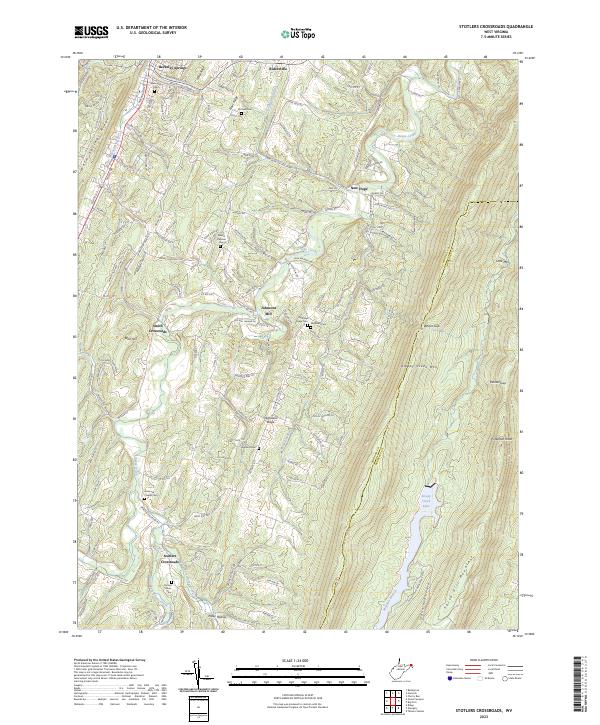 2023 Stotlers Crossroads2023 Print · USGSThe West Virginia Panhandle’s ridgelines and creek valleys come into focus in this contemporary survey of the Morgan and Berkeley County line. Researchers can trace rural genealogy through family landmarks like Johnsons Mill, Highland Ridge Cem, and Ambrose Chapel Cem.
End of results
Showing maps 1-19 of 19
Top cities near Bath (Berkeley Springs)
- Martinsburg historical maps
- Hancock historical maps
- Berkeley Springs historical maps
- Paw Paw historical maps
- Little Orleans historical maps
Top neighborhoods of Bath (Berkeley Springs)
Frequently asked questions
- What are the different types of historical maps available for Bath (Berkeley Springs)?
- What is the oldest map of Bath (Berkeley Springs)?
- Where can I purchase historical maps of Bath (Berkeley Springs) for my home or office?
- Where can I download high-res historical maps of Bath (Berkeley Springs)?
- Are there historical topographic maps available for Bath (Berkeley Springs)?
- Is there historical aerial imagery available for Bath (Berkeley Springs)?
- Where are historical maps of Bath (Berkeley Springs) sourced from?