Old Maps of Bath (Berkeley Springs), West Virginia for Genealogy
Trace your family roots with 15 historic maps of Bath (Berkeley Springs). These high-res maps reveal old neighborhoods, homesites, landmarks, and streets — helping you uncover where your ancestors lived and how the area evolved over time.
- Explore historic neighborhoods: Identify where your relatives may have lived in the 1800s or 1900s.
- Compare maps over time: Trace the changes in streets, buildings, and landmarks for multi-generational research.
- Perfect for genealogy & ancestry research: Used by family historians and researchers to map out lineage and migration.
These maps are an incredible resource for exploring your personal connection to Bath (Berkeley Springs)'s past.
Bath (Berkeley Springs), WV maps
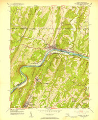
(15)- 1899 Map of Hancock, 1960 Print
 1899 Hancock1960 Print · USGSCovers Bath (Berkeley Springs), including Hancock, Berkeley Springs, and other nearby areas
 - 1901 Map of Hancock
 1901 Hancock1901 Print · USGSCovers Bath (Berkeley Springs), including Hancock, Berkeley Springs, and other nearby areas8 unique versions available
 - 1948 Map of Cumberland
 1948 Cumberland1948 Print · USGSCovers Bath (Berkeley Springs), including Morgantown, Winchester, and other nearby areas3 unique versions available
 - 1951 Map of Hancock, 1953 Print
 1951 Hancock1953 Print · USGSCovers Bath (Berkeley Springs), including Hancock, Berkeley Springs, and other nearby areas4 unique versions available
 - 1952 Map of Cumberland
 1952 Cumberland1952 Print · USGSCovers Bath (Berkeley Springs), including Morgantown, Winchester, and other nearby areas
 - 1956 Map of Cumberland, 1966 Print
 1956 Cumberland1966 Print · USGSCovers Bath (Berkeley Springs), including Morgantown, Winchester, and other nearby areas6 unique versions available
 - 1957 Map of Cumberland
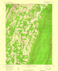
 1957 Cumberland1957 Print · USGSCovers Bath (Berkeley Springs), including Morgantown, Winchester, and other nearby areas
 - 1958 Map of Stotlers Crossroads, 1959 Print
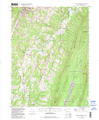
 1958 Stotlers Crossroads1959 Print · USGSCovers Bath (Berkeley Springs), including Johnsons Mill, New Hope, and other nearby areas4 unique versions available
 - 1961 Map of Cumberland
 1961 Cumberland1961 Print · USGSCovers Bath (Berkeley Springs), including Morgantown, Winchester, and other nearby areas
 - 1962 Map of Cumberland
 1962 Cumberland1962 Print · USGSCovers Bath (Berkeley Springs), including Morgantown, Winchester, and other nearby areas
 - 1981 Map of Cumberland, 1982 Print
 1981 Cumberland1982 Print · USGSCovers Bath (Berkeley Springs), including Cumberland, Frostburg, and other nearby areas2 unique versions available
 - 1996 Map of Hancock, 2000 Print
 1996 Hancock2000 Print · USGSCovers Bath (Berkeley Springs), including Hancock, Berkeley Springs, and other nearby areas
 - 1998 Map of Stotlers Crossroads, 1999 Print
 1998 Stotlers Crossroads1999 Print · USGSCovers Bath (Berkeley Springs), including Johnsons Mill, New Hope, and other nearby areas
 - 2023 Map of Hancock, 2023 Print
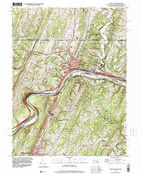
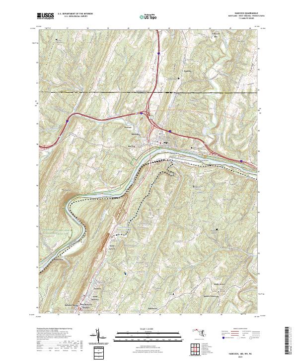 2023 Hancock2023 Print · USGSCovers Bath (Berkeley Springs), including Hancock, Berkeley Springs, and other nearby areas
 - 2023 Map of Stotlers Crossroads, 2023 Print
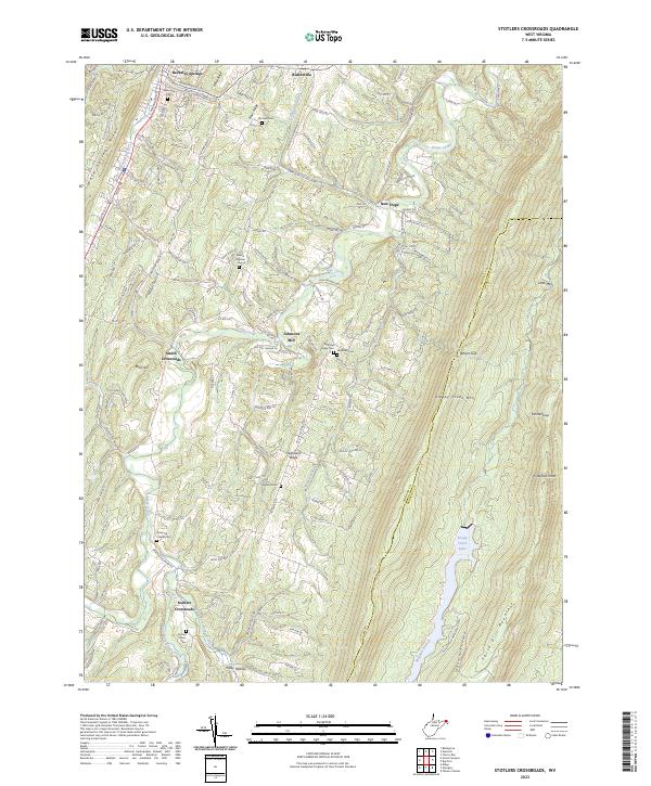 2023 Stotlers Crossroads2023 Print · USGSCovers Bath (Berkeley Springs), including Duckwall, Johnsons Mill, and other nearby areas
End of results
Showing maps 1-15 of 15
Top cities near Bath (Berkeley Springs)
- Martinsburg historical maps
- Hancock historical maps
- Berkeley Springs historical maps
- Paw Paw historical maps
- Little Orleans historical maps
Top neighborhoods of Bath (Berkeley Springs)
Frequently asked questions
- What are the different types of historical maps available for Bath (Berkeley Springs)?
- What is the oldest map of Bath (Berkeley Springs)?
- Where can I purchase historical maps of Bath (Berkeley Springs) for my home or office?
- Where can I download high-res historical maps of Bath (Berkeley Springs)?
- Are there historical topographic maps available for Bath (Berkeley Springs)?
- Is there historical aerial imagery available for Bath (Berkeley Springs)?
- Where are historical maps of Bath (Berkeley Springs) sourced from?