1990s Maps of Preston County, West Virginia
Explore 19 historic maps of Preston County from the 1990s. These maps offer a rare glimpse into what life looked like during the 1990s — showing old roads, neighborhoods, homes, and landmarks that have changed or disappeared over time.
Whether you're researching your family's past, planning a metal detecting trip, or studying how Preston County's landscape evolved across the 1990s, these high-resolution maps are a powerful tool for exploring the history of this region.
- Focus on a specific era: All maps on this page are from the 1990s, giving you a focused view of this time period.
- See what’s changed: Compare century-old streets, trails, and buildings to today's modern landscape using overlays and satellite layers.
- Research with precision: Use these maps for genealogy, historical research, land use analysis, or educational projects.
- View, download, or print: Maps are fully viewable online in high resolution, and can be downloaded or printed for your own records.
Start exploring Preston County's history through authentic maps from the 1990s. This is your window into the past.
Preston County, WV maps
(19)- 1993 Map of Friendsville, 1999 Print
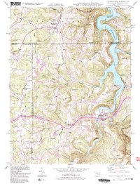 1993 Friendsville1999 Print · USGSThe tri-state border region of Maryland, Pennsylvania, and West Virginia is shown here in the 1990s as the Youghiogheny River Lake reshapes the landscape. Genealogists can trace local roots through sites like the Emberson Cem, Keeler Glade Sch, and Markleysburg.2 unique versions available
 - 1995 Map of Davis, 1998 Print
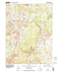
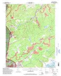 1995 Davis1998 Print · USGSThe West Virginia highlands in the mid-nineties reveal a landscape shaped by coal and timber along the Blackwater River. Trace family history at Thomas Cem or locate industrial sites like the strip mines and tipple near Henry.
 - 1995 Map of Colebank, 1998 Print
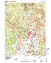
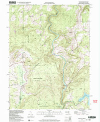
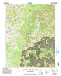 1995 Colebank1998 Print · USGSThe high ridges of Barbour and Tucker Counties come into focus in the mid-nineties as the Monongahela National Forest meets rural valley life. Genealogists and local historians can trace family roots through landmarks like Valley Furnace, Union Chapel, and the Digman Sch.
 - 1995 Map of Lead Mine, 1998 Print
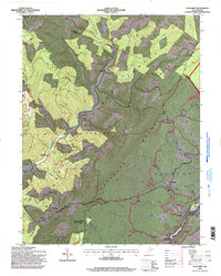 1995 Lead Mine1998 Print · USGSTucker County and the Monongahela National Forest are shown in the mid-nineties as the industrial and natural landscapes converged. Genealogists can trace family landmarks like Sugarland Ch Cem while historians locate coal works at Coketon and Thomas.
 - 1995 Map of Rowlesburg, 1998 Print
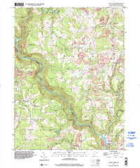
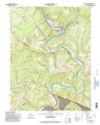 1995 Rowlesburg1998 Print · USGSRowlesburg and the Cheat River valley appear here in the late twentieth century, showing a landscape shaped by rail, timber, and coal. Genealogists can locate several family burial sites and rural landmarks like Wotring Chapel, Riverview Cem, and the Covered Bridge.2 unique versions available
 - 1995 Map of Aurora, 1998 Print
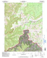 1995 Aurora1998 Print · USGSSoutheastern Preston County communities appear at the end of the century as a blend of forest conservation and upland farming. Trace family roots at Accident Cemetery or locate old community hubs like Amboy Ch and Stemple Ridge School.2 unique versions available
 - 1997 Map of Lake Lynn, 2000 Print
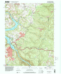 1997 Lake Lynn2000 Print · USGSThe Pennsylvania and West Virginia borderlands are defined here by the industrial and natural forces of the late nineties. Local researchers can trace family roots through sites like Donaldson Cem or find history at Clay Furnace and Cheat Neck.2 unique versions available
 - 1997 Map of Bruceton Mills, 2000 Print
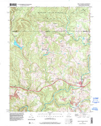 1997 Bruceton Mills2000 Print · USGSThe West Virginia-Pennsylvania state line area near the end of the century shows a landscape defined by forest conservation and mountain streams. Researchers can trace rural community life at Bruceton Mills and locate local landmarks like the Old Valley Furnace and Mountain Grove Sch.
 - 1997 Map of Masontown, 2000 Print
 1997 Masontown2000 Print · USGSPreston County in the late nineties shows a landscape defined by its mining heritage and small mountain communities. Genealogists and historians can trace the footprint of extraction at Morgan Mines and locate rural landmarks like Sturgiss Ch and Zion Chapel.
 - 1997 Map of Morgantown South, 2001 Print
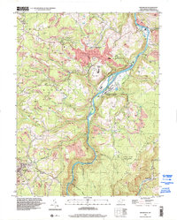
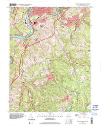 1997 Morgantown South2001 Print · USGSThe Monongahela River valley south of Morgantown comes into focus in the late nineties, documenting the area's transition from industrial outposts to suburban expansion. Genealogists can locate family landmarks like Clinton Furnace, East Oak Grove Cemetery, and several rural churches including Mellons Chapel.
 - 1997 Map of Newburg, 2001 Print
 1997 Newburg2001 Print · USGSPreston County's industrial and communal history is on display in the late nineties, from the New Deal's Arthurdale to the rail hubs at the southern hills. Genealogists can trace family sites at Arthurdale Cem or Browns Mill and locate the rail Tunnels at Tunnelton.
 - 1997 Map of Table Rock, 2001 Print
 1997 Table Rock2001 Print · USGSHigh atop the Maryland and West Virginia border in the late twentieth century, this area reveals a landscape of mountain ridges and rural hamlets. Genealogists can locate family landmarks like Sunnyside Grange Hall, Beckman Cemetery, and Swan Meadow School.2 unique versions available
 - 1997 Map of Valley Point, 2002 Print
 1997 Valley Point2002 Print · USGSPreston County at the close of the twentieth century reveals a landscape shaped by coal mining and the winding path of the Cheat River. Genealogists and historians can locate rural landmarks like the Old Virginia Furnace, Mt Moriah Cem, and the old Beech Run Sch.
 - 1997 Map of Cuzzart, 2002 Print
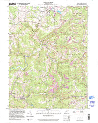
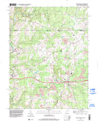
 1997 Cuzzart2002 Print · USGSPreston County's uplands show a landscape defined by coal and community in the late 1990s. Trace old school sites like Mountain View Sch and Center Sch alongside legacy mines and the Brandonville Pike.
 - 1997 Map of Brandonville, 2002 Print
 1997 Brandonville2002 Print · USGSThe borderlands of Preston County and Fayette County are shown in detail during the late nineties, capturing a landscape of small settlements and active industry. Genealogists can locate family-named landmarks like Teets Cem and Canaan Ch, or trace the legacy of local extraction at Glade Farms and various Strip Mine sites.
 - 1997 Map of Oakland, 2002 Print
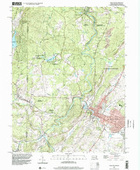 1997 Oakland2002 Print · USGSOakland and the surrounding Garrett County highlands are shown in the late nineties, featuring a landscape shaped by the Youghiogheny River and extensive state forest lands. Researchers can trace local heritage through sites like Sines Cem, Mountain Lake Park, and the Swallow Falls Sch.
 - 1997 Map of Kingwood, 2002 Print
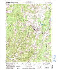
 1997 Kingwood2002 Print · USGSPreston County in the late nineties shows a landscape shaped by the Cheat River and its industrial valley. Genealogists and local historians can trace the foundations of Kingwood and Tunnelton, or locate rural landmarks like St Josephs Ch and Wilson Cem.
 - 1999 Map of Terra Alta, 2000 Print
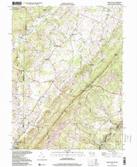
 1999 Terra Alta2000 Print · USGSTerra Alta and the high ridges of Preston County are documented here as they appeared at the end of the century. Genealogists can locate family landmarks like Wesley Chapel, the Lime Plant Sch, and the grounds of the State Tuberculosis Sanitarium.
 - 1999 Map of Sang Run, 2000 Print
 1999 Sang Run2000 Print · USGSGarrett County's river-carved highlands and state forests are captured here at the turn of the millennium. Researchers can trace the rural landscape from Sang Run to Cranesville, finding old family landmarks like the Sivier Cem, Elder Sch, and Browning Dam.2 unique versions available
End of results
Showing maps 1-19 of 19
Top cities of Preston County
- Kingwood historical maps
- Terra Alta historical maps
- Masontown historical maps
- Rowlesburg historical maps
- Reedsville historical maps
- Newburg historical maps
See more
Frequently asked questions
- What are the different types of historical maps available for Preston County?
- What is the oldest map of Preston County?
- Where can I purchase historical maps of Preston County for my home or office?
- Where can I download high-res historical maps of Preston County?
- Are there historical topographic maps available for Preston County?
- Is there historical aerial imagery available for Preston County?
- Where are historical maps of Preston County sourced from?