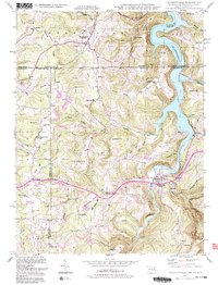
1993 Map of Friendsville
USGS Topo · Published 1999About this map
The Youghiogheny River Lake dominates the eastern landscape of this borderland region where Maryland, Pennsylvania, and West Virginia converge. In the early 1990s, the settlement at Friendsville serves as a local hub along the river, while the surrounding hills are dotted with foundational community landmarks like the Blooming Rose Ch and Webb Chapel. The map reveals a legacy of rural education and memorialization through sites such as the McCabe Sch, Keeler Glade Sch, and the Emberson Cem. Moving north toward Markleysburg, the terrain transitions into significant ridges including Thomas Ridge and Division Ridge. The historic National Road cuts across the northern reaches, following a corridor of long-established travel that predates modern infrastructure. These features illustrate a classic Appalachian pattern of valley settlements and upland schools serving a dispersed mountain population.
Find a feature on this map
63 named features on this map. Tap any name to fly to it.
Don’t see what you’re looking for? This feature index may not catch every label — zoom into the map to look around manually.
Map Details
Editions of this 1993 Friendsville Map
2 editions found
Other maps of this area

1900 · Accident
USGS Topo · 1:62,500

1900 · Uniontown
USGS Topo · 1:62,500

1904 · Bruceton
USGS Topo · 1:62,500

1922 · Confluence
USGS Topo · 1:62,500

1926 · Bruceton
USGS Topo · 1:62,500

1931 · Uniontown
USGS Topo · 1:62,500

1931 · Confluence
USGS Topo · 1:62,500

1931 · Bruceton Mills
USGS Topo · 1:62,500

1933 · Confluence
USGS Topo · 1:62,500

1933 · Bruceton
USGS Topo · 1:62,500