2020s Maps of Putnam County, West Virginia
Explore 14 historic maps of Putnam County from the 2020s. These maps offer a rare glimpse into what life looked like during the 2020s — showing old roads, neighborhoods, homes, and landmarks that have changed or disappeared over time.
Whether you're researching your family's past, planning a metal detecting trip, or studying how Putnam County's landscape evolved across the 2020s, these high-resolution maps are a powerful tool for exploring the history of this region.
- Focus on a specific era: All maps on this page are from the 2020s, giving you a focused view of this time period.
- See what’s changed: Compare century-old streets, trails, and buildings to today's modern landscape using overlays and satellite layers.
- Research with precision: Use these maps for genealogy, historical research, land use analysis, or educational projects.
- View, download, or print: Maps are fully viewable online in high resolution, and can be downloaded or printed for your own records.
Start exploring Putnam County's history through authentic maps from the 2020s. This is your window into the past.
Putnam County, WV maps
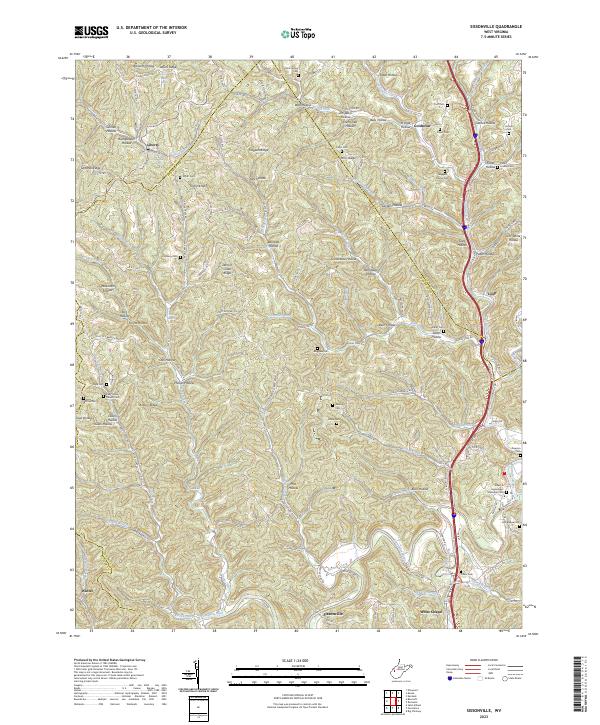
(14)- 2023 Map of Hamlin, 2023 Print
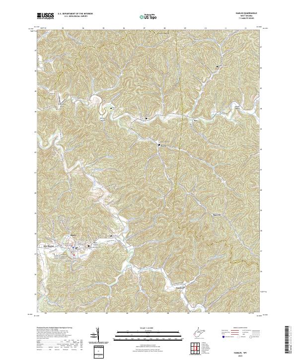 2023 Hamlin2023 Print · USGSThe Lincoln County seat and the winding Mud River valley are documented here in the early twenty-first century. Genealogists and local historians can locate family landmarks such as Roberts Cem and Sycamore Cem, or trace the roads connecting New Hamlin and Sweetland.
 - 2023 Map of Winfield, 2023 Print
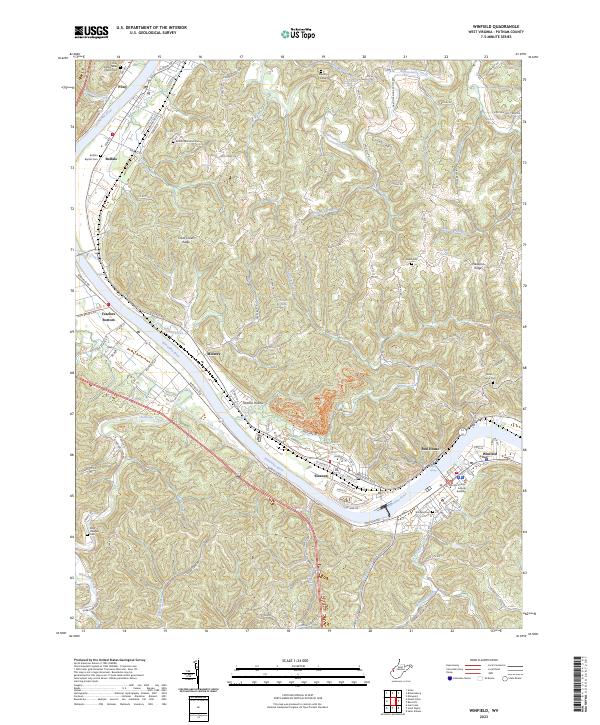 2023 Winfield2023 Print · USGSThe Kanawha River corridor in Putnam County is captured here in detail, showing the historic riverfront towns from Buffalo down to Winfield. Genealogists can trace family footprints through numerous burial sites like Peter Hodges Cem and Winfield Cem or locate old water sources like John Capito Spring.
 - 2023 Map of Arlee, 2023 Print
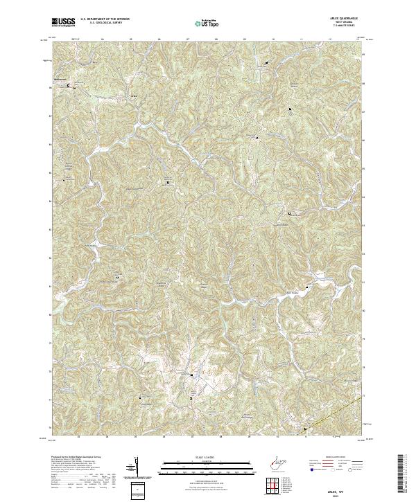 2023 Arlee2023 Print · USGSSettlement in the Mason and Putnam County hills is captured here in the early 2020s, showing a landscape of deep hollows and narrow ridges. Researchers can trace family history through numerous landmarks including Zion Baptist Cem, Potts Chapel Cem, and the small community at Arlee.
 - 2023 Map of Hurricane, 2023 Print
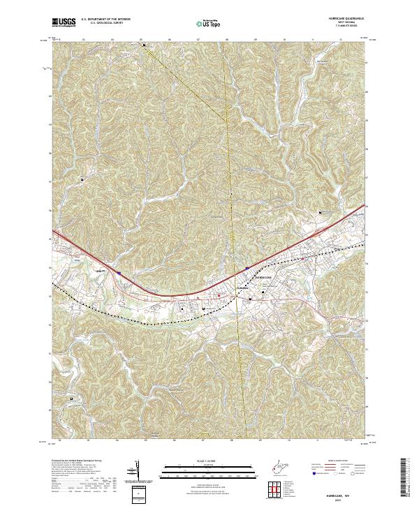 2023 Hurricane2023 Print · USGSThe Teays Valley corridor comes into focus in the early 2020s, showing the modern layout of Hurricane, Milton, and Culloden. Genealogists can trace family plots at Valley View Memorial Park Cem, Zoar Cem, and Martin Cem among the many ridgelines.
 - 2023 Map of Mount Olive, 2023 Print
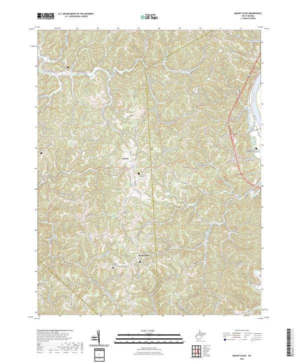 2023 Mount Olive2023 Print · USGSThe Mason and Putnam county borderlands are shown here in modern detail, where ridge-top communities overlook the Kanawha River valley. Genealogists can trace family sites at Mount Zion Cem, Staten Chapel Cem, and Fraziers Bottom United Methodists Church.
 - 2023 Map of Kenna, 2023 Print
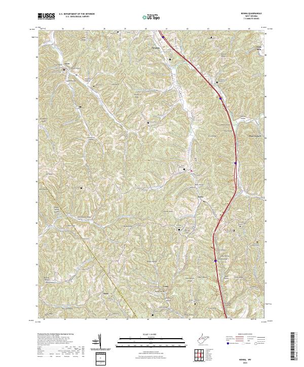 2023 Kenna2023 Print · USGSJackson and Putnam counties come alive in this contemporary survey of West Virginia's ridge-and-hollow country. Researchers can trace deep family roots at Given Cem, Harpold Cem, or the Stonelick Church Cem near Kenna.
 - 2023 Map of Elmwood, 2023 Print
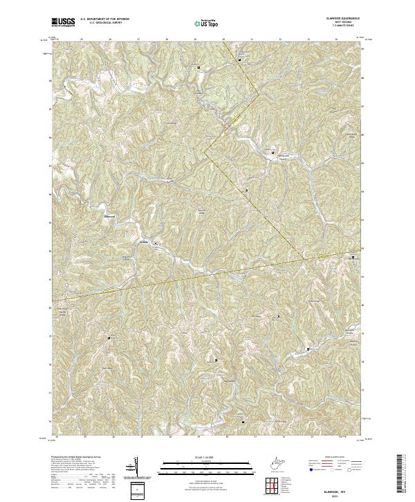 2023 Elmwood2023 Print · USGSThe hills of Putnam and Jackson counties are captured here in the early twenty-first century, showing the enduring rural character of the region. Researchers can trace family history through numerous burial sites like Sayre Cem, Walker Chapel Cem, and the aptly named Tightsqueeze Hollow.
 - 2023 Map of Scott Depot, 2023 Print
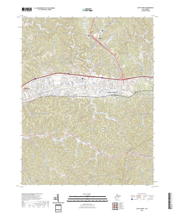 2023 Scott Depot2023 Print · USGSPutnam and Kanawha counties are shown in this modern survey during a period of significant suburban growth. Researchers can trace numerous family burial grounds and natural water sources like Heavens Gateway Cem, Hodges Cem, and Farley Spring.
 - 2023 Map of Bancroft, 2023 Print
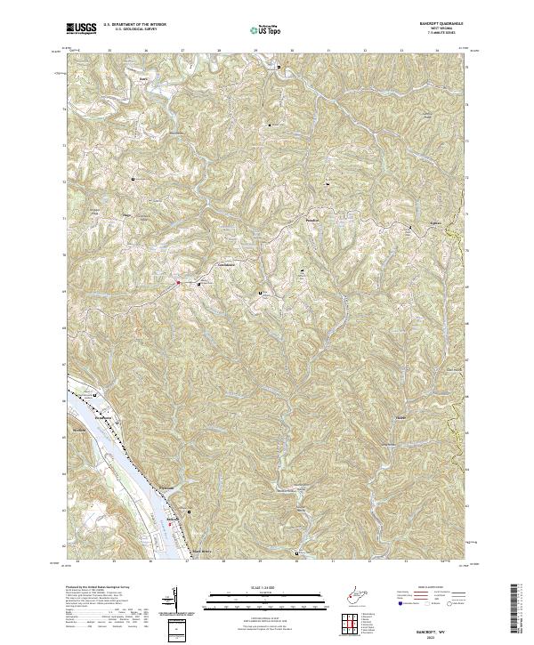 2023 Bancroft2023 Print · USGSThe Kanawha River valley and its surrounding ridges come alive in this contemporary record of West Virginia's heartland. Genealogists can trace family names and burial sites at Schowen Cem, Wade Chapel Cem, and the riverfront community of Black Betsey.
 - 2023 Map of Garretts Bend, 2023 Print
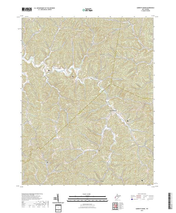 2023 Garretts Bend2023 Print · USGSThis West Virginia highlands map traces the remote hollows of Lincoln and Putnam counties as they appear today. Family researchers can locate numerous burial grounds like Nelson Cem and Watts Cem along the winding Trace Fork Mud River.
 - 2023 Map of Robertsburg, 2023 Print
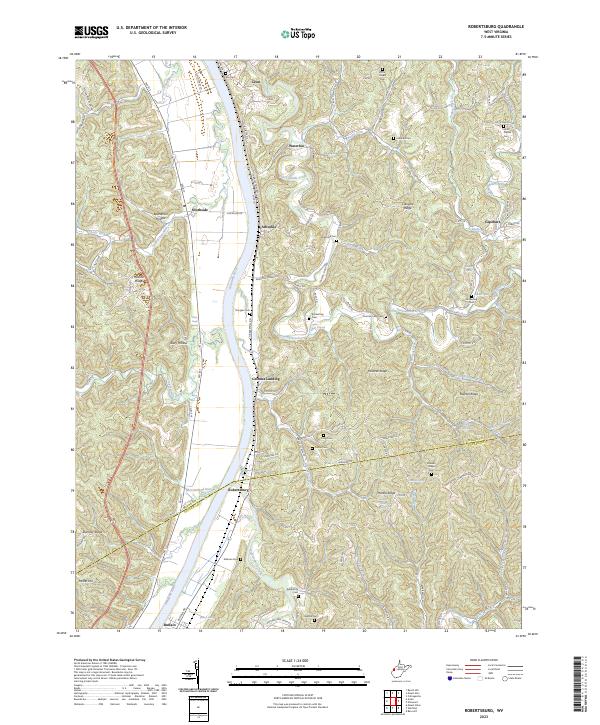 2023 Robertsburg2023 Print · USGSThe Kanawha River valley and its surrounding ridges in Mason County are captured here in the early 2020s. Genealogists can locate family burial sites such as Atkeson Cem and Kimberling Cem or trace early settlements like Grimms Landing and Robertsburg.
 - 2023 Map of Pocatalico, 2023 Print
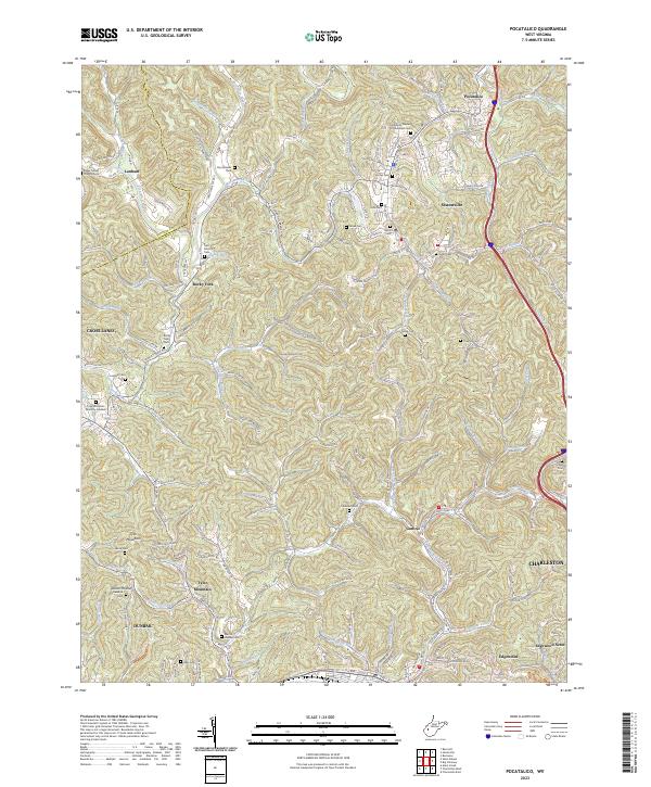 2023 Pocatalico2023 Print · USGSNorth of Charleston in the early 2020s, the hollows and ridges of Kanawha County show a mix of suburban growth and deeply rooted family history. Genealogists can trace decades of local heritage through sites like Martin Dunlap Cem, Casdorph Cem, and the Mcclanahan Cem.
 - 2023 Map of Sissonville, 2023 Print
 2023 Sissonville2023 Print · USGSThe Pocatalico River valley in the early 2020s reveals a landscape deeply etched by family history and rural community life across Kanawha County. Genealogists and local historians can locate numerous family burial sites, including Boggess Family Cem, while tracing the early footprints of Sissonville and Liberty.
 - 2023 Map of Saint Albans, 2023 Print
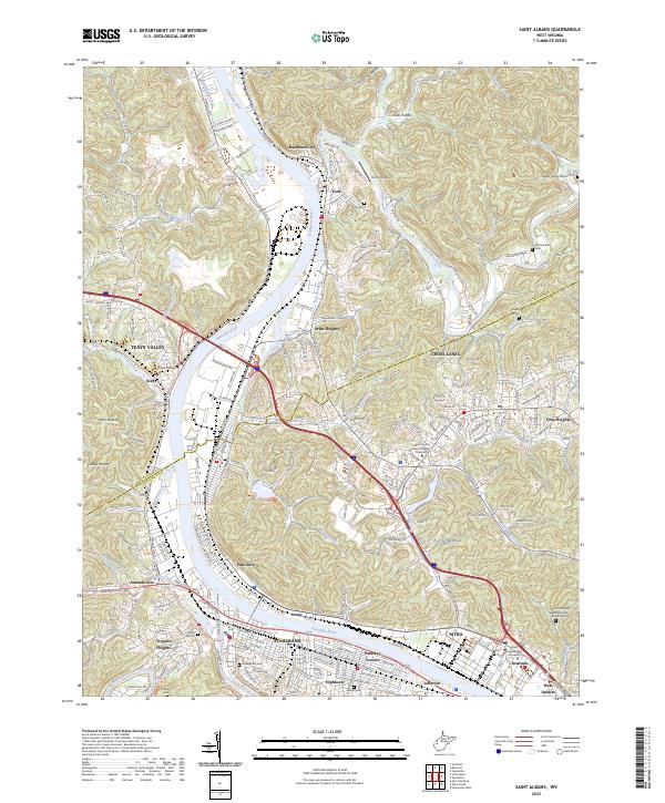 2023 Saint Albans2023 Print · USGSThe Kanawha Valley thrives as a corridor of industry and education in the early twenty-first century. Genealogists can trace family lines at College Hill Cem or Mcclanahan Cem, while historians can study the growth of St. Albans and West Virginia State University.
End of results
Showing maps 1-14 of 14
Top cities of Putnam County
- Teays Valley historical maps
- Hurricane historical maps
- Winfield historical maps
- Eleanor historical maps
- Buffalo historical maps
- Poca historical maps
See more
Frequently asked questions
- What are the different types of historical maps available for Putnam County?
- What is the oldest map of Putnam County?
- Where can I purchase historical maps of Putnam County for my home or office?
- Where can I download high-res historical maps of Putnam County?
- Are there historical topographic maps available for Putnam County?
- Is there historical aerial imagery available for Putnam County?
- Where are historical maps of Putnam County sourced from?