Old Maps of Putnam County, West Virginia for Hiking & Exploration
Hike through history with 66 historic maps of Putnam County. Explore old trails, ghost towns, and forgotten backroads — perfect for outdoor adventurers and local explorers.
- Rediscover forgotten places: Map out old mining camps, roads, and footpaths that no longer exist on modern maps.
- Layer with modern tools: Combine with LiDAR or satellite views to plan hikes through historical terrain.
- Made for exploration: Popular among hikers, overlanders, and local history lovers.
Use these maps to find adventure and explore the hidden past of Putnam County.
Putnam County, WV maps
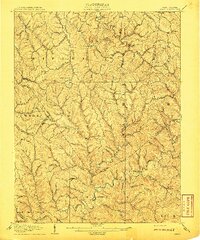
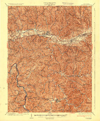
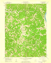
(66)- 1892 Map of Huntington, 1895 Print
 1892 Huntington1895 Print · USGSWest Virginia and Ohio meet along the river in the late nineteenth century, showing the rail-fueled growth of Huntington and Wayne. Local historians can trace the paths of the Chesapeake and Ohio Railroad past Barboursville and find early landmarks like Blue Sulphur Sp's and Davis Mill.
 - 1898 Map of Huntington
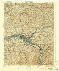
 1898 Huntington1898 Print · USGSNear the turn of the century, the Ohio River valley was transforming through the expansion of the Chesapeake and Ohio RR. Modern researchers can trace early nineteenth-century settlements from the bustling streets of Huntington to the inland hubs of Hamlin and Barboursville.3 unique versions available
 - 1899 Map of Charleston
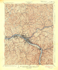
 1899 Charleston1899 Print · USGSWest Virginia's capital and the surrounding coalfields are documented here during the late nineteenth-century industrial boom. Researchers can trace early mining operations at the Graham Mines and follow pioneer rail lines like the Winifrede R. R. through the rugged river hollows.6 unique versions available
 - 1902 Map of Milton
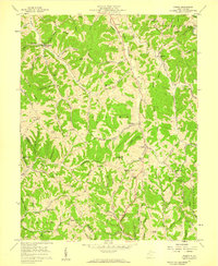
 1902 Milton1902 Print · USGSTeays Valley and the western Virginia hill country are shown here at the turn of the century, as the railroad era transformed the region's commerce. Genealogists can trace early homesteads and landmarks like Howell Mill, Salt Rock, and the Ben Johnson Ford.3 unique versions available
 - 1906 Map of Glenwood, 1958 Print
 1906 Glenwood1958 Print · USGSThe Ohio River valley was a bustling corridor of steam and rail at the start of the 1900s, anchoring the border between Mason County and Ohio. Researchers can trace riverside settlements like Mercers Bottom, find vanished post offices such as Thivener PO, and follow the Baltimore and Ohio RR through Apple Grove.
 - 1906 Map of Kenna, 1959 Print
 1906 Kenna1959 Print · USGSThe West Virginia hills north of Charleston appear in this early century survey of the Jackson and Kanawha county border. Researchers can locate early homesteads and community hubs like Sissonville, the Emma Belle School, and Staats Mills.
 - 1906 Map of Winfield, 1961 Print
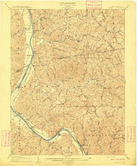
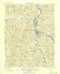
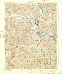
 1906 Winfield1961 Print · USGSThe Kanawha River valley at the turn of the century shows a landscape defined by river locks and the growing influence of the railroad. Genealogists and historians can trace old homesteads and landings from Redhouse Shoals to the small village of Confidence.
 - 1907 Map of Kenna
 1907 Kenna1907 Print · USGSThe hill country of Jackson and Kanawha counties is captured here in the early twentieth century as a landscape of isolated valley farms and ridge-top communities. Genealogists can trace family footprints through rural centers like Sissonville, Staats Mills, and White Chapel.3 unique versions available
 - 1908 Map of Glenwood
 1908 Glenwood1908 Print · USGSThe Ohio River valley at the turn of the century shows a landscape of riverfront rail towns and high ridges before modern development. Genealogists can trace early post offices like Yellowtown Thivener PO and settlements at Mercers Bottom or Ben Lomond.3 unique versions available
 - 1908 Map of Winfield
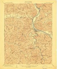
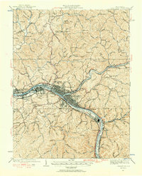
 1908 Winfield1908 Print · USGSThe Kanawha River valley at the turn of the century shows a landscape defined by river traffic and rail expansion. Genealogists and historians can trace riverside settlements like Winfield and Buffalo, or find lost rail stops and river locks including Lock No 10 and Black Betsey.3 unique versions available
 - 1909 Map of Charleston
 1909 Charleston1909 Print · USGSThe Kanawha and Elk rivers converge at the turn of the century, showing a region during a period of rapid industrial expansion. Trace old rail lines and rural landmarks like Mason Sta Graham Mines P.O. and the Morning Star School Church.6 unique versions available
 - 1909 Map of Saint Albans
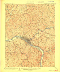
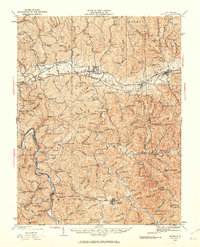
 1909 Saint Albans1909 Print · USGSThe Kanawha and Coal Rivers converge at the height of the river-and-rail era, revealing a landscape of busy lock systems and mountain settlements. Researchers can trace family roots through numerous rural landmarks like Blacks School, Scott Depot, and Alum Creek Rome PO.2 unique versions available
 - 1931 Map of Saint Albans
 1931 Saint Albans1931 Print · USGSThe Kanawha River valley during the early thirties shows an evolving industrial corridor between Saint Albans and Nitro. Genealogists can locate scores of rural schoolhouses and vanished post offices, including Seldom Seen School, Tornado PO, and Lock Seven.2 unique versions available
 - 1931 Map of Charleston, 1956 Print
 1931 Charleston1956 Print · USGSWest Virginia's capital and the surrounding river valley are shown here at a peak of industrial and rail expansion. Genealogists can trace family connections through numerous rural landmarks like the Levi Rand PO, Trinity Ch, and the ancient Mound.5 unique versions available
 - 1931 Map of Milton, 1963 Print
 1931 Milton1963 Print · USGSWestern West Virginia at the height of the railroad era shows a landscape of river-valley towns and ridge-top communities. Trace the vanished world of rural education and commerce at Howell Mill, Skyhigh Sch, and the busy rail stop at Milton.
 - 1933 Map of Saint Albans
 1933 Saint Albans1933 Print · USGSAs industrial growth transformed the Kanawha Valley in the 1930s, rural hill communities maintained a dense network of country schools and small post offices. Trace family roots and vanished landmarks like the U S Naval Ordnance Plant, Black Betsy, and the Seldom Seen School.2 unique versions available
 - 1935 Map of Milton
 1935 Milton1935 Print · USGSCabell and Lincoln Counties appear here in the mid-1930s, defined by the winding river valleys and ridge-top communities of the Appalachian Plateau. Genealogists can trace early homesteads and social hubs through numerous sites like Howell Mill, Skyhigh Sch, and Bethesda Ch.3 unique versions available
 - 1935 Map of Charleston, 1942 Print
 1935 Charleston1942 Print · USGSThe Kanawha Valley industrial corridor thrives in the mid-1930s as Charleston expands along its namesake river and rail lines. Local historians can trace the footprint of the U S Navy Reservation and dozens of rural hilltop schools like Walnut Gap Sch and Alum Sch.2 unique versions available
 - 1936 Map of Charleston
 1936 Charleston1936 Print · USGSCharleston and the Kanawha Valley are captured during the 1930s industrial boom, when the river was a bustling corridor of rail and navigation. Genealogists can trace family names across dozens of rural schools like Roxalana Sch and sites like the U S Naval Reservation.
 - 1954 Map of Charleston
 1954 Charleston1954 Print · USGSWest Virginia’s industrial heart and mountain highlands are captured here during the mid-fifties, centered on the capital city. Researchers can trace historic river-and-rail corridors along the Kanawha River and locate remote peaks within the Monongahela National Forest.
 - 1957 Map of Kenna, 1959 Print
 1957 Kenna1959 Print · USGSJackson County in the late fifties was a region of high ridges and deep hollows where community life centered on remote schools and chapels. Genealogists can trace family roots through landmarks like Seldom Seen Sch, Parchment Chapel, and Southall Cem.2 unique versions available
 - 1957 Map of Huntington, 1966 Print
 1957 Huntington1966 Print · USGSThe industrial heart of the Ohio River valley is captured here in the mid-sixties, showing the growth of Huntington and Ashland. Researchers can trace the extensive rail networks of the Chesapeake and Ohio RR and locate sites like the Chief Cornstalk Hunting Ground.3 unique versions available
 - 1957 Map of Charleston, 1966 Print
 1957 Charleston1966 Print · USGSMid-century West Virginia unfolds along the industrial Kanawha River valley and into the high Allegheny Mountains. Genealogists and historians can trace the vital rail lines of the Chesapeake and Ohio and locate riverside settlements from Saint Albans to Buckhannon.3 unique versions available
 - 1958 Map of Charleston
 1958 Charleston1958 Print · USGSMid-century West Virginia is defined here by the industrial corridor of the Kanawha River and the high ridges of the Allegheny Mountains. Researchers can trace the rail networks of the New York Central or locate remote highland communities like Pickens and Hillsboro.
 - 1958 Map of Mount Olive, 1959 Print
 1958 Mount Olive1959 Print · USGSThe rural borderlands of Mason and Putnam counties were a patchwork of ridge-top schools and creek-side chapels in the late fifties. Genealogists and local historians can trace family locations near Mount Olive, Hannan Sch, and Five and Twenty Mile Ch.2 unique versions available
Showing maps 1-25 of 66
Top cities of Putnam County
- Teays Valley historical maps
- Hurricane historical maps
- Winfield historical maps
- Eleanor historical maps
- Buffalo historical maps
- Poca historical maps
See more
Frequently asked questions
- What are the different types of historical maps available for Putnam County?
- What is the oldest map of Putnam County?
- Where can I purchase historical maps of Putnam County for my home or office?
- Where can I download high-res historical maps of Putnam County?
- Are there historical topographic maps available for Putnam County?
- Is there historical aerial imagery available for Putnam County?
- Where are historical maps of Putnam County sourced from?