1900s (20th Century) Maps of Sullivan, West Virginia
Explore 6 historic maps of Sullivan from the 1900s (20th Century). These maps offer a rare glimpse into what life looked like during the 1900s — showing old roads, neighborhoods, homes, and landmarks that have changed or disappeared over time.
Whether you're researching your family's past, planning a metal detecting trip, or studying how Sullivan's landscape evolved across the 1900s, these high-resolution maps are a powerful tool for exploring the history of this region.
- Focus on a specific era: All maps on this page are from the 1900s, giving you a focused view of this time period.
- See what’s changed: Compare century-old streets, trails, and buildings to today's modern landscape using overlays and satellite layers.
- Research with precision: Use these maps for genealogy, historical research, land use analysis, or educational projects.
- View, download, or print: Maps are fully viewable online in high resolution, and can be downloaded or printed for your own records.
Start exploring Sullivan's history through authentic maps from the 1900s. This is your window into the past.
Sullivan, WV maps
(6)- 1909 Map of Elkins
 1909 Elkins1909 Print · USGSRandolph County's river valleys and mountain ridges are captured here during the peak of the regional railroad and timber era. Genealogists can trace family roots through numerous named schools and churches, from Trinity Church to the Goff School, while following the paths of the Coal and Coke Ry and Staunton and Parkersburg Pike.4 unique versions available
 - 1949 Map of Charlottesville
 1949 Charlottesville1949 Print · USGSThe Shenandoah Valley and Blue Ridge appear in the late 1940s as a thriving corridor of rail and river commerce. Researchers can trace the mid-century footprints of Harrisonburg, Staunton, and Culpeper alongside the historic routes of the Southern Railway.2 unique versions available
 - 1956 Map of Charlottesville, 1966 Print
 1956 Charlottesville1966 Print · USGSThe Shenandoah Valley and Blue Ridge are captured in detail during the mid-1960s as the modern interstate system began to emerge. Genealogists and historians can trace rail-connected hubs like Waynesboro or follow the river paths of the Rapidan River and Rivanna River.4 unique versions available
 - 1969 Map of Elkins, 1971 Print
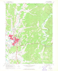 1969 Elkins1971 Print · USGSElkins serves as a bustling rail and mountain hub in the late sixties, where the river valley meets the high forest ridges. Researchers can trace the lines of the Baltimore and Ohio Railroad or locate local landmarks like Davis and Elkins College and Maplewood Cem.2 unique versions available
 - 1981 Map of Elkins, 1983 Print
 1981 Elkins1983 Print · USGSThe West Virginia mountains in the early eighties were a hub of rail-based industry and emerging conservation lands. Genealogists and historians can trace the paths of the Western Maryland RR through Elkins and locate small upland communities like Harpertown, Bowden, and Wymer.
 - 1995 Map of Elkins, 1998 Print
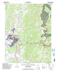 1995 Elkins1998 Print · USGSThe Tygart Valley and the ridges of the Monongahela National Forest meet at Elkins in the 1990s. Trace local history at Davis and Elkins College, the Elkins-Randolph County Airport, and the IOOF Cem.
End of results
Showing maps 1-6 of 6
Top cities near Sullivan
- Elkins historical maps
- Philippi historical maps
- Parsons historical maps
- Beverly historical maps
- Mill Creek historical maps
- Valley Bend historical maps
See more
Frequently asked questions
- What are the different types of historical maps available for Sullivan?
- What is the oldest map of Sullivan?
- Where can I purchase historical maps of Sullivan for my home or office?
- Where can I download high-res historical maps of Sullivan?
- Are there historical topographic maps available for Sullivan?
- Is there historical aerial imagery available for Sullivan?
- Where are historical maps of Sullivan sourced from?