1960s Maps of Ritchie County, West Virginia
Explore 13 historic maps of Ritchie County from the 1960s. These maps offer a rare glimpse into what life looked like during the 1960s — showing old roads, neighborhoods, homes, and landmarks that have changed or disappeared over time.
Whether you're researching your family's past, planning a metal detecting trip, or studying how Ritchie County's landscape evolved across the 1960s, these high-resolution maps are a powerful tool for exploring the history of this region.
- Focus on a specific era: All maps on this page are from the 1960s, giving you a focused view of this time period.
- See what’s changed: Compare century-old streets, trails, and buildings to today's modern landscape using overlays and satellite layers.
- Research with precision: Use these maps for genealogy, historical research, land use analysis, or educational projects.
- View, download, or print: Maps are fully viewable online in high resolution, and can be downloaded or printed for your own records.
Start exploring Ritchie County's history through authentic maps from the 1960s. This is your window into the past.
Ritchie County, WV maps
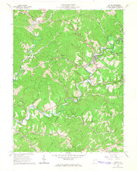
(13)- 1960 Map of Middlebourne, 1962 Print
 1960 Middlebourne1962 Print · USGSThe Tyler County hillsides and the sharp oxbows of Middle Island Creek are captured here in the early sixties. Genealogists can trace family roots through numerous upland burial sites like Archers Chapel Cem and the settlement at Bearsville.2 unique versions available
 - 1961 Map of Clarksburg
 1961 Clarksburg1961 Print · USGSThe mid-century industrial and river landscapes of West Virginia and Ohio are detailed here, centered on the Ohio River. Researchers can trace the Baltimore and Ohio rail lines connecting towns like Parkersburg, Clarksburg, and Monongah.
 - 1961 Map of Schultz, 1962 Print
 1961 Schultz1962 Print · USGSPleasants and Ritchie counties in the early sixties reveal a landscape of deep hollows and narrow ridgeline roads. Genealogists can locate family sites near Cloverdale Ch, the settlement at Maxwell, or tracing the paths along Goose Creek.3 unique versions available
 - 1961 Map of Ellenboro, 1962 Print
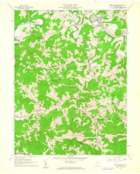
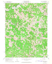
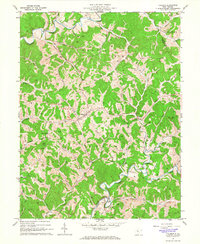
 1961 Ellenboro1962 Print · USGSRitchie County in the early sixties is captured here as a landscape of deep hollows and rail-side towns. Genealogists and historians can trace family locations near Ellenboro and Lamberton or find rural landmarks like Zoar Church and Mt Zion Church.3 unique versions available
 - 1961 Map of Pennsboro, 1962 Print
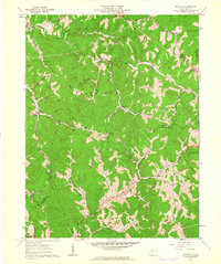
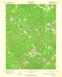
 1961 Pennsboro1962 Print · USGSRitchie County's rail and river valleys come alive in the early sixties as the energy industry shapes the landscape around Pennsboro. Trace family roots and local industry through features like the Baltimore and Ohio RR, Mole Hill Chapel, and the Buck Run Sch.4 unique versions available
 - 1964 Map of Burnt House, 1966 Print
 1964 Burnt House1966 Print · USGSMid-century Ritchie and Gilmer counties are documented here at the height of the local energy and rural agricultural era. Genealogists and historians can trace family locations through numerous sites like Burnt House, Roseville Ch, and the Bush Cem.3 unique versions available
 - 1964 Map of Macfarlan, 1966 Print
 1964 Macfarlan1966 Print · USGSRitchie County’s winding river valleys were defined by timber and fuel extraction in the mid-1960s. Genealogists and researchers can trace local family lineages through remote landmarks like Hartley Sch, Nutter Cem, and the river community of Macfarlan.3 unique versions available
 - 1964 Map of Smithville, 1966 Print
 1964 Smithville1966 Print · USGSIn the mid-1960s, the Ritchie County hills were a busy landscape of energy extraction and remote settlements. Genealogists and historians can trace family roots at Westfall Cem or Ayers Cem while locating old sites like Deep Valley School and Bethany Ch.
 - 1964 Map of Harrisville, 1966 Print
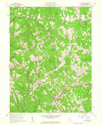
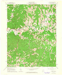
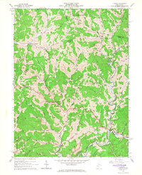
 1964 Harrisville1966 Print · USGSRitchie County is shown in the mid-1960s as a landscape of deep ridges and active oil and gas fields centered around the town of Harrisville. Researchers can locate numerous family-named landmarks and rural churches, including Riddles Chapel, Victory Church, and the river community of Cornwallis.3 unique versions available
 - 1964 Map of Cairo, 1966 Print
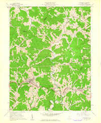
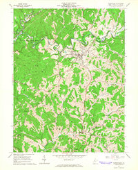
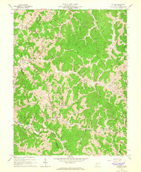
 1964 Cairo1966 Print · USGSRitchie County’s river-and-rail landscape is captured here in the mid-1960s, showing the intersection of industry and rural community life. Genealogists can trace family landmarks like Rexroad Cem, Nutter Farm, and the many tunnels of the Baltimore and Ohio RR.3 unique versions available
 - 1964 Map of Pullman, 1966 Print
 1964 Pullman1966 Print · USGSRitchie County's ridgelines and river forks are captured here in the mid-1960s, centered on the rural hub of Pullman. Researchers can trace old family burial grounds like Taylor Cem and remote country landmarks from Five Forks to Mt Zion Ch.2 unique versions available
 - 1964 Map of Auburn, 1966 Print
 1964 Auburn1966 Print · USGSCentral West Virginia in the mid-1960s was a landscape of remote oil and gas wells connected by winding creek-side roads. Genealogists can trace family roots through numerous landmarks like Lawther Cem, Mt Earnest Ch, and the settlement of Auburn.2 unique versions available
 - 1964 Map of Oxford, 1966 Print
 1964 Oxford1966 Print · USGSMid-century Doddridge County is defined here by its narrow valleys and the gas wells that dot its ridges. Researchers can locate remote family landmarks like Natter Cem and South Branch Cem, or trace early settlements at Oxford and Porto Rico.3 unique versions available
End of results
Showing maps 1-13 of 13
Top cities of Ritchie County
- Harrisville historical maps
- Pennsboro historical maps
- Ellenboro historical maps
- Cairo historical maps
- Pullman historical maps
- Auburn historical maps
Frequently asked questions
- What are the different types of historical maps available for Ritchie County?
- What is the oldest map of Ritchie County?
- Where can I purchase historical maps of Ritchie County for my home or office?
- Where can I download high-res historical maps of Ritchie County?
- Are there historical topographic maps available for Ritchie County?
- Is there historical aerial imagery available for Ritchie County?
- Where are historical maps of Ritchie County sourced from?