1970s Maps of Ritchie County, West Virginia
Explore 5 historic maps of Ritchie County from the 1970s. These maps offer a rare glimpse into what life looked like during the 1970s — showing old roads, neighborhoods, homes, and landmarks that have changed or disappeared over time.
Whether you're researching your family's past, planning a metal detecting trip, or studying how Ritchie County's landscape evolved across the 1970s, these high-resolution maps are a powerful tool for exploring the history of this region.
- Focus on a specific era: All maps on this page are from the 1970s, giving you a focused view of this time period.
- See what’s changed: Compare century-old streets, trails, and buildings to today's modern landscape using overlays and satellite layers.
- Research with precision: Use these maps for genealogy, historical research, land use analysis, or educational projects.
- View, download, or print: Maps are fully viewable online in high resolution, and can be downloaded or printed for your own records.
Start exploring Ritchie County's history through authentic maps from the 1970s. This is your window into the past.
Ritchie County, WV maps
(5)- 1975 Map of Ellenboro, 1979 Print
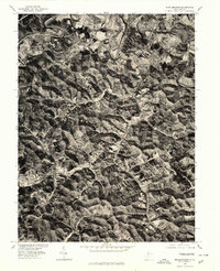
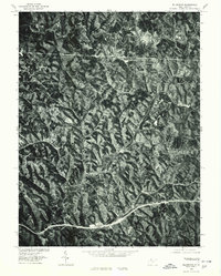 1975 Ellenboro1979 Print · USGSEllenboro and the Ritchie County hills are shown in detail through mid-1970s aerial imagery. Researchers can trace the exact road layouts and land clearances around Hebron, Lamberton, and the winding path of Bonds Creek.
 - 1975 Map of Schultz, 1979 Print
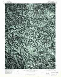 1975 Schultz1979 Print · USGSThe wooded ridges of Pleasants County are seen in high detail in this mid-seventies orthophoto survey. Local researchers can trace the rural road networks connecting the small settlements of Calcutta, Schultz, and Glendale.
 - 1976 Map of Willow Island, 1979 Print
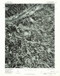 1976 Willow Island1979 Print · USGSThe Ohio River valley in the mid-seventies is seen here through high-resolution aerial imagery, showing the mix of industrial riverfronts and rural ridges. Genealogists and researchers can trace the roads and homesteads around Willow Island, Eureka, and Deerwalk.
 - 1976 Map of Pennsboro, 1979 Print
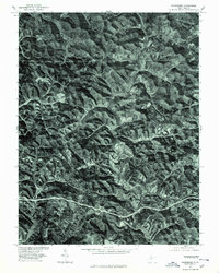 1976 Pennsboro1979 Print · USGSRitchie County's wooded ridges and valley settlements are seen here in the late 1970s via rectified aerial photography. Researchers can trace the exact 1976 footprints of Pennsboro and Greenwood along the winding North Fork Hughes River.
 - 1976 Map of Middlebourne, 1979 Print
 1976 Middlebourne1979 Print · USGSMiddlebourne and the surrounding Tyler County hills appear in sharp photographic detail during the mid-seventies. Local researchers can trace the course of Middle Island Creek and examine the layout of Middlebourne and Wick at this specific moment in time.
End of results
Showing maps 1-5 of 5
Top cities of Ritchie County
- Harrisville historical maps
- Pennsboro historical maps
- Ellenboro historical maps
- Cairo historical maps
- Pullman historical maps
- Auburn historical maps
Frequently asked questions
- What are the different types of historical maps available for Ritchie County?
- What is the oldest map of Ritchie County?
- Where can I purchase historical maps of Ritchie County for my home or office?
- Where can I download high-res historical maps of Ritchie County?
- Are there historical topographic maps available for Ritchie County?
- Is there historical aerial imagery available for Ritchie County?
- Where are historical maps of Ritchie County sourced from?